Where to Point the Camera: St. Croix's Best Photo Spots by the Hour
St. Croix guides · Plan your trip30 min readUpdated Aug 2026
The first U.S. sunrise, a yellow fort and a red one, mill towers on the hills, and the one coast where the sun sets into the sea — with the times, the rules, and where to stand.
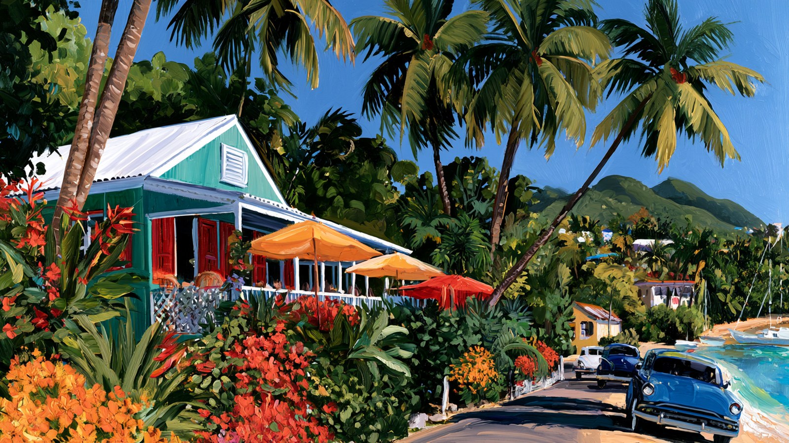
Original illustration
St. Croix is an easy island to photograph and a hard one to photograph well. The light is fast, the wind is constant, the best subjects face in different directions, and the agencies that manage several of them have rules about where you stand and what you fly. This is the working version: where to be for the first sunrise under the U.S. flag, which fort to shoot at which hour, why the sun only meets the sea on the west end, what the drone rules say, and how to keep salt off a lens. Times are computed for Christiansted and hedged; where a rule is unclear, we say so.
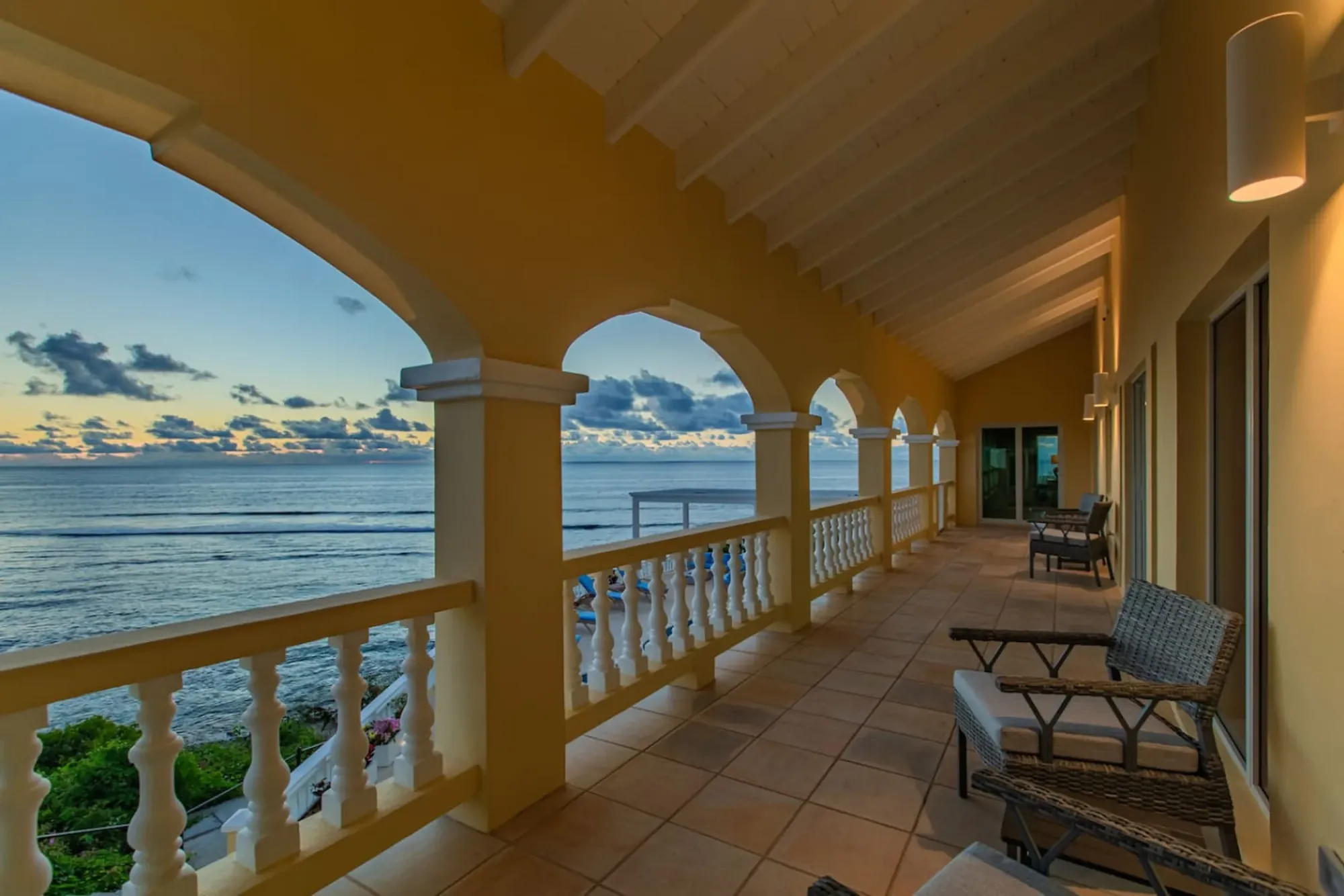
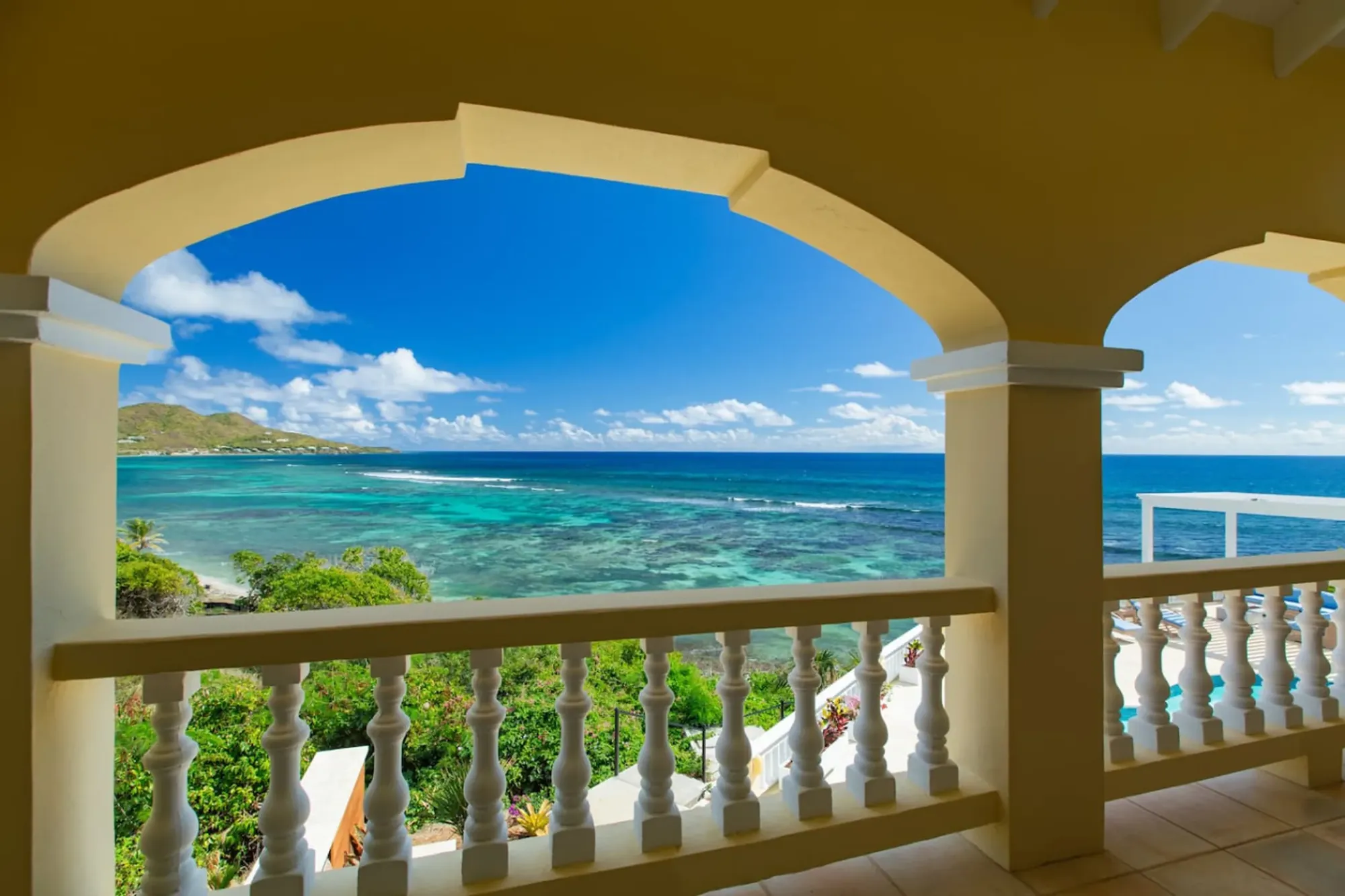
The villa's arched veranda faces east, so the first light of the day comes across the water and along the colonnade — the easiest photograph on the island is the one you take before breakfast.Photo: The Cerulean
How the light works on St. Croix
Start with latitude, because it changes every habit you brought from home. St. Croix sits at about 17.7 degrees north, and the sun does not slide along the horizon here; it climbs almost straight up. By the standard solar equations, from the moment the sun clears the sea to the moment it reaches six degrees of altitude — the usual definition of the end of golden hour — takes about 28 to 30 minutes in every month of the year, and the evening version is the same in reverse. Civil twilight, the blue light before sunrise and after sunset, runs about 22 to 25 minutes. So the "golden hour" on St. Croix is a golden half hour, and the whole soft-light window, blue to gold, is under an hour at each end of the day.
The clock is friendlier than the geometry. Sunrise runs from about 5:42 am in mid-June to about 6:52 am in mid-January, and sunset from about 5:40 pm in November to about 6:58 pm in July, all Atlantic Standard Time; the Virgin Islands do not observe daylight saving, so a phone still on East Coast time will be an hour out in winter. On August 15, 2026, Christiansted had a 6:00 am sunrise, a 6:46 pm sunset, and civil twilight from 5:39 am until 7:08 pm. Nothing about the day requires a 4 am alarm; the earliest useful moment of the year is around 5:15.
Then there is the shape of the island. St. Croix runs roughly east to west, about 22 miles long, with the East End a dry ridge that takes the trade wind first and the west end a flat coast facing open sea. That is the whole photographic logic of the place: the East End is the sunrise coast, and the villa and Point Udall are on it; Frederiksted is the only town where the sun sets into water; the north shore is side-lit all day; and the middle of the day, from about 9:30 to 4, is hard white light everywhere, best spent under water or under an arcade. Two more variables: the trade wind often parks a bank of cloud on the eastern sea line at dawn and swallows the moment of sunrise (the color before and after is usually better for it), and from roughly mid-June to mid-August the Saharan Air Layer turns the sky milky and the sunsets orange rather than gold — see our weather-by-month guide. Dust weeks are for people and for under water, not for horizons.
Sunrise at Point Udall: where to stand
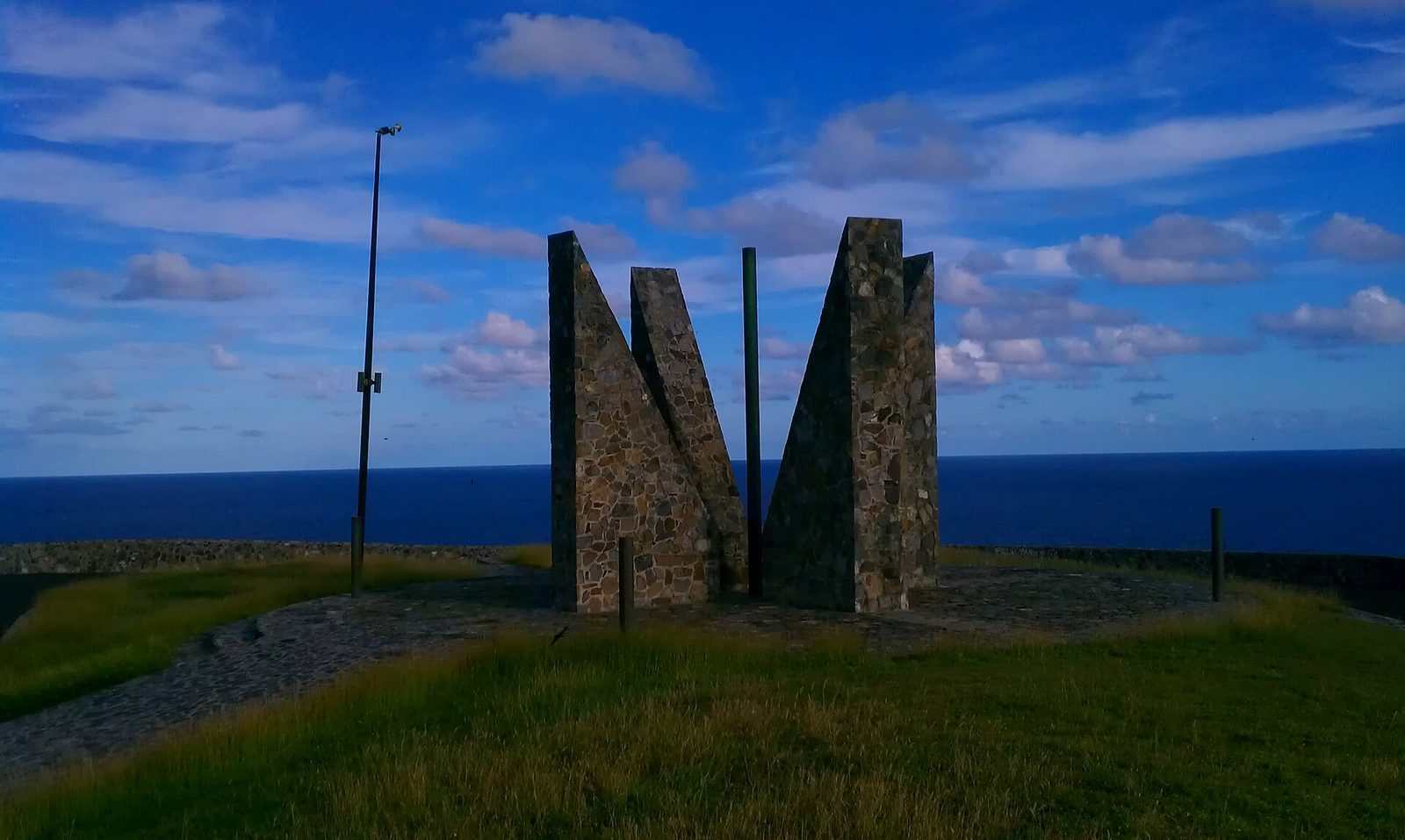
The easternmost point of the United States is about ten minutes from the villa along Route 82, the East End Road, past Cramer's Park and the white radio-telescope dish, then up a narrow, winding, unlit climb to a small parking lot below the headland. Above the lot stands the Millennium Monument, the big stone sundial built for the New Year's celebration of 2000; it marks the azimuth of the first U.S. sunrise of that year, and by the solar equations that bearing is about 24 degrees south of due east. Our Point Udall guide has the history and a month-by-month sunrise table; this section is only about the photograph.
The classic frame is the monument as a silhouette against the eastern sky, which means you stand inland of it — west of it, uphill toward the parking side — and shoot east through its arcs with the sea beyond. From late November to early February the sun comes up more or less on the monument's line, so the disc appears inside the frame; in June it rises about 25 degrees north of east and appears well off to the left, a different and, frankly, less tidy picture. Either way expose for the sky and let the stone go black; if you want detail in the monument, bracket and blend later, or wait ten minutes after sunrise for the light to wrap around.
The second frame is the coast itself: the headland dropping to the sea, the reef surf below, and Buck Island low on the horizon to the north. That one wants a wider lens from the edge of the platform, and it wants care — beyond the walls the ground is loose rock and it is dark. Arrive 30 to 45 minutes before sunrise; the color comes in shades of orange, gold, mauve and purple across the sky and off the water, with the glow reaching the monument, Goat Hill and Buck Island. That is the window: civil dawn to about half an hour after the sun, and then it is over.
The practical part: this headland takes the trades first, so weight or hold your tripod; there is no restroom, water, shade, shop or reliable phone signal; and the lots at the point and the Jack and Isaac trailhead have a long record of break-ins. Our journal piece describes the morning from the villa's side — coffee in a lidded mug, a layer for the wind, and back for breakfast by seven.
Point Udall, the eastern tip of St. Croix: the Millennium Monument stands above the parking area, and the first sunrise under the U.S. flag comes up out of the sea in front of it.Photo: Aaron Cortina (CC BY 3.0)
The East End ridge: Goat Hill and the road out
Behind Point Udall the ridge climbs to Goat Hill, at roughly 672 feet one of the highest points on the East End, and the summit is the island's best single overlook: a 360-degree view down the spine of St. Croix, over both coasts, to Buck Island and back to the point. The hike, covered in our ridge hikes guide, is about two miles round trip up an old four-wheel-drive road that has become a footpath — loose rock, no shade, little to no cell reception — from a small signed lot on the right just before the monument. Start by seven with two liters of water each; the light is better then anyway.
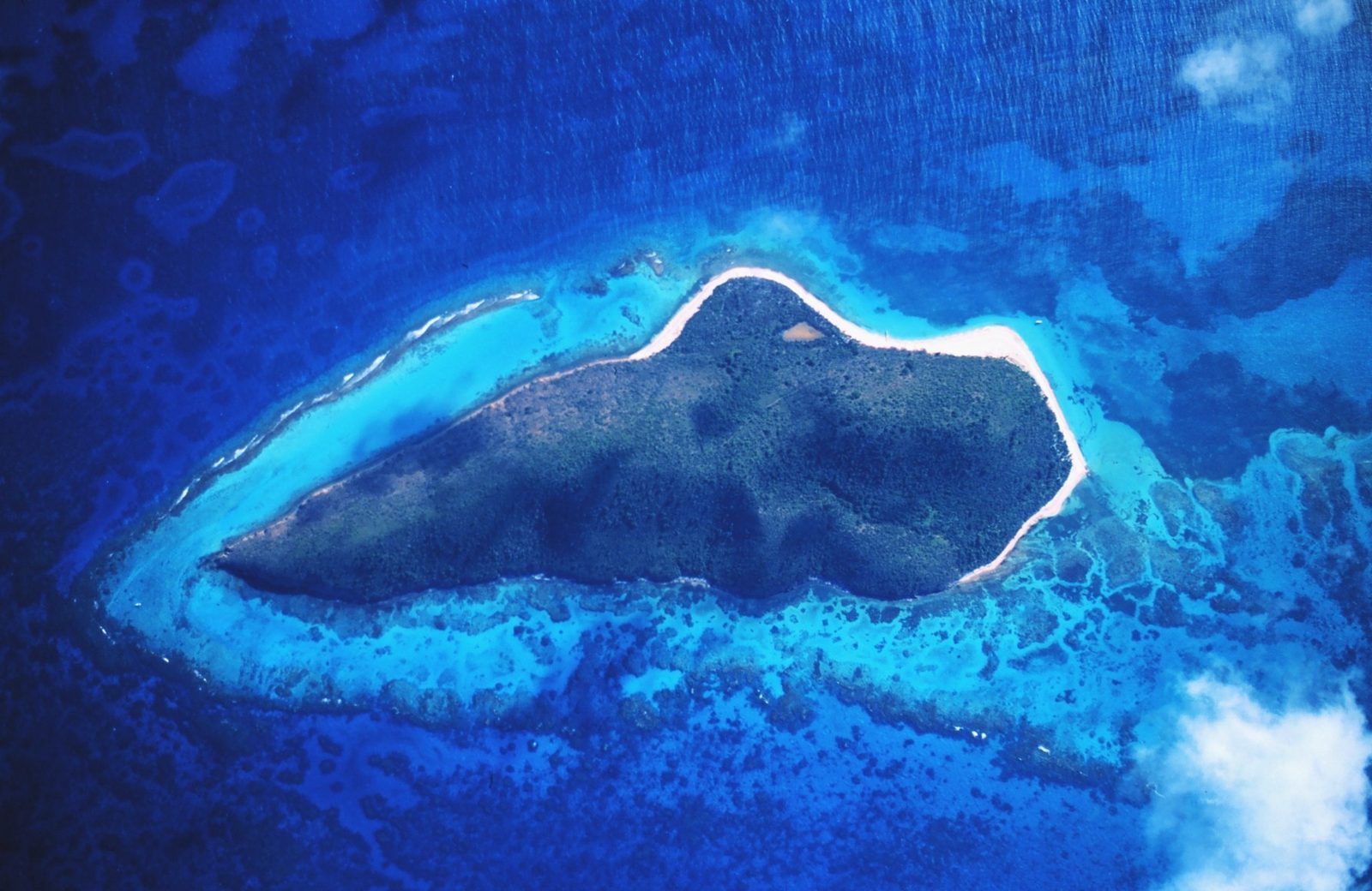
What the summit gives a photographer is layers. Buck Island sits about a mile and a half off the northeast coast, a low, dry-forest island of 176 acres with its reef and lagoon on the eastern side, and from the ridge it reads as a green lens on a blue field. Early morning, the sun is behind you if you shoot west down the island and side-lights Buck Island if you shoot north; by nine the haze builds and the picture flattens. Bring a longer lens than you think — 70 to 200 mm on a full-frame camera pulls the island out of the water — and a polarizer, the single most useful piece of glass on St. Croix.
About the roadside overlooks. Route 82 climbs from Cramer's Park up the ridge to the point, and there are places along it where the shoulder is wide enough to stop and the view opens north across the reef to Buck Island. We are not going to map them: they are informal, the road is narrow with blind bends, and a car half on the pavement is a hazard for the next driver coming down in the dark. Stop only where all four wheels leave the road, never near a bend, and treat the two proper lots, Cramer's Park and Point Udall, as the safe places to leave a car. The coast shot with Buck Island in the distance is easier from the shore anyway: from the beach at Cramer's Park and the East End bays along that north-facing coast, the island sits on the horizon with the reef surf breaking in front of it, side-lit morning and late afternoon and a gray shape at noon. The boat's-eye version, with Turtle Beach white against the dry forest, is a day on the water, and our Buck Island guide covers the boats and the rules — including no drones anywhere inside the monument.
Buck Island from the St. Croix side: a low island about a mile and a half off the northeast coast, with reef surf between it and the shore — the East End's horizon in every north-facing photograph.Photo: Wikimedia user Russavia (Public domain)
The villa's own vantage points
The Cerulean was built facing east on purpose, and for a photographer that decision does most of the work. The arched veranda looks straight out over the private beach and the reef to the open sea, so at sunrise the light comes across the water and along the colonnade, and the arches frame the bay the way a viewfinder frames a scene. Our gallery's most-loved image is exactly this: turquoise water composed inside the yellow arches. Shoot it from inside the veranda looking out, expose for the sea and sky and let the arches go dark, or wait until seven or eight, when the sun is high enough to rake the columns and light the whole colonnade. It stays good until about ten; after that the sea is white.
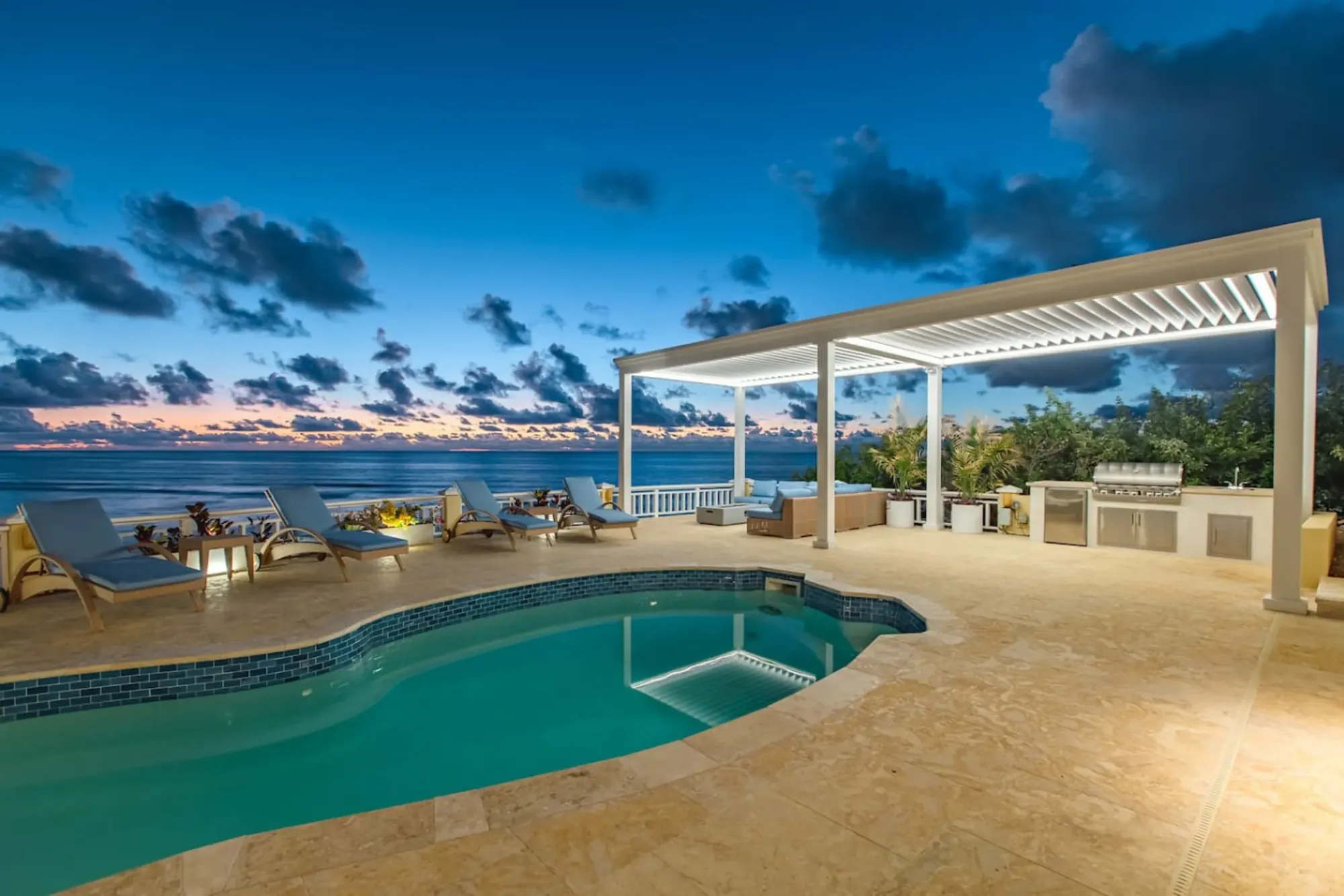
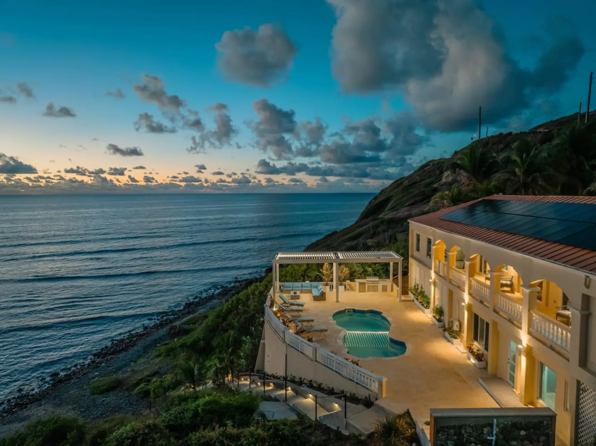
The second vantage is the pool deck, which sits above the sea on the villa's seaward side. At dusk the pool lights come on while the sky still has color, and because you are on the sunrise coast the color at that hour is not the sun itself but the pink and gray band that rises in the east opposite the sunset, with the sea going dark blue below the deck. A phone handles it; a tripod and a two-second exposure handle it better. The pool and deck page shows what we mean, and the fire pit terrace does the same trick later, with the fire as the light source.
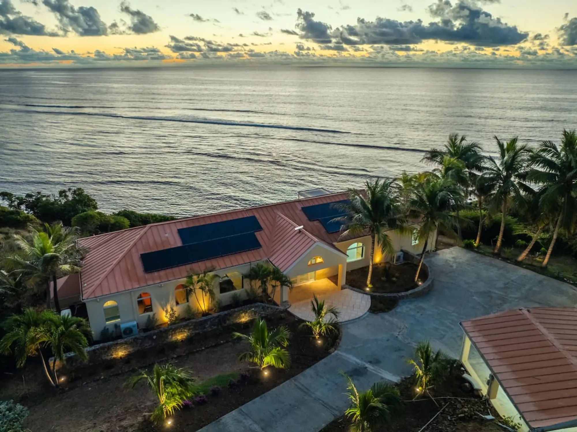
The private beach is the third: direct water access, reef in front, facing the same sunrise as the veranda from a lower angle, so the sea fills more of the frame and on a calm morning the reef line shows as a darker band with the light coming over it. It is also where to practice with an underwater housing before Buck Island — the reef off the beach is close and yours, and one guest, Emily, wrote in April 2026 of "amazing snorkeling off the reef." The beach and grounds page shows how the beach and reef sit relative to the house. The aerial photographs on this site were made by the villa's photographer; if you would like your own, read the drone section further down, register the aircraft, and ask Sterling Point before you fly — the villa is private property, not park land, but neighbors are close and the East End is windy.
The pool deck sits above the sea on the villa's seaward side. At dusk the pool lights come on while the eastern sky still holds pink and gray — the East End's version of a sunset picture.Photo: The Cerulean
Christiansted's colors
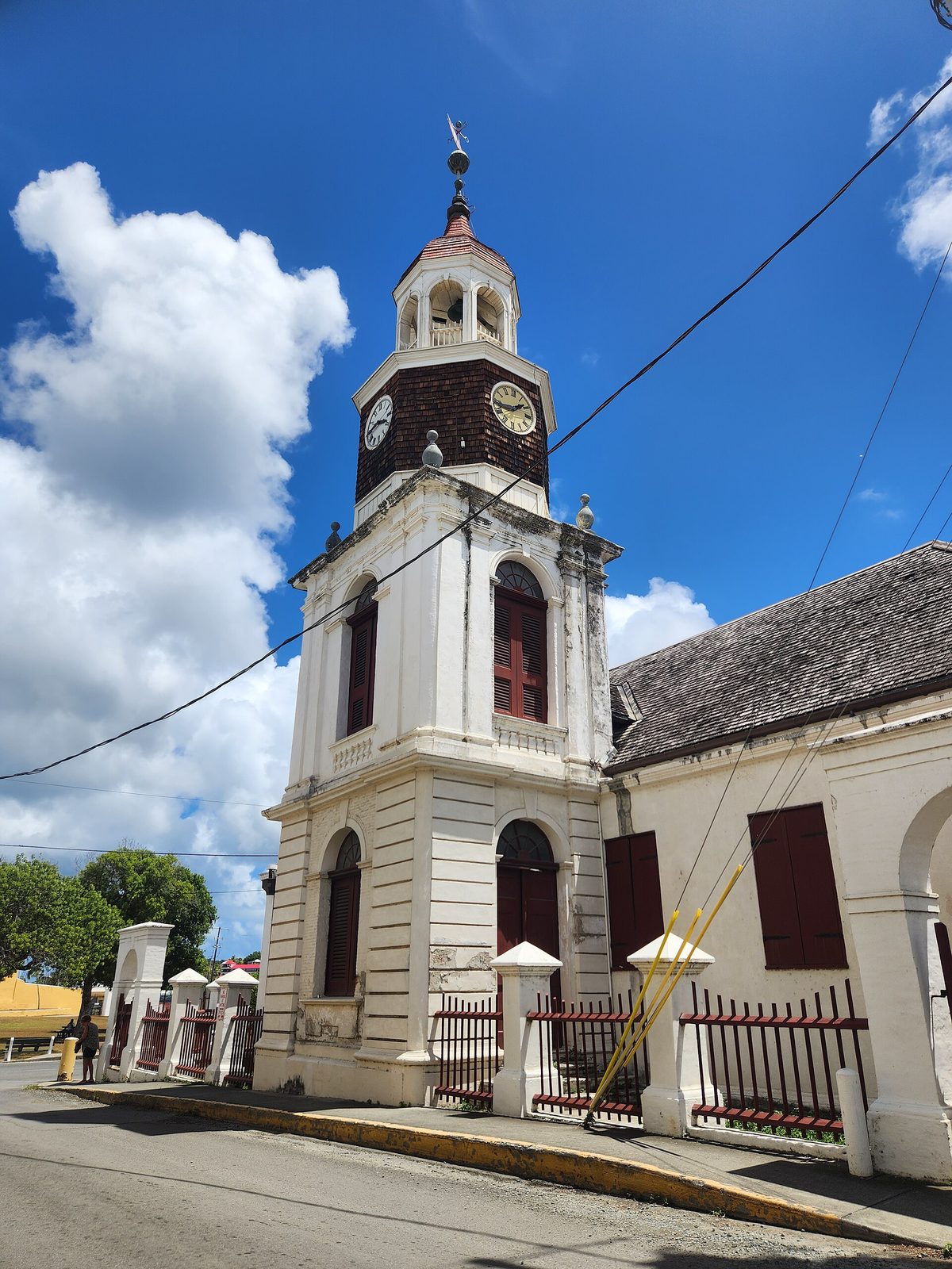
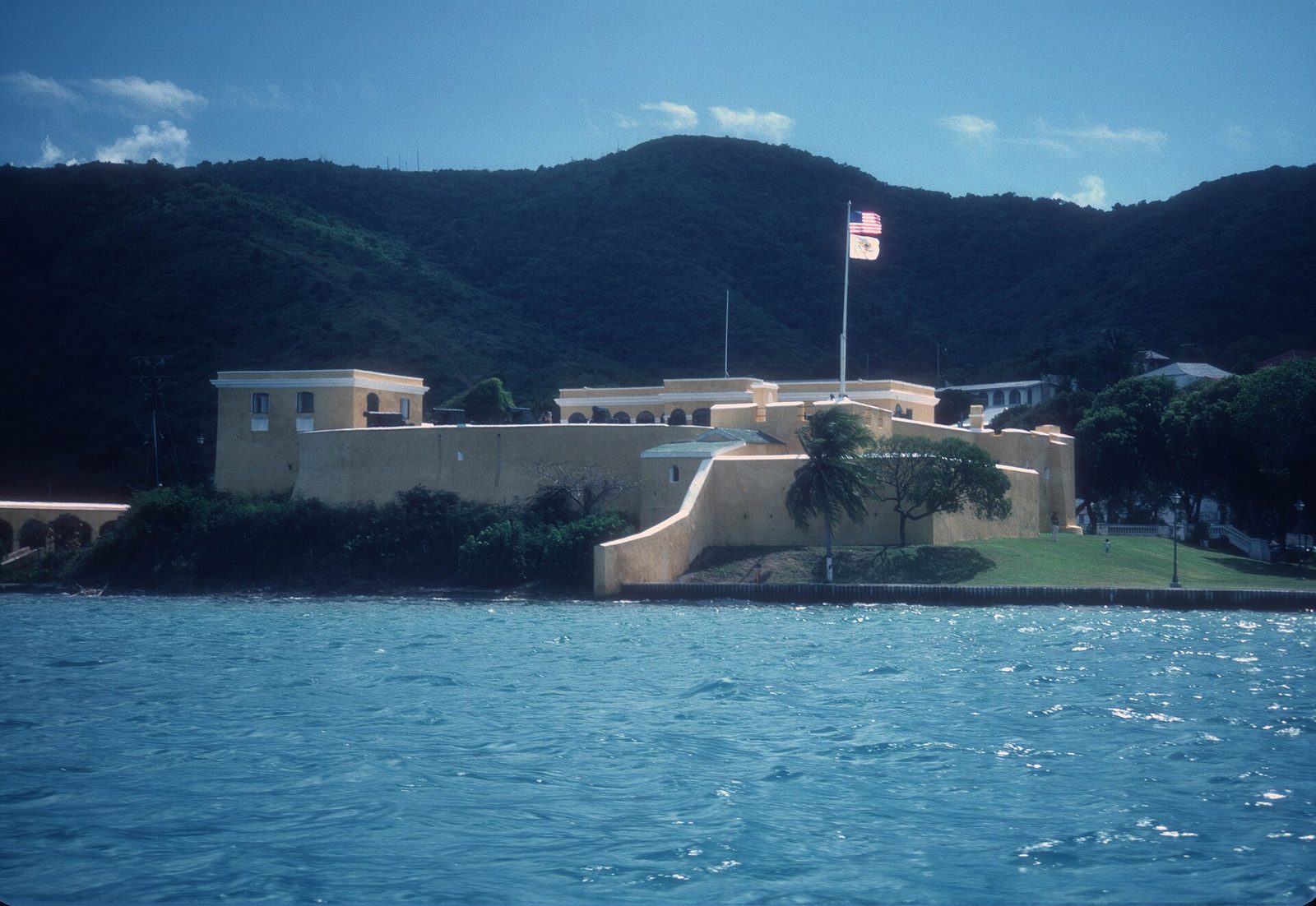
Christiansted, 15 to 20 minutes from the villa, is where St. Croix keeps its color: a yellow fort on the water, arcaded sidewalks, red roofs, and, along the harbor, colorful pastel blue, yellow and pink-washed buildings set against the sea. Fort Christiansvaern is the anchor. It was built between 1738 and 1749, it is run by the National Park Service as part of Christiansted National Historic Site, and per the NPS hours page it opens daily 8:30 am to 4:30 pm, with adult admission around $10, good for three days. Our Christiansted town guide has the walking loop; here is how the light falls on it.
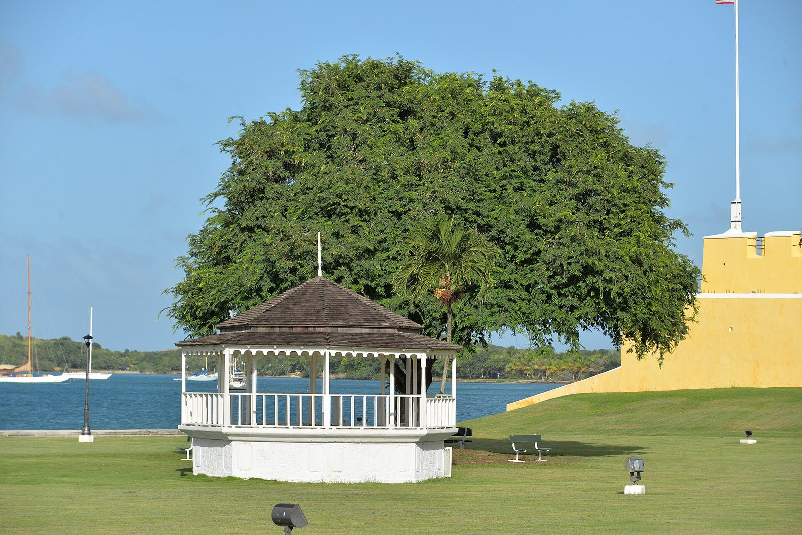
The fort stands at the eastern end of the waterfront, so from the boardwalk you are looking roughly east toward it. In the morning that means it is backlit from the boardwalk side and better shot from the wharf lawn or the streets behind it, where the sun is on its east-facing walls; in the late afternoon the sun swings behind you on the boardwalk and the yellow reads the way it does in every postcard. Inside, the courtyard is its own light box — yellow walls bouncing sun into the shade — and mid-morning, soon after opening, is the hour: low light, few people, the ramparts still cool enough to walk. By one o'clock the courtyard is an oven and the light is flat.
The arcades on King and Company Streets are the opposite problem: they are shade, so they photograph best when the street beyond them is bright. Stand inside an arcade mid-morning and use the arch as a frame on the sunlit building across the road; the Custom House by the Scale House, the arcaded building with the outside stairway, is the one everyone photographs and deserves it. The boardwalk earns two visits — once mid-morning when the shops are open and the seaplanes are landing in the harbor, and once at dusk, when the lights come on along the water and the blue hour lasts its twenty-odd minutes. Park up in town and walk; the best frames are found on foot, from the alleys down to the water and back under the arcades, and Sunday mornings are the emptiest. Christiansted is a working town, not a set, and the section on people below applies in full.
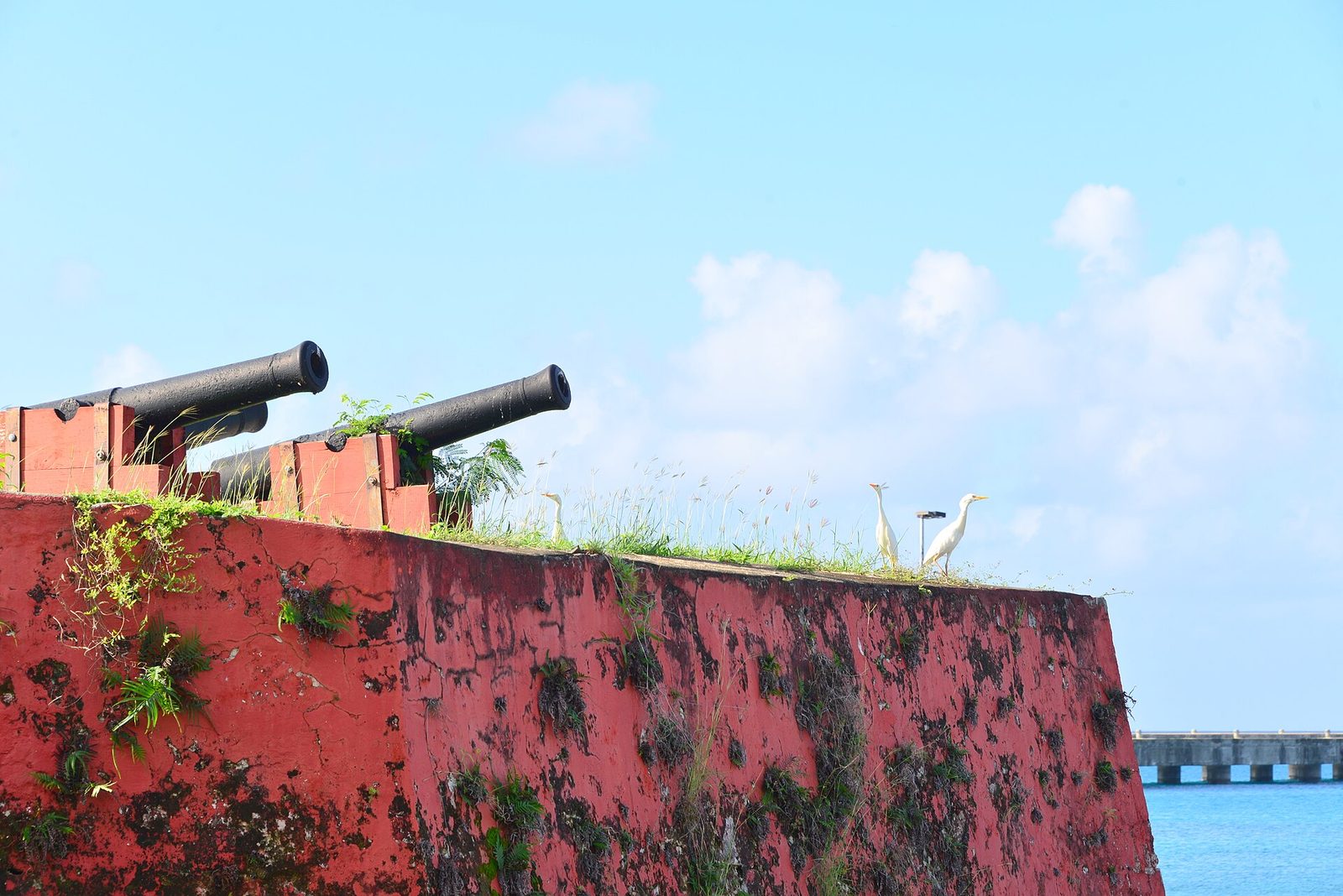
Only the west end watches the sun go into the water, and Frederiksted is where to be for it. Fort Frederik, built 1752 to 1760 and named like the town for King Frederik V, sits at the water's edge just north of the pier, painted a deep red with white trim — the opposite of Christiansted's yellow — and its west face takes the last light head-on. This is also the fort where, on July 3, 1848, slavery in the Danish West Indies ended, which is worth knowing while you compose it; our emancipation guide tells that story. As of 2026 the museum lists weekday hours of 8:30 am to 4 pm and Saturday 1 to 4, closed Sunday, but hours here change without much notice, so call ahead if you want the interior.
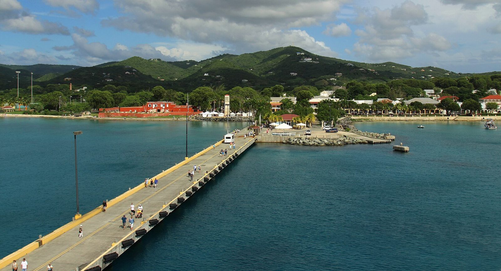
The exterior needs no ticket. Come about 40 minutes before sunset, walk the beach north of the fort and look back at it with the sea on your right, and watch the red go to amber and then to something close to rust as the sun drops. Then turn around: the pier. The Ann E. Abramson Marine Facility, to give it its name, opened on July 15, 1994 and runs 1,526 feet straight out from the town, the best set of leading lines on the island. From the beach it points at the sunset; from the pier itself, looking back, the Victorian waterfront and the fort sit under the last light, and after the sun goes the pier's lights and the blue hour give you a second picture.
The catch is ships. On cruise days a vessel ties up alongside the pier from about 8 am to 5 pm and fills the western sky, and Strand Street and the beach are busy from late morning to mid-afternoon; check the schedule and choose a day without one, or come after the ship has sailed. Frederiksted Beach — Fort Frederik Beach, same sand — is also the island's sea-glass beach, a foreground if you want one, and Rainbow Beach a little north puts palms between you and the setting sun. Our pier guide and west end beaches guide cover both properly.
The drive back is the price: about 50 minutes to the villa along Route 70 and through or around Christiansted, in the dark, on the left, on roads with few lights — read the driving guide before you commit. Make Frederiksted the end of a whole west-end day, eat in town while the traffic clears, and drive home slowly.
Fort Frederik on the Frederiksted waterfront, just north of the pier: deep red with white trim, west-facing, and the one fort on the island that takes the sunset straight on.Photo: Андрей Бобровский (CC BY 3.0)
The Cerulean
Plan it from the villa.
Five bedrooms, a private swimmable beach, and all of this within a day trip.
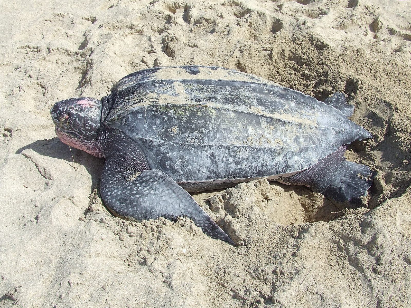
Sandy Point is the two-mile white beach at the island's southwest tip that closes the film The Shawshank Redemption, and it is a national wildlife refuge before it is anything else: the largest leatherback sea turtle nesting site in the United States. The rules follow from that. It is open on weekends only, Saturday and Sunday from 10 am to 4 pm, and it is closed entirely for nesting season — the posted closure in recent years has run from April 1 through August 31, with the beach reopening the first weekend of September, and the U.S. Fish and Wildlife Service describes it as roughly mid-April to August. Entry is free. On a Tuesday, or in July, you will drive an hour to a locked gate. Our Sandy Point guide has the whole story.
For a photographer the hours are the problem and the point. Ten to four is the harshest light of the day, so the picture you can make here is the midday one: a very long, very white beach, sea on one side, scrub on the other, no reef, no buildings, no people to speak of. That is a picture worth making — it is why the film crew came — but make it on purpose: a polarizer for the glare, a lens hood, and in winter the last hour before the gate closes, when the sun is lower. If you want the walking-toward-each-other frame from the film, you need a friend at the far end and a long lens; a phone flattens the beach into a white line.
The rules are the other half. Refuge regulations prohibit collecting shells, sand or plants, disturbing wildlife or nests, driving anything onto the sand and staking gear into the beach; drones are out; dogs, treat as no. Most of all, stay on the wet sand — the vegetation line at the back of the beach is where the nests and the nesting birds are. Read the board at the entrance; it is the current word. From the villa allow about an hour, west on the Melvin H. Evans Highway to its western end; leave by 8:30 or 9 for the gate opening, come on the earliest weekend day of your stay that the calendar allows, and pair it with Frederiksted, ten minutes north, for the sunset.
The north shore: Cane Bay, Route 80 and Salt River from the hill
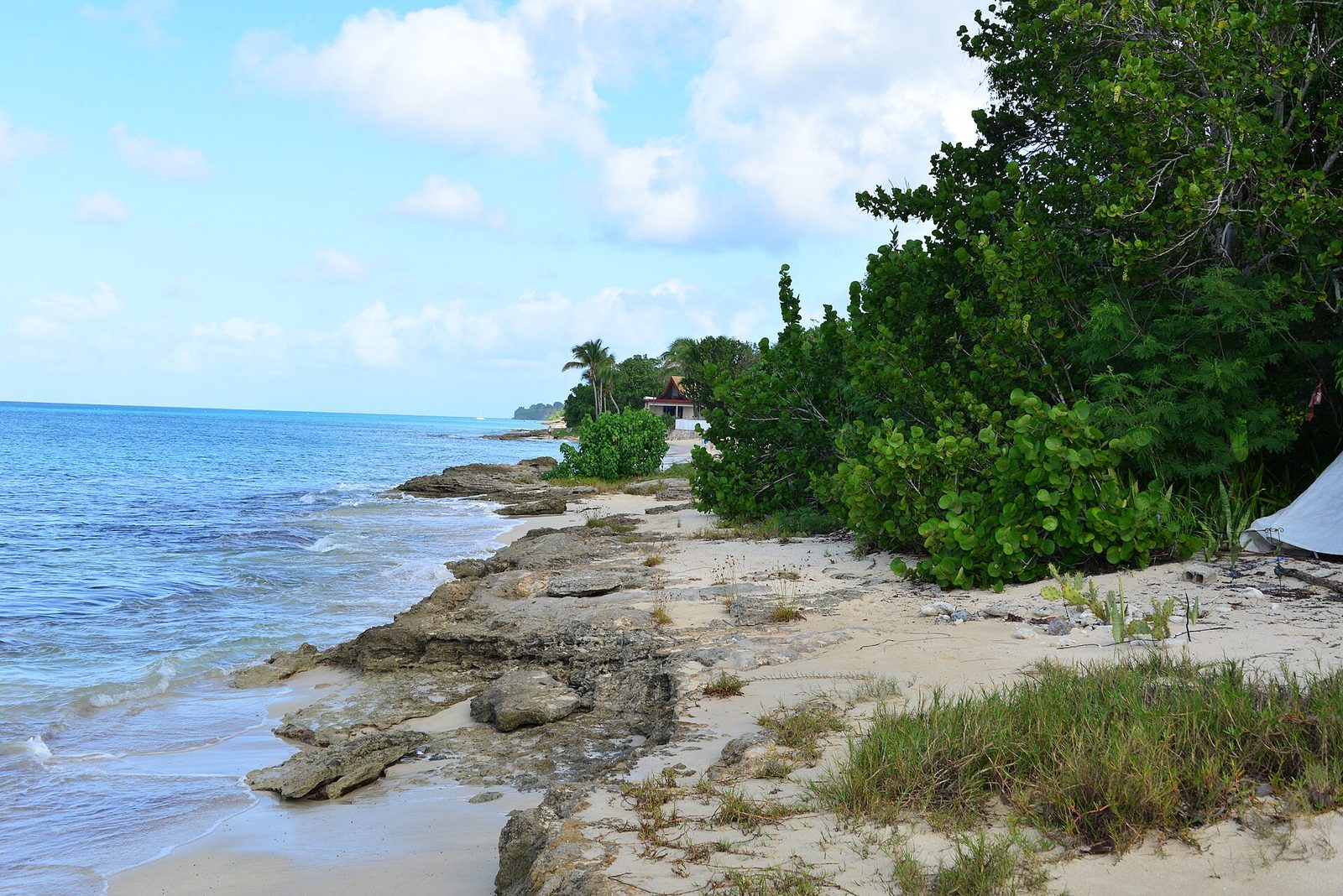
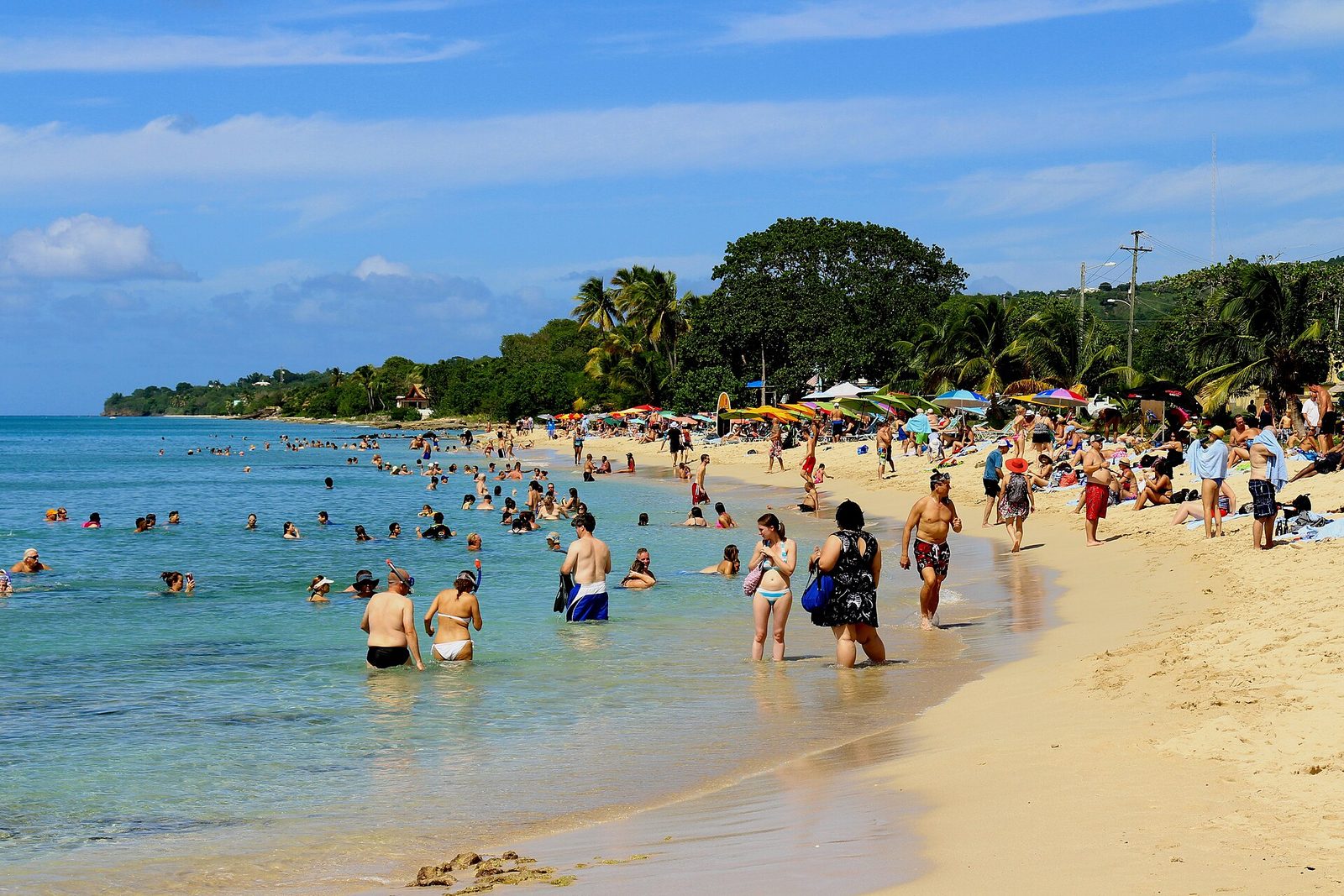
Cane Bay is the beach St. Croix people take you to first: a long, tree-shaded curve of sand on Route 80, the North Shore Road, between Christiansted and Carambola, with a dive shop across the road, bars you can walk to barefoot, and the Cane Bay Wall a couple of hundred yards offshore. It faces north, which for a camera means it is side-lit morning and evening and never has the sun behind it, and that the palms and sea grapes along its back edge throw their shadows across the sand at both ends of the day. Mid-morning, when the water goes from gray to turquoise as the sun climbs, is the beach at its most colorful; late afternoon, when the divers are coming out and the light comes down the coast from the west, is its quietest.
The road is the second subject. Route 80 runs along the water's edge for miles — at Cane Bay you park on the shoulder and walk twenty steps to the sand — and the drive west from Christiansted, hills on the left and sea on the right, is the best scenic road on the island. Above the road just east of Cane Bay, on private land, stands the Rust op Twist windmill, a stone tower dated to about 1765 to 1767; late afternoon puts the sun on its west side and the sea behind it. Photograph it from the road and do not climb the fence, and because the road is narrow and busy with dive trucks, pull fully off the pavement or keep driving. Our Cane Bay guide covers the wall, the shops and the food; the drive from the villa is about 45 minutes.
Salt River Bay is a few minutes east on the same road, 35 to 40 minutes from the villa: a National Historical Park and Ecological Preserve of about 1,015 acres — mangrove forest, a bay mouth, reef — and, on the western side of the mouth, the strip of sand where a landing party from Columbus's second voyage came ashore on November 14, 1493, one of two documented Columbus landfalls on what is now U.S. territory, per the NPS landmark page. The picture is the bay from above. The park's visitor contact station sits on a hilltop overlooking the landing site, and as of 2026 the NPS hours page says it has been closed since Hurricane Maria, so whether you can drive up depends on the gate; treat the overlook as a maybe, and if you can, go in morning light with the sun behind you. Failing that, Columbus Landing Beach gives you the bay at water level. Road signs are scarce; use your maps app, and read our Columbus guide for the history.
By night the bay glows, and it is the hardest photograph on this list: the bioluminescence varies with moon phase, so the operators publish calendars, and the frames people manage are long exposures from a stable point — tripod, high ISO, wide aperture — of paddle trails and the odd bright wake. Our bio bay guide covers the operators. Go for the eyes first, bring a dry bag, and remember the drive back to the East End is about 40 minutes on unlit roads.
The North Shore Road runs at the water's edge west of Christiansted, past Salt River and Cane Bay toward Carambola — the island's best scenic drive and its most north-facing light.Photo: Андрей Бобровский (CC BY 3.0)
Sugar-mill ruins in the last light
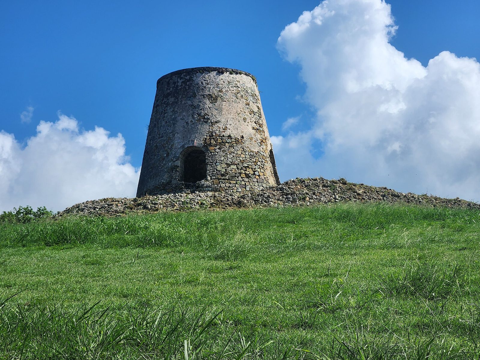
The mill towers are St. Croix's signature landscape object. Historically the island had more than 150 sugar mills at the height of the trade, and well over a hundred stone towers survive in some state today — on hilltops, in cane fields gone to scrub, behind gas stations, in the middle of housing. Most are conical stone windmill towers without their caps and sails, which is exactly what makes them photograph well: a simple dark shape against a big sky, best at the ends of the day when the sun is low, the stone goes warm and the shadows stretch. Our sugar plantations guide tells the history; this is only about the frame.
The composed, permission-easy version is Estate Whim, the St. Croix Landmarks Society's 12-acre plantation museum at 52 Estate Whim on Centerline Road near Frederiksted, about 50 to 60 minutes from the East End. It has all three kinds of mill on one site — the restored windmill with its cap and sails, the site of the animal mill, and the steam mill with its Glasgow-built engine — plus the great house, the cookhouse and the workers' houses. As of August 2026 the Society lists Wednesday through Saturday and cruise-ship days, 10 am to 3 pm, admission around $10 for adults and $5 for children six to twelve; confirm before you cross the island, and know that the great house interior has been reported closed since hurricane damage.
The honest problem with Whim is the clock: it closes at three, so the golden light is not available inside the fence. The windmill in its full dress — cap, sails, the whole silhouette — you shoot at ten in the morning as the site opens, with the sun still lowish in the east and the grounds empty, and that is a good photograph. The dusk mill, the hilltop tower with amber sky behind it, is a roadside picture: the Rust op Twist tower above the North Shore Road, the towers along Centerline Road and up on the northwest heights, seen from the shoulder. Almost all are on private land — shoot from the road, do not open a gate, do not climb. A long lens compresses a tower against the hills behind it; a wide lens from close makes it loom against the sky; the pink minutes after the sun goes need a tripod. Drive Centerline Road home from Whim in the late afternoon and count the towers, and you will have a shot list for the next dusk.
Estate Whim, the St. Croix Landmarks Society's plantation museum on Centerline Road: the restored windmill is the tower everyone photographs, and the site opens at ten — the low-sun hour inside the fence.Photo: CaptJayRuffins (CC BY-SA 4.0)
Underwater basics: the trail, the pier and the villa's reef
Under water the island stops being about where you stand and starts being about how close you get. Two sites carry the reputation. Buck Island's marked snorkel trail runs through the shallow lagoon at the island's east end, mostly under about 12 feet deep, past elkhorn coral with signs on the seafloor naming what you see; the National Park Service runs it with a firm hand — the monument is day-use only, 7 am to 5 pm, you go by authorized concession boat or with a private permit, guides take six snorkelers at a time, and you touch nothing. The Frederiksted Pier is the other: flat, shallow, close, best done at half speed with your face a foot from a piling, and the Caribbean's favorite macro site for divers looking for the longsnout seahorse, Hippocampus reidi.
The gear question is simpler than the internet makes it. For the trail, a housed phone or a waterproof compact is enough; the water is shallow and clear, and the pictures that work are taken close and slightly upward, with the surface as the sky. Color is the thing you lose first: below the first few feet the reds and oranges go and everything turns blue-green, so a red filter over the lens, or a custom white balance set against your own hand or a white fin, brings the reef back. Do not stand on, hold, kick or rest against the coral; elkhorn breaks and grows back slowly, and the concession crews will not be shy about telling you.
The pier is a different discipline. Depth along most of its length is around 25 feet, the guided dives stay under about 40, and the subjects are small — seahorses, frogfish, octopus at night — so a macro lens or setting, a strong light and time matter more than any wide-angle rig, and sightings are common, not guaranteed. Snorkelers can work the shallow pilings near the shore end on days without a ship. Our pier guide and the dive shops directory cover who takes you and when. Sunscreen in the territory has been mineral-only since 2020, and a long-sleeve rash guard is the better answer for you and for the reef. Practice at home first: the villa's private beach has the reef right in front of it, and an hour there learning where the housing's buttons are while wearing fins is worth more than any tutorial. Then read the Buck Island guide for the boats and the trail.
Night skies on the East End, plainly
The East End is the darkest inhabited part of St. Croix, and it is not dark. Say both, because both are true. Christiansted's glow sits low on the western sky, the mid-island lights add to it, ships pass, and the villa has lights of its own — pool, paths, kitchen — that you will want off for anything serious. What the East End has going for it is direction: south of St. Croix there is nothing but open Caribbean for a very long way, and east of Point Udall nothing but Atlantic, so the southern and eastern horizons are as dark as horizons get on an inhabited island. At Point Udall at night, the sea is nearly dark all around, good for Milky Way photography.
The season is the constraint. Northern Hemisphere astro guides put the Milky Way core season at roughly February through October, with the best months from about March to September; early in the season the core rises in the southeast in the hours before dawn, by midsummer it stands in the south for much of the night, and by September and October it is in the southwest after dusk. All of that is toward the sea from the East End. Two other rules from the same guides: moonlight above about 30 percent illumination washes the core out, so plan around the new moon, and the farther south you are the longer the season and the higher the core stands, which at 17.7 degrees north is a real advantage over anywhere on the mainland.
The technique is standard and the conditions are not. A wide, fast lens, a sturdy tripod with weight on it, ten to twenty seconds at high ISO, manual focus on a bright star, a headlamp on red. The trade wind is the problem: it shakes tripods, it moves cloud across the sky all night, and it makes Point Udall at 1 am a cold, loud, pitch-black headland at the end of an unlit road with no phone signal, which is not where we would send anyone alone. The villa's terrace and beach are the sane alternative — the same southern sea horizon, a wall to break the wind, and a bed thirty steps away. Two more honest notes: the mid-June to mid-August Saharan dust that softens the sunsets also dims the stars, and the summer wet months bring cloud, so a February pre-dawn, a March or April night after midnight, or a September evening are the realistic windows; and long exposures gather light the eye cannot, so the Milky Way you photograph will always be brighter than the one you saw.
Drone rules, plainly
The U.S. Virgin Islands are U.S. airspace, and the Federal Aviation Administration's rules apply here exactly as they do in Florida. The Virgin Islands Port Authority's own drone page puts it in one sentence — "Drone use is allowed in the United States Virgin Islands with the approval of the Federal Aviation Administration" — and then adds the part people miss: the Port Authority and the control-tower staff at its airports "can not issue approval to operate drones," so nobody local can wave you through. Commercial pilots go through the FAA's Part 107 process and request airspace authorization at faa.gov/uas. Recreational flyers, per the FAA's rules as summarized in the search results we could reach (the FAA's own page blocked our fetch), take the free online TRUST test and carry proof, register any aircraft of 250 grams or more, fly under 400 feet, keep the aircraft in sight, and stay out of controlled airspace without authorization. The airport is Henry E. Rohlsen, at Estate Manning Bay on the south coast, mid-island; the airspace around it is controlled, the FAA's apps and the LAANC system show where the lines are, and the East End is a long way from it, but check before every flight. Remote ID rules and fees change; the FAA site is the current word, not this paragraph.
The federal land is where the answer is simply no. In June 2014 the National Park Service issued Policy Memorandum 14-05, which directs every superintendent to prohibit "the launching, landing, or operation of unmanned aircraft" on lands and waters administered by the NPS; it was written as interim policy and it is still in force across the whole system. On St. Croix that is three places, two of them on every photographer's list: Buck Island Reef National Monument, including all 19,000-odd acres of its water and not just the island; Christiansted National Historic Site, the fort and the wharf; and Salt River Bay National Historical Park and Ecological Preserve. Jurisdiction ends at the park boundary, superintendents can issue special-use permits case by case, and the penalty for ignoring it is a misdemeanor with, per the NPS, "the maximum penalty of six months in jail and a $5,000 fine."
The rest is judgment. Sandy Point is a national wildlife refuge managed for endangered species; treat drones there as prohibited and do not test it. The Nature Conservancy's page for the Jack and Isaac Bay Preserve lists "nature photography" among the permitted activities and says nothing about drones either way, so ask the Conservancy's Virgin Islands office before you fly over two turtle-nesting beaches; the honest default is not to. Cramer's Park and the East End roads are territorial land, where the FAA rules govern. And the villa is private property with neighbors close on either side: ask Sterling Point, keep the aircraft over the estate, and never over people on the beach.
2014NPS drone ban since
250 gRegistration threshold
400 ftCeiling
Up to $5,000 + 6 monthsNPS penalty
3NPS units on St. Croix
People, vendors and festivals: ask first
The best pictures on St. Croix are of people, and the rule for them is older than photography: ask. The Saturday farmers market at La Reine, the food stalls at Jump Up in Christiansted, the vendors at the Crucian Christmas Festival village in Frederiksted, the fishermen selling off the boats — these are people at work, and a lens pointed at someone's face while they are counting change is not a compliment. Buy something first. Then ask, in words, and take no for an answer without arguing. Most people say yes, and the picture is better for it, because a person who has agreed to be photographed looks at you rather than away.
Festivals loosen the rule and add another. Parade performers, the mocko jumbies on their stilts, the steel bands and the troupes in costume expect cameras — that is partly what the costume is for — and you do not need to ask each one. What you owe them is the route: stay behind the line, do not step into the street for a better angle, do not stop a troupe to pose, and do not use flash in a performer's face at night. Our guides to Jump Up, the Crucian Christmas Festival and the mocko jumbies and quelbe explain who and what you are looking at, which is the other half of respect.
Children: a parent's yes, every time, and if there is no parent there is no photograph. Homes, yards, laundry, someone's boat pulled up on the sand — these are people's lives, not scenery, and the same goes for churches and cemeteries. If somebody asks you to delete a picture, delete it in front of them. The photographers who come home from St. Croix with the best frames are the ones who arrived early, stayed out of the way, and spent more time talking than shooting.
The light by month
The table below is for planning; check a proper sunrise table for your exact date the night before. Times are for Christiansted, Atlantic Standard Time, rounded, computed with the standard NOAA solar equations and spot-checked against sunrise-sunset.org for August 15, 2026 (6:00 am and 6:46 pm). Point Udall and the villa run within a minute or so of these. The half-hour rule from the first section holds all year: golden light ends about 30 minutes after sunrise and starts about 30 minutes before sunset, and the blue hour is the 22 to 25 minutes on either side of that.
Month
Sunrise (approx., AST)
Sunset (approx.)
What it means for the camera
January
6:50 am
6:05 pm
Sun rises about 24 degrees south of east, on the monument's line — dry, windy, clear
February
6:45 am
6:20 pm
Still southerly, and the dry season's best clarity
March
6:25 am
6:30 pm
Equinox — sun rises due east and sets due west, Milky Way core before dawn
April
6:00 am
6:35 pm
Sandy Point closes April 1, and the driest stretch of the year begins
May
5:45 am
6:45 pm
Early alarms, a small rainy peak, the core rising earlier each night
June
5:42 am
6:55 pm
Earliest sunrise of the year (around June 4), Saharan dust ramps up mid-month
July
5:52 am
About 7:00 pm
Latest sunsets, dust peak, milky skies and orange sunsets
August
6:00 am
6:45 pm
Dust fades after mid-month, hurricane season's peak begins
September
6:05 am
6:20 pm
Equinox again, Sandy Point reopens the first weekend, wetter weeks
October
6:12 am
5:55 pm
Earlier sunsets, still hurricane season, core in the southwest at dusk
November
6:24 am
5:40 pm
Earliest sunsets, trades pick up, the sky clears
December
6:40 am
5:45 pm
Late, southerly, dry sunrise — the easy month for a Point Udall run
Read across the seasons rather than the months. December through April is dry, clear and windy: the best air for landscapes, the sun rising near the monument's line, and civilized alarm clocks, at the cost of the Christmas Winds shaking your tripod on the headland. April through June is the driest stretch, with the earliest sunrises. Mid-June to mid-August is the dust: fine for people and under water, poor for horizons. August to October is the wet, hot, hurricane-peak stretch, with the biggest skies of the year between the showers and the fewest other visitors; our hurricane season guide is the honest read on the risk. November is short days and clearing air. There is no bad month for the veranda at sunrise; there are bad weeks for Point Udall, and the forecast tells you which.
Gear, heat and salt
The island will try to fog, salt and cook your equipment, in that order. Fog first: the villa is air-conditioned and the outdoors at 6 am is warm and humid, so a cold camera fogs the instant it comes outside — inside the lens, sometimes, where you cannot wipe it. Leave the bag zipped for ten or fifteen minutes on the veranda before you shoot, or keep the camera out of the cold room overnight. The same happens in reverse to a phone brought from the beach into the AC; give it a minute before you panic about a cloudy lens.
Salt second. Point Udall and the pier deliver a fine spray on the wind that you will not see until you look at the pictures. Wipe the front element with a clean microfiber after every windy session, keep a clear filter on lenses you care about, and rinse any underwater housing in fresh water at the villa the same evening — the outdoor shower does the job — working the buttons under the water so the salt does not set in the seals. Silica packets in the bag, and a dry bag for the Jack and Isaac hike and for anything on a boat.
Heat third. Batteries drain faster and phones throttle or shut down when they overheat, so carry a spare battery and a power bank and keep the camera under a hat or a towel between frames rather than on the hot seat of the car. Never leave a camera, a phone or a drone in a parked car on St. Croix — the break-in problem is real and the heat is worse. Bring twice the cards you think you need and back up nightly over the villa's Wi-Fi.
What to pack, in order of usefulness: a circular polarizer, which turns gray water turquoise and takes the glare off the sea and the sand; a lens hood; a light travel tripod, with a bag you can hang from it for weight in the wind; a neutral-density filter if you want long exposures of surf; a housing or a proper waterproof phone case, and a red filter for it; a headlamp with a red mode; and a lidded coffee mug, which is not gear but will get used more than the tripod. Our packing guide has the rest.
A sunrise-to-sunset photo day, and the mistakes
You cannot do every spot in this guide in one day and should not try; the island is 22 miles long and the good light is under an hour at each end. But one full west-and-back day, built around the geometry — sunrise on the East End, midday in shade or under water, sunset on the west end — covers a remarkable amount, and it is the day we would plan for a photographer with a car and one clear forecast.
A sunrise-to-sunset photo day
Leave the villa 45 minutes before sunrise (about 5:00 am in June, 6:05 in December) and be on the Point Udall platform for civil dawn — stay through the half hour after the sun.
Back at the villa by about 7:15 for the veranda and the beach in the low light, then breakfast.
Christiansted from 8:30 to about 10:30 — the fort courtyard at opening, the arcades mid-morning, the boardwalk before the heat.
Drive west on Centerline Road toward Frederiksted, counting mill towers — Estate Whim if it is a Wednesday-to-Saturday or a ship day, then lunch in Frederiksted.
Early afternoon in shade — or, on a September-to-March weekend, Sandy Point between 10 and 4, or the pier's shallow pilings with the housing on a no-ship day.
From about 40 minutes before sunset: Fort Frederik from the beach, then the pier's lines into the sun, then the blue hour on the waterfront.
Dinner in Frederiksted while the traffic clears, then the roughly 50-minute drive home, on the left, slowly, with the deer in mind.
The mistakes are the same ones every year. Expecting a mainland golden hour and arriving at the light instead of before it. Expecting a sunset over the sea from the East End, and driving out to Point Udall at 6 pm to watch the sun go down behind the hills — a fine pink sky, but not the picture you meant. Forgetting there is no daylight saving and missing sunrise by an hour on a winter phone. Shooting the beaches at noon and wondering why the water looks white. Choosing a cruise-ship day for the pier. Leaving a bag on the back seat at the trailhead. Flying a drone at Buck Island because the boat crew did not stop you (they will). Driving Route 82 down from the point in the dark faster than you would at home.
And the quiet one: photographing everything and seeing nothing. The people who come home happiest from this island are the ones who put the camera down for the second half of every sunrise. The light lasts half an hour. Give it fifteen minutes.
The Cerulean
Twelve of you, one private beach.
The Cerulean sleeps twelve on St. Croix's quiet East End — check your dates.
Point Udall, the easternmost point of the United States, about ten minutes from The Cerulean on Route 82. The Millennium Monument sundial gives you a foreground and the sea gives you the horizon. Arrive 30 to 45 minutes before sunrise, because the color before the sun is the best of it, and expect wind. Sunrise runs from about 5:42 am in June to about 6:52 am in mid-January, Atlantic Standard Time, with no daylight saving.
Can you photograph the sunset over the ocean on St. Croix?
Only from the west end. The island runs east to west, so the East End faces the sunrise and Frederiksted faces the sunset. From Frederiksted's beach and pier the sun sets into open sea; Fort Frederik's deep-red walls face west and take the last light straight on. From the East End the sun goes down behind the hills, which still gives you pink and amber sky over the water to the east, but no sun on the sea. Budget about 50 minutes each way from the villa.
How long is golden hour on St. Croix?
About half an hour, morning and evening. At 17.7 degrees north the sun climbs steeply: by the standard solar equations it goes from the horizon to six degrees of altitude in roughly 28 to 30 minutes in every month of the year, and it drops just as fast at the end of the day. Civil twilight, the blue-hour light, lasts about 22 to 25 minutes before sunrise and after sunset. Plan to be in position, not parking, when the light starts.
Can I fly a drone on St. Croix?
FAA rules apply in the U.S. Virgin Islands exactly as on the mainland: recreational pilots need the free TRUST certificate, aircraft of 250 grams or more must be registered, and you fly under 400 feet within visual line of sight and outside controlled airspace without authorization. The National Park Service bans launching, landing or operating drones in every unit it manages, which on St. Croix means Buck Island Reef National Monument, Christiansted National Historic Site and Salt River Bay. Treat Sandy Point refuge as a no. Ask before flying anywhere else, including the villa.
Can you see the Milky Way from St. Croix?
Yes, on a clear moonless night, and the East End is the darkest inhabited part of the island, though not perfectly dark: Christiansted's glow sits to the west and the villa has lights of its own. Astro guides put the Northern Hemisphere core season at roughly February through October, best from about March to September, with the core in the southeast before dawn early in the season and in the south and southwest later. From the East End that direction is open sea. Keep the moon under about 30 percent illumination.
Is Sandy Point open for photography?
Only on weekends, 10 am to 4 pm, and only outside leatherback nesting season; the posted closure has run from April 1 through August 31, reopening the first weekend of September. On weekdays and all summer the gate is locked. Entry is free. It is a national wildlife refuge, so no drones, no collecting, no staking gear into the sand, and stay on the wet sand below the vegetation line where nests are. Check the refuge's page before you drive out — it is about an hour from the East End.
What camera do I need for the Buck Island snorkel trail or the pier?
For the Buck Island trail, a housed phone or a waterproof compact is enough: the marked lagoon is shallow, mostly under 12 feet, and the rule is get close, shoot slightly upward, and never touch or stand on the coral. A red filter or a custom white balance brings the color back once you are below the first few feet. The Frederiksted Pier is the macro site — pilings, small animals and, if you are lucky, the longsnout seahorse — so a macro setting or lens and a light matter more than a wide one.
Is it OK to photograph people at the market or at festivals?
Ask first, every time. Vendors at the Saturday market and food stalls at Jump Up or the Crucian Christmas Festival are working; buy something, then ask, and take no for an answer. Parade performers and mocko jumbies expect cameras, but stay off the route and out of the way of the crowd. Do not photograph children without a parent's say-so, and do not photograph people's homes, yards or boats as if they were scenery. A camera does not change the manners you would use anywhere else.
How do I protect a camera from the heat, salt and humidity?
Let gear warm up sealed in a bag for ten or fifteen minutes when you leave the air conditioning, or the lens will fog. Wipe salt spray off the front element after Point Udall and the pier, rinse any underwater housing in fresh water the same evening, and keep silica packets in the bag. Never leave a camera or a phone in a parked car. Batteries drain faster in the heat, so carry a spare, and back everything up nightly over the villa's Wi-Fi.
Doing it from The Cerulean
The villa is on the sunrise side of the island, which is the side this whole guide is built on. Point Udall is about ten minutes away, the Jack and Isaac trailhead and the Goat Hill lot about five, Christiansted 15 to 20, Salt River 35 to 40, Cane Bay about 45, Estate Whim and Frederiksted 50 to 60, and Sandy Point about an hour. The mornings need no driving at all: the veranda, the pool deck and the private beach all face the same sunrise, and one guest, Suzanne Temple, put it plainly in March 2026 — "super private location, incredible sunrises." A house that faces east is a house where the best photograph of the day is the first one, which is why our journal argues that the mornings are the point.
The concierge can do the logistics that photography days need: a car for the whole stay, since nothing runs to Point Udall at dawn and nothing should; a driver for the west-end sunset day so nobody drives Route 70 home in the dark after a long one; a Buck Island boat, or, for a serious underwater brief, a private charter that will hold position where a scheduled trip will not; a bio-bay paddle on a dark-moon night; and a private chef, so that a group back from Frederiksted at nine is fed rather than cooking. Ask when you book, and say what you are trying to photograph; the answer changes the plan.
Spot
Best time
The light
Notes
Point Udall
Civil dawn to 30 min after sunrise
Silhouette east, sun on the monument's line Nov–Feb
About 10 min from the villa, wind, nothing left in the car
Goat Hill summit
Early morning
Side-light on Buck Island, haze by 9
About 2 mi round trip, water, no shade
The villa (veranda, pool deck, beach)
Sunrise to about 10 am, and dusk
Light rakes the colonnade, pool lights under a pink eastern sky
Expose for the sea, tripod at dusk
Fort Christiansvaern
Mid-morning inside, late afternoon from the boardwalk
Yellow walls bounce the sun
Opens 8:30 daily, about $10 for three days
Christiansted arcades and boardwalk
Mid-morning, and dusk
Shade framing a sunlit street, blue hour on the water
Walk it, two visits
Fort Frederik and the pier
40 min before sunset to blue hour
Sun into open sea, red walls go amber
Check ship days, about 50 min from the villa
Sandy Point
Weekends 10–4, September to March only
Hard midday light, polarizer
Refuge rules, about an hour away
Cane Bay and Route 80
Mid-morning, late afternoon
Side-lit north shore, palms and shadows
Pull off fully or keep driving, about 45 min
Sugar mills (Estate Whim, roadside towers)
Whim at 10 am opening, roadside towers in the last half hour
Low eastern sun on the windmill, silhouettes at dusk
Whim Wed–Sat and ship days (confirm), private land — shoot from the road
Salt River from the hill
Morning
Sun behind you on the bay
Contact station closed as of 2026, the gate is a maybe
Under water (Buck Island trail, the pier)
Boat schedule, midday sun is best below the surface
Shallow and clear, macro under the pier
Housed phone is enough for the trail, no touching
Night sky from the villa terrace
New moon, roughly March to September
Core to the south over open sea
Wind, lights off, not the headland alone at 1 am
Three closing points. First, the guide is built for the East End because that is where the house is, but the location is not a compromise for a photographer: it is the sunrise, the ridge, Buck Island on the horizon and the darkest southern sky on the island, with the rest of St. Croix a day trip away. Second, the rules in this guide — the refuge weekends, the park drone ban, the fort hours, the Whim days — are true as of August 2026 and will drift; check the agency pages the week you travel, and read the board at every gate. Third, the sea between the villa and the sunrise is where the reef is, and the reef, unlike the light, is there all day.
The villa and the East End coast at dusk, from the air — made by the villa's own photographer. Guests who want their own aerial should read the drone section and ask Sterling Point first.Photo: The Cerulean
Sources
Facts in this guide were checked against these primary sources in 2026. Hours, prices and schedules change — confirm before you go.