

The CeruleanSt. Croix · U.S. Virgin Islands
Point Udall

Point Udall: First Light at the Easternmost Point of the U.S.

The easternmost point under the U.S. flag is about ten minutes from the villa — with a sundial on top, a radio telescope on the way, and two wild bays below.

Photo: Aaron Cortina (CC BY 3.0)

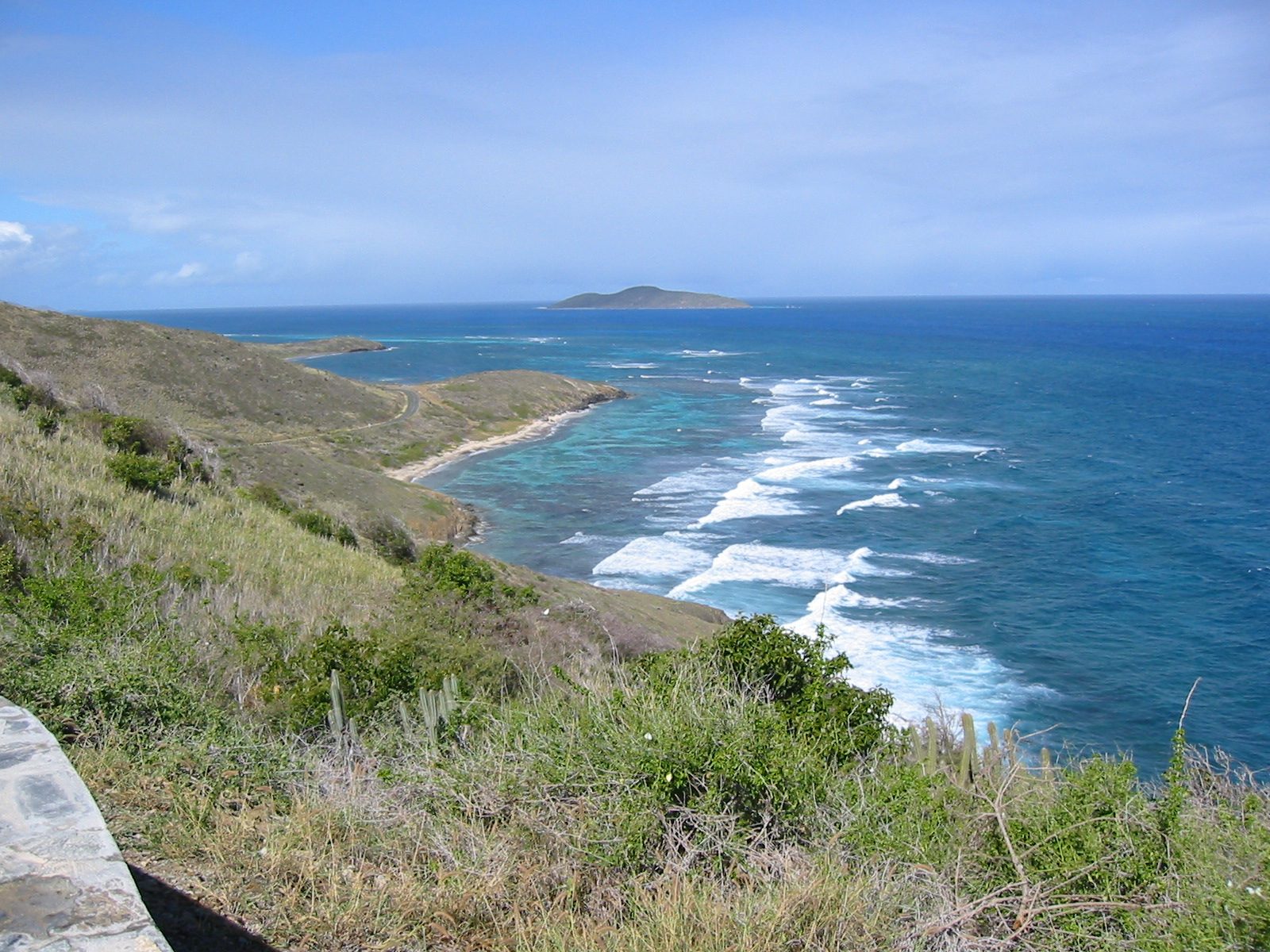
Point Udall is where the East End Road runs out. About ten minutes past the villa's gate, past a beach park and a radio telescope, the pavement climbs a dry headland and stops at a stone sundial with nothing east of it but water. This is the easternmost point of the United States by the usual definition, the place a crowd came to watch the first American sunrise of 2000, and the trailhead for two of the wildest beaches on St. Croix. It costs nothing, has no facilities, and is worth at least one early alarm.

Where it is on St. CroixChristianstedFrederikstedPoint UdallThe CeruleanPoint Udall
Where it is. Island outline © OpenStreetMap contributors (ODbL).

What Point Udall actually is

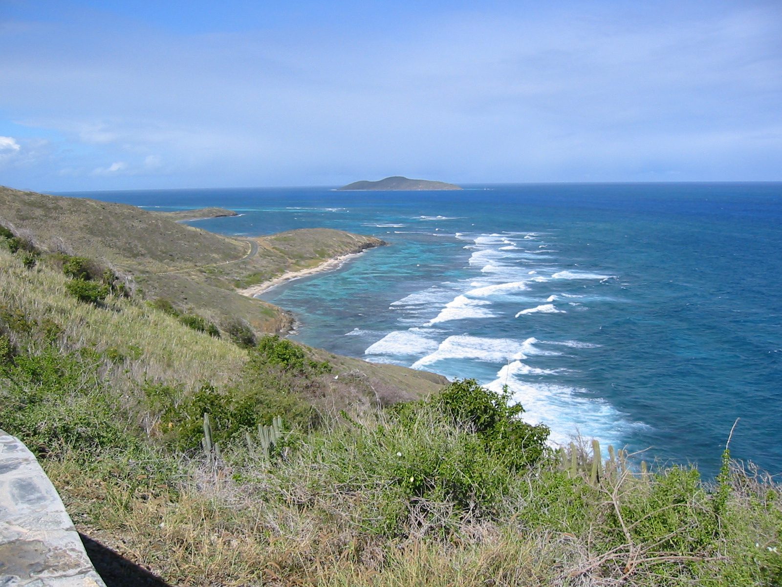
Strip away the slogans and Point Udall is a headland at the far eastern tip of St. Croix, at about 17°45′ north and 64°34′ west. The rock is old and rough: uplifted and rotated volcanic and sedimentary rocks of Upper Cretaceous origin, which is a geologist's way of saying the ground under your feet was laid down in the age of the dinosaurs and then shoved up and tilted. It looks it. The vegetation is low and sun-loving, sea grape and coastal scrub rather than palms, because this is the sunny, drier end of the island.

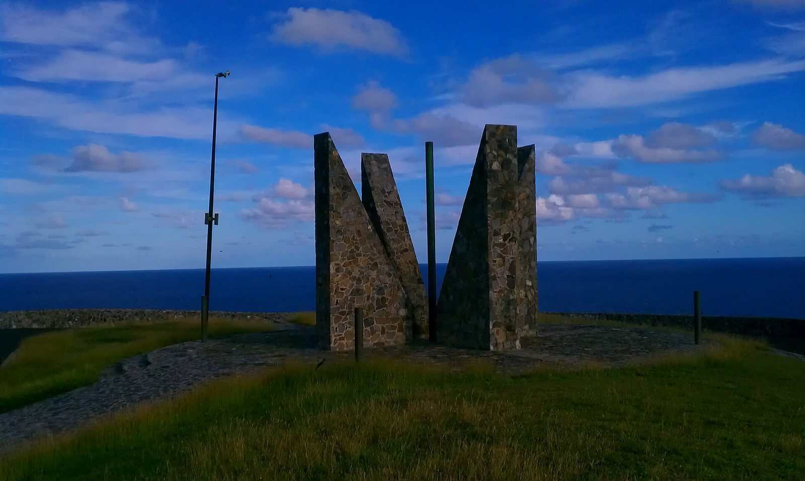
Two things sit here. The point itself is the low rock at the water's edge, the true easternmost ground. Above it, on the headland where the road ends, is the Millennium Monument, a big stone sundial raised for New Year's 2000. Most people never go down to the actual point; they park below the monument, walk up to the platform, and look. From there the coast falls away on three sides, with Buck Island off to the north, the ridge running west behind you, and the two bays of the Jack and Isaac preserve below to the south. It is one of the widest views on the island.

What Point Udall is not is a park in the developed sense. There is no gate, no ranger, no fee, no restroom, no shade structure, and no shop; there are no concessions at the point either. One more thing to settle early: the water. St. Croix sits in the Caribbean Sea, but due east the horizon is empty. The nearest land in that direction is the Leeward Islands, well over a hundred miles off and far below the horizon, and beyond them nothing until Africa. That empty eastern horizon is why the sunrise here looks the way it does, and why the monument faces the way it does.

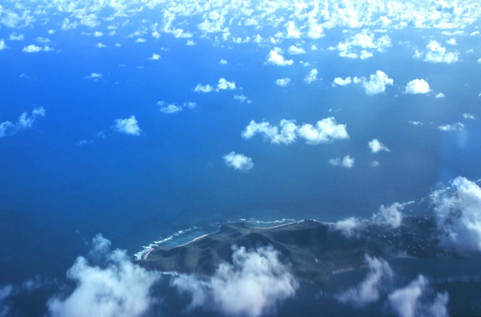
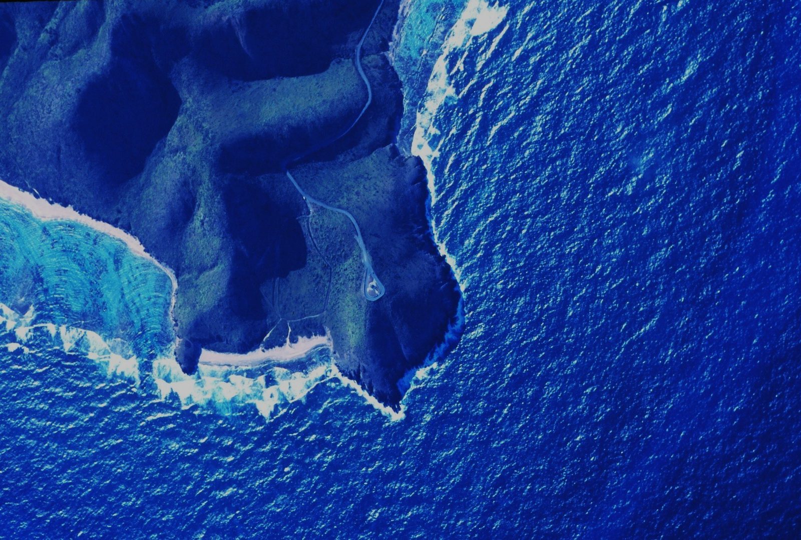
UdallPoint.AerialView
Point Udall, at the eastern tip of St. Croix: a dry headland with the Millennium Monument above it and open water to the east. Photo: Sean Linehan/National Oceanic and Atmospheric Administration (Public domain)

What "easternmost" really means

Every guidebook calls Point Udall the easternmost point in the United States, and it is, but the claim carries a footnote that is more interesting than the slogan. The careful wording is this: the easternmost point of the U.S. by travel, not by longitude. The reason is Alaska. A handful of the Aleutian Islands lie across the 180th meridian, which technically puts them in the Eastern Hemisphere. Measured the way people actually move across the map, from the mainland outward, St. Croix's tip is as far east as American soil goes; measured on a globe with a protractor, an Aleutian rock wins on a technicality.

The symmetry on the other side of the map is real and worth telling your kids in the car. The westernmost point of the United States by travel is on Guam, and it is also named Point Udall, for Stewart Udall's brother Morris. The Udall brothers of Arizona bracket the country: Stewart's point is the last American ground on the Atlantic side, Mo's the last on the Pacific side. Guam, across the International Date Line, also gets each calendar date before any other American ground.

Now the sunrise fine print. "First sunrise in the United States" is exactly true on the morning the monument was built for: on January 1 the sun clears the sea at Point Udall about an hour and a quarter before it clears the coast of Maine, in absolute time, because winter dawns come late at high latitudes. From roughly the September equinox to the March one, Point Udall really is first. From spring to fall the tables turn: in late June, Maine's easternmost point sees the sun about an hour before St. Croix does. So the honest version is: the first American sunrise of the year and of every winter morning, not of every single day.

None of that changes what you see from the platform. It just means you can answer the pedant in your group before they ask. The easternmost point of the fifty states, for the record, is in Maine; Point Udall's title includes the territories, and the territories are part of the country.

64°34′ WLongitude
1969Named
2000Monument built
About 3 miVilla to point
25 mVLBA dish
60 sq miMarine park

Stewart Udall and the name

Until the late 1960s this was simply the East End's last headland. Then it was named for Stewart L. Udall, Secretary of the Interior under Presidents Kennedy and Johnson from 1961 to 1969. The naming year is given variously as 1969, the last year of his tenure, or 1968. Either way, it came at the end of his eight years running the department that oversees the national parks, the public lands, and, then as now, much of the federal government's business with the territories. The stated reason was to honor his work supporting the economy of the islands.

Udall's Interior years overlap with the East End in one specific way you can see from the ridge. Buck Island Reef National Monument, the reef island a mile and a half off the northeast coast, was proclaimed by President Kennedy in December 1961, in Udall's first year at the department, and the Interior Department, through the National Park Service, has run it ever since. Stand at the monument, look north, and the small green island on the horizon is one of the places his department took on while he was there; our Buck Island guide tells the rest.

He was a strong advocate for a cleaner earth, and the naming here is modest by the standards of monuments: no plaque the size of a wall, no statue. A headland, a name, and later a sundial. The Guam naming, for Congressman Morris "Mo" Udall, gives the family the two ends of the country; we could not find a reliable account of whether that was planned as a pair or happened as a coincidence, so we will not invent one.

  1. Late CretaceousThe volcanic and sedimentary rock of the headland is laid down, later uplifted and tilted
  2. 1961Stewart Udall becomes Secretary of the Interior — Buck Island Reef National Monument is proclaimed that December
  3. 1968–69The East End's last headland is named Point Udall in his honor
  4. 1993The Very Long Baseline Array is dedicated, its easternmost dish a mile west of the point
  5. 1999The Nature Conservancy protects the Jack and Isaac Bay Preserve below the point
  6. Jan 1, 2000Sunrise ceremonies at the new Millennium Monument mark the first U.S. sunrise of the year
  7. Jan 9, 2003The St. Croix East End Marine Park is established around the point
  8. Sept 2017Hurricane Maria damages the VLBA dish — a $2 million repair follows

The Millennium Monument

The sundial on the headland was built for one morning. As 1999 ran out, the Virgin Islands prepared to be the first place under the U.S. flag, on this side of the date line, to see the sun rise on the year 2000, and Point Udall was where it would happen. A monument went up above the point: a sundial known as the Millennium Monument, built for the New Year's celebration in 2000, which marks the azimuth of the first U.S. sunrise of that year. The design is credited to Bill Rich. Special ceremonies were held on the headland as the sun came up on January 1, 2000.

The word "sundial" sets the wrong expectation. You will not read the time off it. It is better understood as a sightline: a big stone structure whose alignment records where on the horizon the sun appeared that morning. That bearing is not due east. By the standard solar equations, at this latitude on January 1 the sun clears the horizon at an azimuth of about 114 degrees, roughly 24 degrees south of east. So the monument aims southeast, and in winter you can watch the sun come up along its line. Visit in June and the sun rises about 25 degrees north of east instead, well off to the left of the monument's bearing.

The pedants will remind you that the third millennium began on January 1, 2001, not 2000. The monument says 2000, the party was in 2000, and the sunrise on the first of January is the same both years, so we are on the monument's side. It is a plain, heavy, unglamorous object that has weathered a quarter century of trade wind and salt on an exposed headland, which is more than most millennial souvenirs managed. It stands on the platform above the small parking area, a short walk up, and it is the natural foreground for photographs, the natural windbreak on a blowy morning, and the natural place to stand for the sunrise.

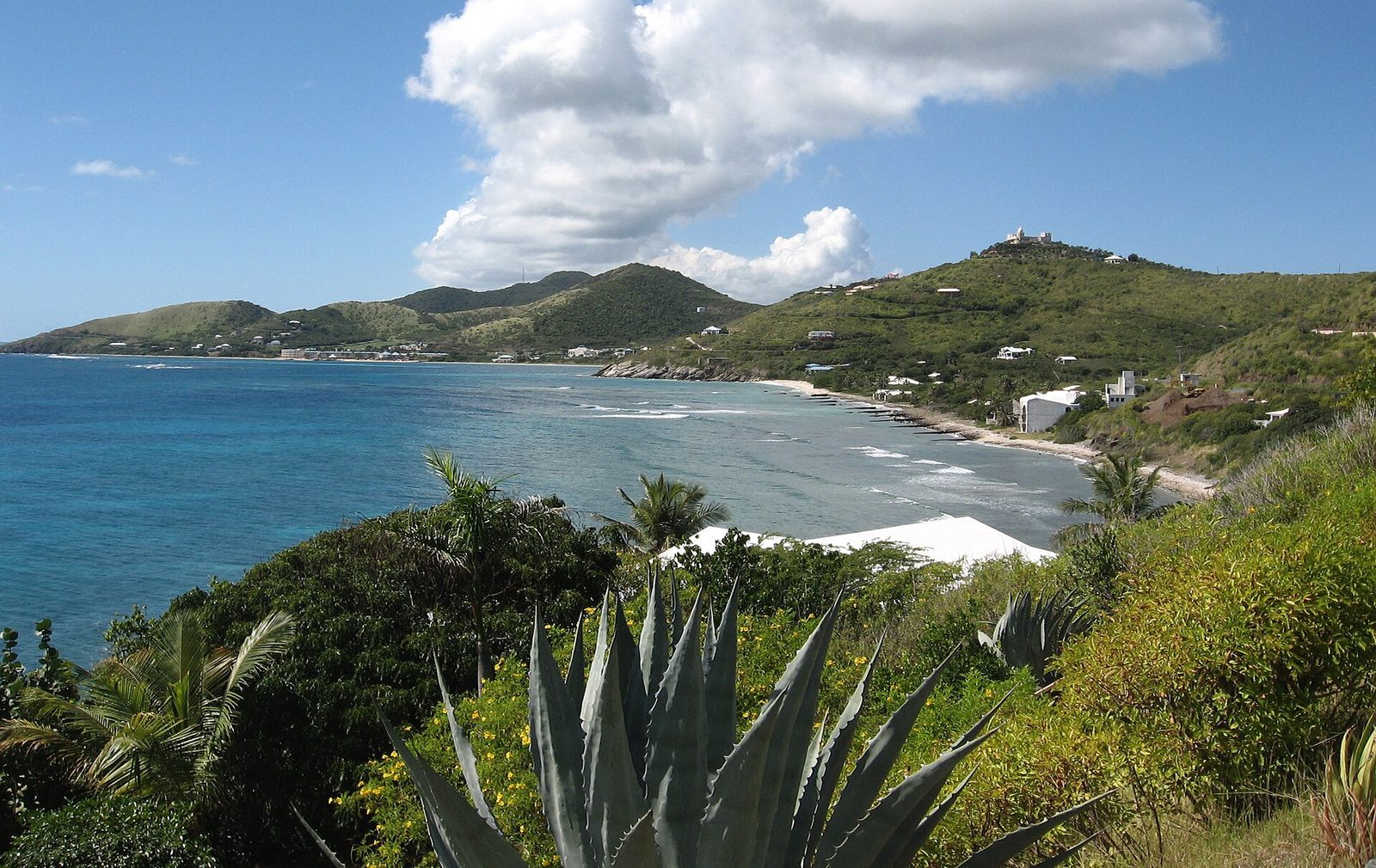
Boiler Bay from Point Udall
The easternmost point of the United States and the East End coast around it, where the island runs out. Photo: Dartrider (CC BY-SA 4.0)

Sunrise at Point Udall, minute by minute

Here is how the morning goes. You leave the villa in the dark. The road is empty, the telescope dish is a pale shape against the sky, and the last hills feel longer than they are. You park below the monument, walk up, and find the wind. First light, what astronomers call civil dawn, comes about 20 to 25 minutes before the sun itself, and it comes fast this close to the equator. The eastern sky goes gray, then pale gold along the horizon, then amber, and any cloud out over the water picks up pink on its underside.

The sun itself is quick. On an unclouded morning it clears the sea in a couple of minutes, and the light comes straight across the water at you with nothing in between. That is the whole show, and it is a good one, but it is short. Most people stay ten or fifteen minutes past sunrise, take their pictures, and go: back to the villa for breakfast, or down the trail to Isaac Bay while it is still cool.

Two variables matter more than anything else. The first is cloud on the eastern horizon: the trade wind pushes low cloud in from the east, and it is common for a bank of it to sit right on the sea line and swallow the actual moment of sunrise. That is not failure; the color before and after is often better with cloud than without, and the sun clears the bank a few minutes later. The second is timing. Arrive 30 to 45 minutes before sunrise: the light before the sun is the best of it, and you want to be standing still, not parking, when it starts.

The wind is the surprise for first-timers. The East End is the windward end of the island, and this headland takes the trades first. Bring a layer. Bring coffee in a lidded mug. Hats go into pockets. If you carry a tripod, weight it or hold it. In winter, when the Christmas Winds blow, the platform can be properly blustery; in a summer calm it can be almost still. Either way, on the drive home the villa's veranda will feel remarkably sheltered.

MonthApprox. sunrise (AST)Notes
January6:49–6:52 amLatest sunrises of the year — sun rises far to the south of east, on the monument's line
February6:45 amStill late and southerly, dry season, strong trades
March6:26 amEquinox — sun rises almost due east, still dry
April6:02 amSunrise moving earlier and north of east
May5:46 amEarly alarms begin, sun well north of east
June5:42–5:44 amEarliest sunrise of the year (around June 4), longest days
July5:52 amSun rises about 25 degrees north of east
August6:00 amHurricane season peak begins — watch the forecast
September6:04–6:06 amEquinox — due east again, wetter months start
October6:12 amEarlier sunsets, later sunrises
November6:24 amSun swinging back south of east, trades pick up
December6:41–6:44 amLate, southerly and dry — the easy month for sunrise runs

Reading the sunrise table

The times above are computed for Point Udall's coordinates with the standard NOAA solar equations, and they agree with published tables for nearby Christiansted to within a minute or two: mid-August 2026, for example, shows a 6:00 to 6:01 am sunrise on both. Use them for planning and check a proper sunrise table for your exact date the night before. All times are Atlantic Standard Time. The Virgin Islands do not observe daylight saving, so in summer the clock here matches New York and in winter it runs an hour ahead of it, which matters if your phone is still on East Coast time.

The range is smaller than mainland visitors expect: about an hour and ten minutes between the earliest sunrise, around June 4, and the latest, in mid-January, and day length swings only from about eleven hours in December to a little over thirteen in June. What moves more than the clock is the bearing: about 24 degrees south of east at midwinter, about 25 degrees north of east at midsummer, a swing of nearly fifty degrees along the horizon.

If you want the sunrise to behave the way the monument's builders saw it, come between late November and early February. If you want to sleep, come then too: a 6:45 am sunrise means a 6:00 am alarm, which is civilized, while a June sunrise at 5:42 am means leaving the villa in the dark at 5:10.

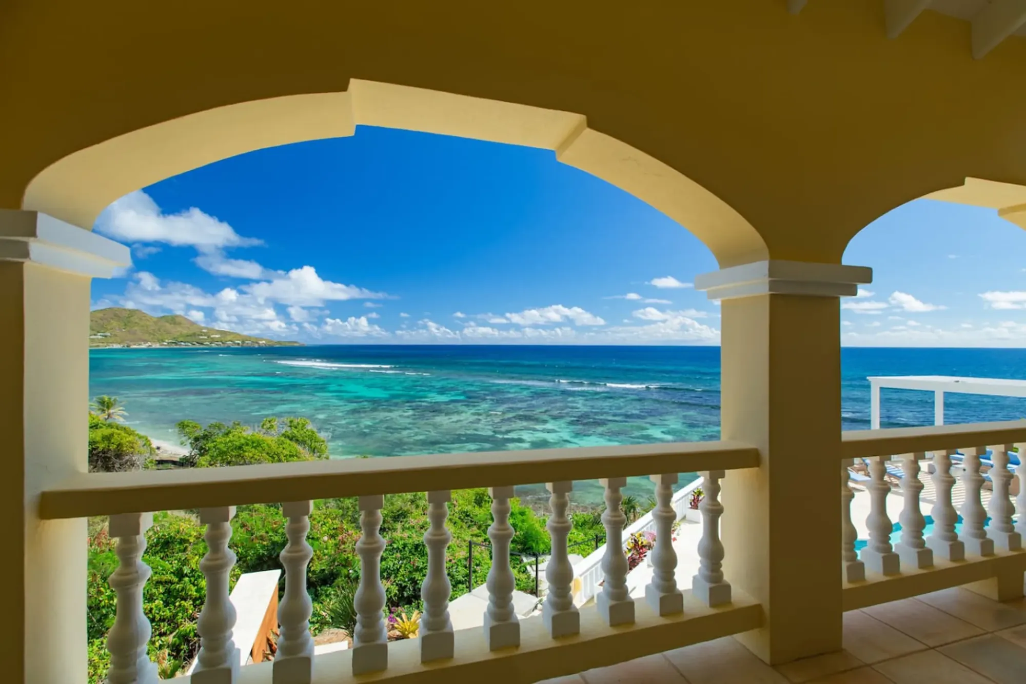
Turquoise bay framed by the villa's arched veranda
The Cerulean

Plan it from the villa.

Five bedrooms, a private swimmable beach, and all of this within a day trip.

Sleeps 12 · 4.90 ★ · rates by season

The drive from The Cerulean

This is the easiest outing on the island because you are already on the East End. The point is a little over three miles from the villa in a straight line and about ten minutes by road, give or take a few for the hills; the Jack and Isaac trailhead, just short of the point, is about a five-minute drive. The last leg is Route 82, the East End Road, which runs out along the north shore past Cramer's Park, the public beach park, and the white radio-telescope dish, then climbs to the headland. There is nothing to buy along the way, so leave the villa with coffee already in hand.

The end of the road is the part to respect. It is narrow and winding: a paved but tight climb with rock and scrub close on both sides and no lighting. Drive it slowly in the dark, use your high beams when nobody is coming the other way, and expect the occasional car coming down from someone who beat you to it. Our driving guide covers the island's left-side-of-the-road habit; the East End Road is where you will be glad you read it before dawn.

Parking is a small lot below the monument, and it fills on popular mornings, particularly New Year's Day; parking is limited, so arrive early for sunrise. Do not leave valuables in the car: an empty lot at the end of a road, out of sight of any house, is exactly the kind of place a bag on a back seat goes missing.

What you will not find: a restroom, a water tap, a shop, a shade structure, a ranger, or a reliable phone signal; there is no cell reception and no nearby stores. Plan the morning so that none of that matters, then come back to the villa's kitchen for the breakfast you left half-made.

A sunrise run from the villa

  1. Check the sunrise time the night before and set the alarm for 45 minutes before it, more in the dark of winter.
  2. Coffee into lidded mugs, a layer each, shoes with soles, phone charged, and nothing valuable left in the car.
  3. Drive Route 82 east past Cramer's Park and the radio dish, then take the last winding climb slowly with high beams.
  4. Park in the small lot below the monument and walk up to the platform. Face southeast in winter, more east-northeast in summer.
  5. Watch the light from civil dawn through sunrise, then either drive home to breakfast or start down the Jack and Isaac trail while it is still cool.

The radio telescope you drive past

About a mile west of the point, next to Cramer's Park on the East End Road, stands a white dish 25 meters (82 feet) across, tilted at the sky. It is not a satellite dish and not a military installation. It is the St. Croix station of the Very Long Baseline Array, the VLBA, one of ten identical radio telescopes spread across the United States and its territories that observe together as a single instrument. The other nine are on Mauna Kea in Hawaii, in Washington, California, Arizona, two sites in New Mexico, Texas, Iowa, and New Hampshire. St. Croix is the easternmost, which is the whole reason it is here.

The idea is called very long baseline interferometry: telescopes far apart record the same source at the same instant, the recordings are combined, and the array behaves like a dish as wide as the distance between its farthest antennas. For the VLBA that distance, from Mauna Kea to St. Croix, is about 8,611 kilometers, or 5,351 miles; the NRAO's station page describes the result as "an image as though the array were a single antenna with a diameter nearly the diameter of the earth." That is why a small dry island in the Caribbean has a piece of a continent-sized telescope: nobody else under the U.S. flag is this far east.

The numbers are worth having in the car. Each dish is 25 meters in diameter and weighs about 240 tons, or 218 metric tons, the same weight in different units. Construction began in February 1986 and finished in May 1993; the first observation using all ten antennas was made on May 29, 1993, and the NRAO dates the array's dedication to that year. Nobody sits at this dish and looks through it. The array is run remotely from Socorro, New Mexico, and the St. Croix station is staffed to keep the machine healthy in a hard climate: the sea air corrodes parts, and the dish needs painting more often than its mainland siblings.

The hardest day in its life was September 2017. Hurricane Maria damaged both the 240-ton antenna and the building housing its electronics, and in August 2018 the observatory announced $2 million in National Science Foundation disaster-relief funding to put it right; the NSF's astronomy director called the station "the key easternmost element of this continent-sized array." Repairs followed and the dish went back to work. There is no advertised visitor program that we could find; you look at it from the road, which is enough.
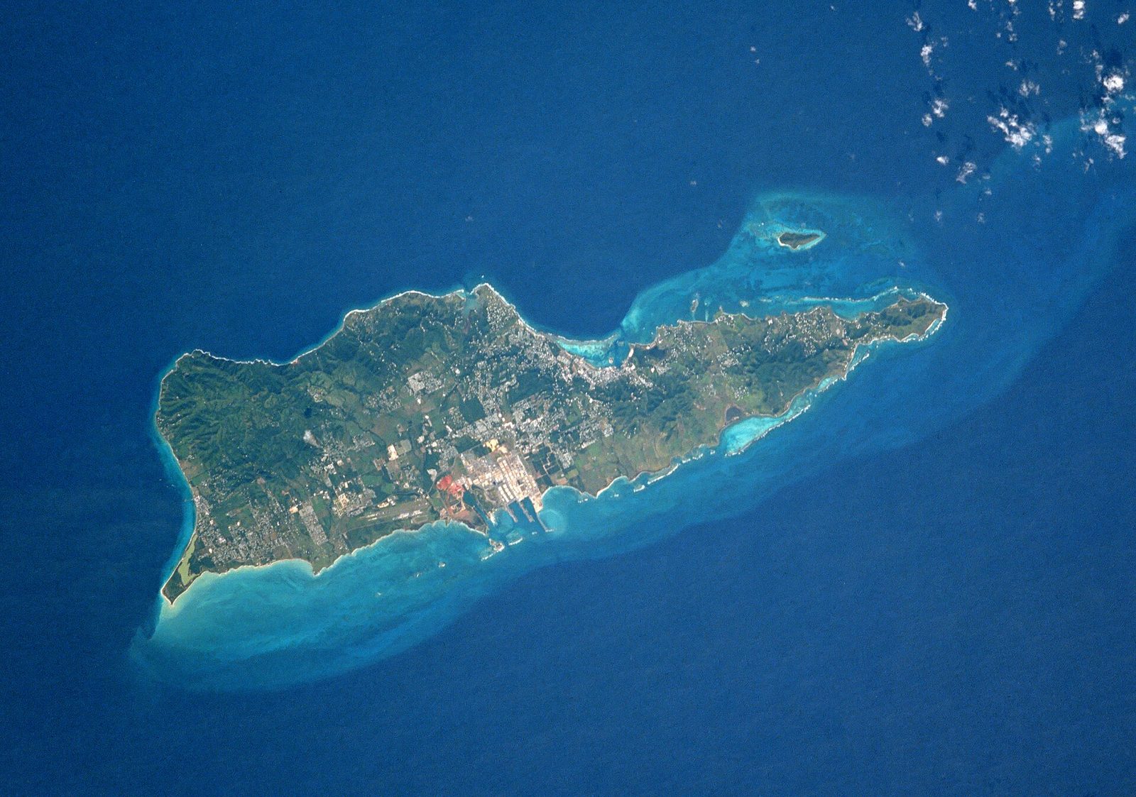
St Croix NASA
The East End from above: the ridge, the bays, and the last headland where St. Croix ends. Photo: NASA (Public domain)

Below the point: the Jack and Isaac Bay Preserve

Just short of the monument, on your right as you climb, there is a small parking lot. That is the trailhead for the Jack and Isaac Bay Preserve, 301 acres of upland forest and two undeveloped white-sand bays that The Nature Conservancy has protected since 1999, adjoining a further tract of government-owned natural area. There is no road to either beach. You walk in on foot along a narrow trail, which is precisely why the sand stays empty. Our East End beaches guide and the journal entry on the hike cover the beaches properly; here is only what you need to decide whether to combine them with a sunrise.

The route from the lot runs to East End Bay first, then Isaac Bay, then Jack Bay. The terrain is easy to moderate, mostly upland forest, scrub and beach, with little to no shade on the hike, which matches the whole East End. Isaac Bay is the snorkeling bay, with elkhorn, staghorn and brain corals and at least 400 species of fish offshore; the beaches together hold the largest nesting populations of green and hawksbill turtles on St. Croix. There are no amenities on either beach, no lifeguards, and the water can be choppy with currents. Nesting runs mainly from August into November, so if you find tracks or a marked nest, give it room.

The pairing with sunrise works, with one condition: start down soon after the sun is up. The trail is exposed, the East End is dry, and by mid-morning the heat is real. Carry more water than seems reasonable, wear shoes with soles, put on mineral sunscreen and a hat, and turn around before you are tired rather than after. If the group is mixed, send the walkers down and let the rest drive back to the villa for a swim. What makes the preserve special is that two of the finest beaches on the island sit ten minutes from a private villa and are reached only on foot. Point Udall is the front door to that.
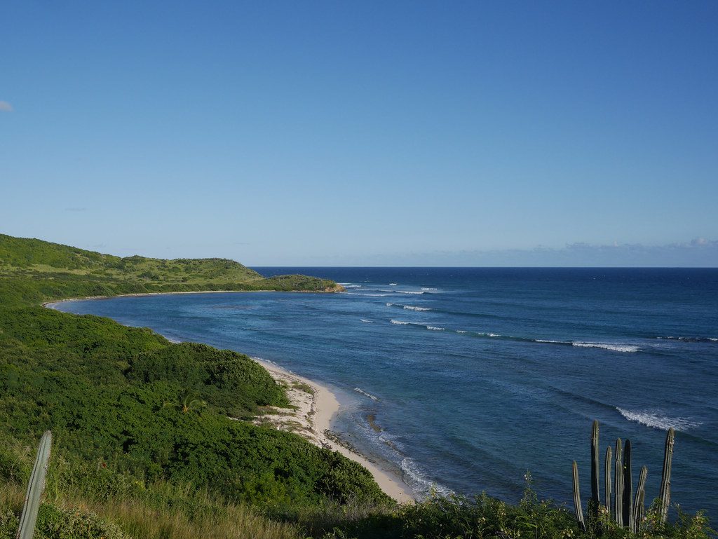
Jack Bay View, St Croix
The Jack and Isaac Bay Preserve below Point Udall: sunny hills and undeveloped white-sand bays reached only on foot. Photo: GRI SHA (Flickr) (CC BY-SA 2.0)

The East End Marine Park around it

Everything in the water around Point Udall, from the surf line out to the three-nautical-mile territorial limit, is inside the St. Croix East End Marine Park. The park was established on January 9, 2003 as the U.S. Virgin Islands' first territorially designated and managed marine protected area. It covers 60 square miles of water along about 17 miles of shoreline, from Green Cay on the north side round the point to Great Pond Bay on the south, and it is managed by the Coastal Zone Management division of the territory's Department of Planning and Natural Resources. The point, the bays below it, and Cramer's Park all sit inside it.

The park is zoned, and the zones matter to visitors. There are recreation areas, where line fishing is allowed from the beach out to 100 feet and spearfishing is not; no-take areas, about 8.6 percent of the park, where nothing may be fished or taken but where you may still snorkel and dive; an open fishing area under standard territorial rules; and a Turtle Wildlife Preserve covering East End Bay, Isaac Bay and Jack Bay out to a mile and a quarter offshore. Leatherback, green and hawksbill turtles nest on the park's beaches, and the bays under Point Udall are among the important nesting grounds; our sea turtles guide explains what that looks like on the sand.

What the park protects is the habitat that makes the snorkeling below the point worth the walk: seagrass meadows that serve as nurseries, shallow linear reefs and patch reefs, deeper reefs offshore, mangroves including the largest remaining tract at Great Pond, and a string of beaches and salt ponds. It sits beside Buck Island Reef National Monument, so between the federal reef and the territorial park, almost the whole northeastern corner of the island's waters is under some kind of protection.

For you the rules reduce to good manners: no spearfishing, no taking anything from the no-take zones, no touching coral, no anchoring on it if you are on a boat, and no disturbing a nesting turtle. Bring mineral sunscreen or a rash guard, since the territory bans the reef-harming chemical kinds. None of it costs you anything, and all of it is why the water below the point still looks the way it does.

Goat Hill and the ridge behind you

Turn your back on the sea and the East End's ridge runs west from the point, low, sun-washed and folded. Its high point is Goat Hill, 672 feet, and the summit is the East End's other great viewpoint. The trailhead is across the street from Cramer's Park, on the east side of the radio telescope: past the dish, a right turn onto a dirt road for about 0.7 miles brings you to an overlook and a fork, and the left fork climbs. It is about two miles round trip, an hour and a half to two hours, on an old four-wheel-drive track that is thoroughly rutted and rocky.

The reward is the only 360-degree view on this end of the island. From the summit you look west down the spine of St. Croix, out over the sea on both sides, north to Buck Island, and east to Point Udall and the two bays below it. The vegetation is sea grape, eugenia and ginger thomas, the last with yellow bell-shaped flowers much of the year. There is no shade at all, cell reception is thin, and going alone is not advised. Our East End ridge hikes guide has the full route; do not do Goat Hill as an afterthought to a sunrise, do it as its own morning, early.

Buck Island is the thing you keep looking at from up here. It sits about a mile and a half off the northeast coast, a low dry-forest island wrapped by an elkhorn barrier reef, a national monument since 1961 and a no-take marine reserve since 2001. From the ridge road and from Goat Hill you see its whole shape, and the nearest boats for it leave from the East End; the Buck Island guide covers the boats, the trail and the rules. From the point itself, Buck Island is off to the north on your left as you face the sunrise, and on a clear morning it takes the first light a moment after the water does.
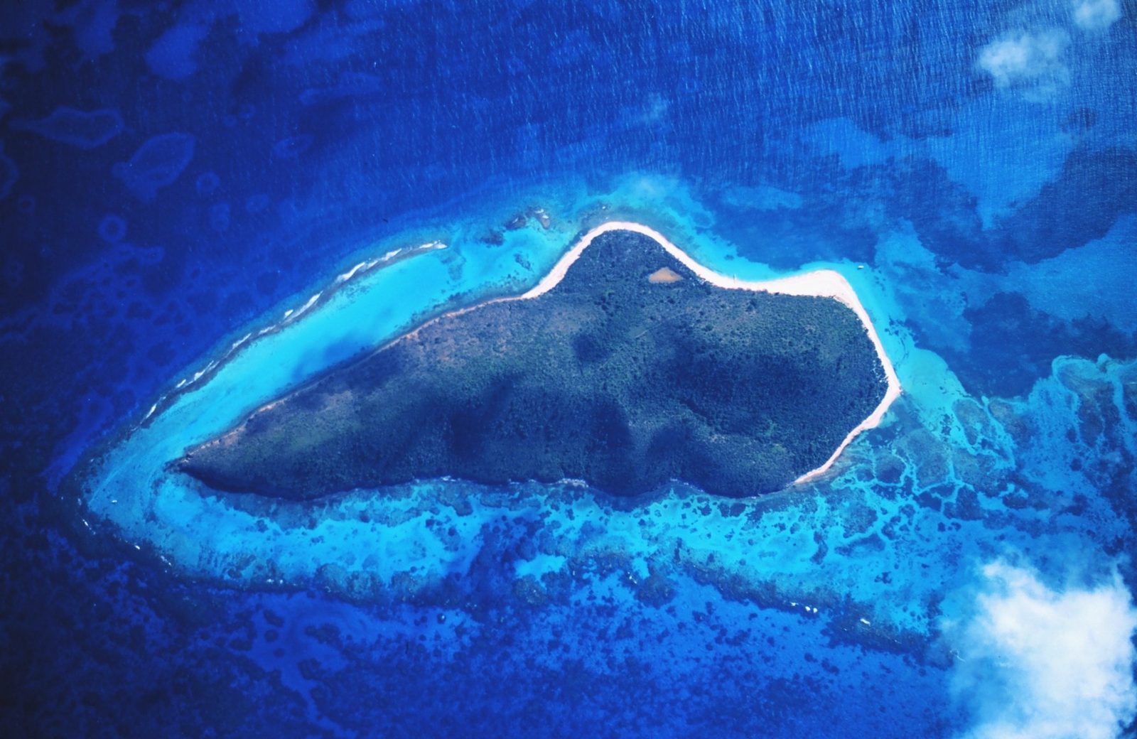
BuckIslandReedNM
Buck Island off St. Croix's northeast coast: a low reef island that you can pick out from the East End ridge and from the point. Photo: Wikimedia user Russavia (Public domain)

Wind and weather on the windward end

The East End is the sunny end of St. Croix: low coastal hills and sea grape where the west end has rainforest. The reason is the trade wind. It blows out of the east most of the year, meets the island here first, and drops what rain it carries on the higher ground farther west, so the East End sits in a rain shadow of its own island. For a sunrise visit that means clearer skies on average than the wet side gets, and it means wind. The point takes the trades before anything else on St. Croix, and the monument platform is exposed on three sides.

By season, the pattern most guests notice: December through March brings the strongest, steadiest winds, the so-called Christmas Winds out of the north and northeast, which make the headland blustery and the sea below it white; the sky is at its driest and clearest then. April through June is calmer and still relatively dry. July through November is hurricane season, with the peak from August to October, and it is also the wetter half of the year, with more cloud over the eastern horizon at dawn. Read our weather by month guide for the numbers and our hurricane season guide for the honest odds; a named storm is rare in any given week, cloud at dawn is not.

What this means for the plan is simple. In winter, dress for the wind, not the temperature: a light layer, a hat you can hold onto, and a windbreak in mind (the monument itself works). In summer, come earlier than you think, because the light and the heat both arrive fast. In any month, if the horizon is banked in when you arrive, wait: the trades move cloud quickly, and a gap often opens within the first quarter hour after the official sunrise time. On a gray, windy morning the point is still the end of the road, the bays are still empty, and the platform still faces the emptiest horizon in the country.
Line1513 - Flickr - NOAA Photo Library
Photo: Mr. Sean Linehan, NOAA, NGS, Remote Sensing. (Public domain)
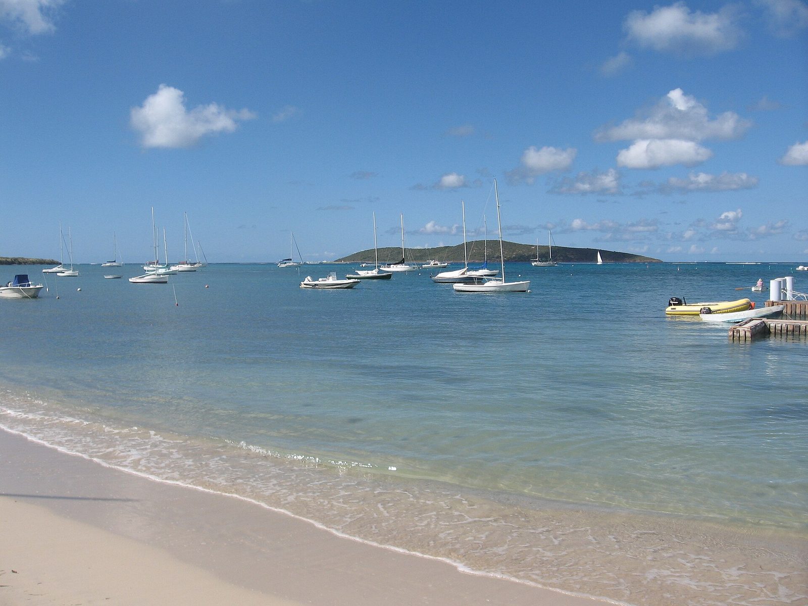
2008-01-27 Teague Bay Beach St. Croix USVI
Photo: Jpheym Jason P. Heym / Seascape Pool Center Inc. (CC BY-SA 3.0)
2008-01-27 Grapetree Bay St. Croix USVI
Photo: Jpheym Jason P. Heym / Seascape Pool Center Inc. (CC BY-SA 3.0)

Photographing the point

Point Udall photographs better than most famous viewpoints because it has a foreground. The monument gives you a solid, angular shape to set against the sky, and the low scrub and rock give you texture at your feet. The classic frame is from the platform looking southeast in winter, with the monument on one edge and the sun coming up along its line; in summer, when the sun rises north of the monument, swing round and shoot it over the open water with the headland's edge in the lower third. Get there for civil dawn: the twenty minutes before the sun are gold and pink and soft, the five minutes after are hard and white. Our photography guide covers the rest of the island.

The second frame most people miss is behind them. Turn west after sunrise and the first low light rakes across the ridge, Goat Hill and the folded East End hills, with the radio dish a small white shape a mile off and Buck Island a green line to the north; that view is at its best in the ten minutes after the sun clears the horizon, and almost nobody shoots it because they are still facing east. Then look down from the south side of the platform at the bays of the Jack and Isaac preserve, empty, with the reef showing as darker water.

The wind is the technical problem. A light tripod on the platform will shake; hang your bag from it or shoot handheld at a higher shutter speed than you would like. Lens cloths get used, because the air carries salt. If you fly a drone, remember that the point sits inside a territorial marine park above turtle-nesting beaches and that the wind up here is stronger than it feels; keep it short and check the current territorial and FAA rules first. And put the camera down for the two minutes when the sun actually comes up. From the villa's veranda, for the record, you can shoot the same sunrise over your own beach without a drive.

Safety and the small print

Point Udall is not dangerous, but it is unattended and exposed, and a few plain rules cover it. Heat first. There is no shade on the headland or on the trails, the East End is the driest part of the island, and the sun after nine in the morning is strong in every month; carry water, wear a hat, and plan the walking parts of the morning for the first two hours of daylight. Cell reception is poor to absent at the point and thin on Goat Hill, so tell someone at the villa where you are going and when you expect to be back.

Footing second. The platform and lot are paved; everything beyond them is rock, loose gravel and thorn. The edges of the headland drop away steeply to the water, so do not count on a railing: stay back from them, keep children in hand, and never go looking for the actual easternmost rock in the dark or in a strong wind. Wear closed shoes if you plan to step off the pavement at all, and long trousers if you are heading down the trail.

Third, the car. Do not leave anything of value in it, ever, at the point or at the trailhead lot. Take your phone and wallet with you, leave the passports at the villa, and lock up; our car rental directory lists operators if you have not booked one yet.

Finally, the sea. The water below the point and off Jack and Isaac is open to the trades, can be choppy with currents, and has no lifeguard. Swim inside the reef at Isaac Bay in calm conditions and not otherwise, never alone, and never at dawn or dusk when the light on the water is poor. None of this should put you off. It should put you in shoes, with water, with company, and back at the villa's pool by mid-morning.

Mistakes to avoid, and doing it with kids or a crowd

The commonest mistake is arriving at the published sunrise time. By then the color is half over and the sun is a minute from clearing the water; you spend the best light finding a place to park. Be standing on the platform when the sky first grays, and treat the sunrise time as the end of the show, not the start. The second mistake is not checking the time zone; East Coast visitors in winter set their phones an hour wrong more often than you would think. The third is walking down to Isaac Bay in flip-flops "just to look." Either commit to the hike with shoes and water, or admire the bays from above and go back for breakfast.

With children, Point Udall works better than most sunrise outings because it is so short: ten minutes in the car, a short walk, half an hour of standing about, ten minutes home. Bring blankets, because the wind makes a mild dawn feel cool to a child in a T-shirt, and bring something to eat. Give them the two facts that land: the sun is touching America here first, and there is another Point Udall on the far side of the world where it touches America last. Keep them off the edges, and let them be the ones who spot Buck Island. Our St. Croix with kids guide has more of this kind of thing.

With a large group, the constraint is the parking lot and the platform, both small. Take two cars, not four, and go on a weekday if you can. Do not try to bring the whole villa: a house of twelve at Point Udall at 6 am is eight people who wanted to sleep. The right sunrise party is three to five, the ones who actually want it, and the rest get the veranda version and the coffee. For an anniversary, a proposal or a birthday the point delivers, provided you accept that another car may pull in behind you; there is no way to reserve the easternmost point of the United States. And do not stay too long: the best light is gone twenty minutes after sunrise.

Sunrise from the villa or sunrise at the point

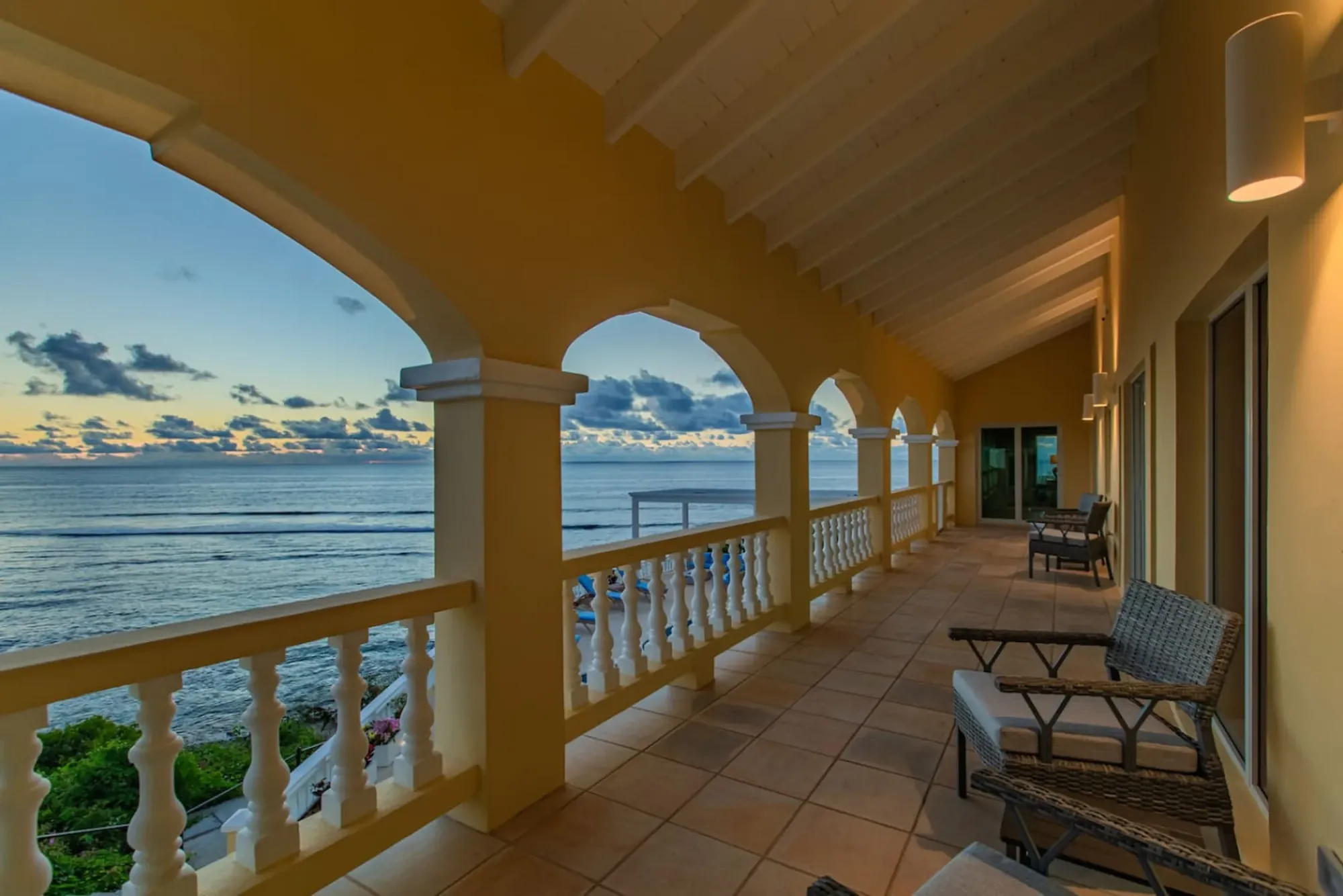
Here is the honest comparison, because The Cerulean faces the same sunrise. The villa's veranda, pool deck and beach look east over the reef, and on any clear morning you can watch the sun come up over your own water without leaving the house. Suzanne Temple, who stayed in March 2026, called the sunrises "incredible" in her review, and a whole journal entry, why the mornings are the point, exists because guests keep saying the same thing.

So why drive anywhere? Three reasons. Point Udall gives you the last-land-in-America fact, and facts of that kind are worth standing on once. It gives you a wider horizon than the villa's, with the sun coming out of the sea unframed by anything. And it is the trailhead for Jack and Isaac, so a sunrise there can turn into an empty beach by seven-thirty. The villa gives you sleep, silence, coffee from your own kitchen, a swim right after, and a private beach where the only footprints are yours. The two are not in competition; they are two mornings.

The plan we suggest to guests: on your first morning, sunrise from the veranda, because you have just arrived and the villa should get the first look. On a later morning, the point, with the early alarm and the flask, then either the trail down to the bays or straight home for the pancakes. If you have only three mornings, do the point on the middle one. If it is winter and the wind is up, the veranda wins twice.

The one honest caution: from the villa you will not see the monument, and from the point you will not have the pool. Both are first light in America; only one has a bathroom.

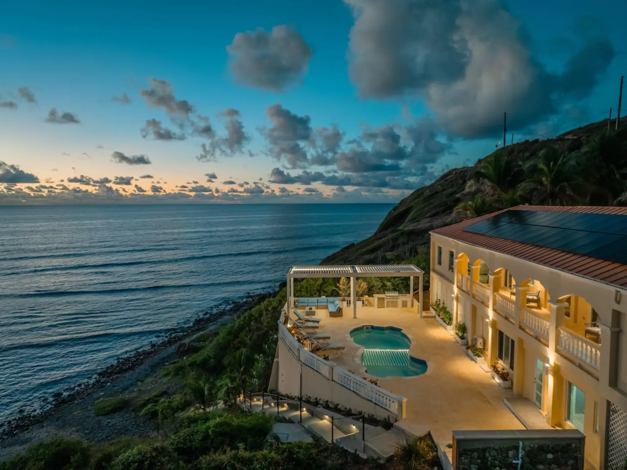
The Cerulean's veranda at sunrise: the villa faces the same eastern horizon as the point, with the reef and its own beach in front.
The Cerulean's veranda at sunrise: the villa faces the same eastern horizon as the point, with the reef and its own beach in front. Photo: The Cerulean

“Great property with a super private location. The sunrises are incredible.”

Suzanne Temple, guest, March 2026

Questions people ask

Is Point Udall really the easternmost point in the United States?

Yes, with one honest qualifier: by travel, not by raw longitude. A few of Alaska's Aleutian Islands sit across the 180th meridian, which technically puts them in the Eastern Hemisphere, so geographers say Point Udall is the easternmost point of the U.S. and its territories by the way you would actually get there. The easternmost point of the fifty states is in Maine. And the westernmost point by travel, on Guam, is also called Point Udall, for Stewart Udall's brother Morris.

What time is sunrise at Point Udall?

It moves through the year from about 5:42 am in early June to about 6:52 am in mid-January, Atlantic Standard Time. The Virgin Islands never change their clocks, so that is the same as Eastern Daylight Time in summer and an hour ahead of Eastern Standard Time in winter. First light comes roughly 20 to 25 minutes before the sun itself. Arrive 30 to 45 minutes early, and check a sunrise table for your exact date.

How far is Point Udall from The Cerulean?

A little over three miles in a straight line, and about ten minutes by car, give or take a few for the hills. The last leg is Route 82, the East End Road, which passes Cramer's Park and the big white radio-telescope dish before it climbs to the headland. The road at the end is narrow and winding, and there is a small parking area below the monument. The Jack and Isaac Bay trailhead, just before the point, is about a five-minute drive.

Is there a fee, a restroom, or any shade at Point Udall?

No, no, and no. Point Udall is free and open to the public with no admission charge, and there are no restrooms, no concessions, no water, and no shade worth the name. Cell reception is poor to nonexistent. Bring water and sun protection, wear real shoes if you plan to walk anywhere off the pavement, and do not leave valuables in the car.

What is the Millennium Monument?

A large stone sundial built above the point for the New Year's celebration of 2000. Its line marks the azimuth — the compass bearing — of the first sunrise of that year on U.S. soil, which is what the ceremonies at Point Udall on January 1, 2000 were held to watch. The design is credited to Bill Rich. Think of it less as a clock and more as a sightline aimed at where the sun came up that morning: roughly 24 degrees south of due east.

What is the big white dish near Point Udall?

It is the St. Croix station of the Very Long Baseline Array, a radio telescope with a 25-meter (82-foot) dish weighing about 240 tons. It is one of ten identical dishes spread from Hawaii to St. Croix that work together as a single instrument, run remotely from Socorro, New Mexico, and it has been in service since the array was dedicated in 1993. Hurricane Maria damaged it in 2017; the National Science Foundation paid for repairs. You see it from the road; there is no advertised visitor program.

Can you hike down to Jack and Isaac Bay from Point Udall?

Yes. The trailhead is a small parking lot on your right as you head up toward the monument. From there the trail runs through the 301-acre Jack and Isaac Bay Preserve, protected by The Nature Conservancy, to East End Bay, then Isaac Bay, then Jack Bay. There is no shade and no water on the trail and no lifeguard on the beaches, so start early, carry a lot of water, and read our East End beaches guide before you go.

Is Point Udall a good place to see stars?

It is very dark — no lights, nothing east of you but ocean — so on a clear, moonless night the sky is as good as St. Croix offers. Go with company, stay on the paved area, watch your footing on the loose rock, and remember there are no facilities and little cell signal. The villa's own beach faces the same dark eastern horizon, which is the easier option for most nights.

When is the best month for a sunrise at Point Udall?

December through February, if you can pick. The sun comes up later (about 6:40 to 6:52 am), so you sleep more; it rises well to the south of east, close to the line the monument was built for; and the East End is in its drier season. The trade-off is stronger trade winds on the headland. Summer sunrises are earlier (about 5:42 to 5:52 am) and the sun comes up north of east, off the monument's line.

Doing it from The Cerulean

This is the villa's home ground. Point Udall is about ten minutes east, the Jack and Isaac trailhead a few minutes closer, Cramer's Park and the radio dish on the way, and Goat Hill's track a right turn past the telescope. Nothing about the outing needs a tour, a ticket or a booking; it needs an alarm, a lidded mug and shoes. If you want the morning to be more than that, the concierge can have breakfast provisions in the kitchen the night before, and a private chef from the directory can be at the stove when you walk back in.

A good East End morning, in order: alarm at 45 minutes before sunrise; coffee and a layer; the drive out with the dish pale against the sky; the platform for the gray-gold-amber run-up and the two minutes of sun; ten minutes of the west view behind you; then a decision. Walkers take the trail to Isaac Bay while it is cool and are back at the villa by ten for a swim. Everyone else is home in ten minutes for breakfast on the veranda, where the light is still coming across the reef. By mid-morning the two parties are together on the pool deck, and the rest of the day is a Buck Island boat, a drive west, or nothing.

Two logistics notes. First, the villa is gated and quiet, and leaving at 5:30 in the morning is easy; drive out slowly, because the East End roads are unlit and narrow. Second, book a hire car for the whole stay rather than relying on taxis; nothing runs to Point Udall at dawn, and nothing should. Our getting here page covers flights and cars.

The last word is the plainest one. Point Udall is the easternmost point of the United States, the country's first sunrise of every winter morning, a stone sundial built for the year 2000, and a headland at the end of a road ten minutes from the villa's gate. You will drive out there once for the fact, and you may go back for the light. Either way, the villa faces the same sun; sleep in the other mornings and let it come to you.

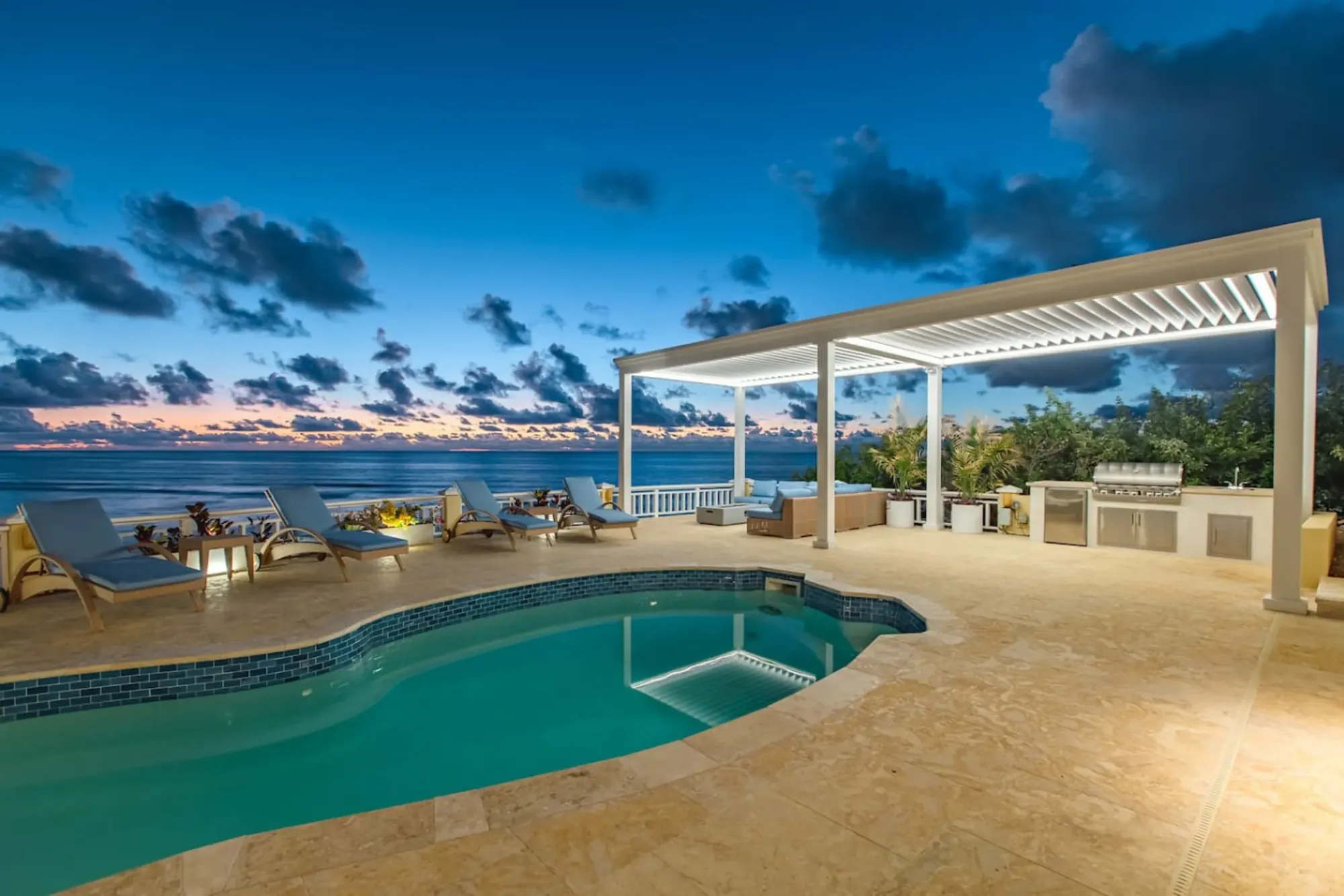
The Cerulean's pool at sunset above the sea
The Cerulean

Twelve of you, one private beach.

The Cerulean sleeps twelve on St. Croix's quiet East End — check your dates.

Sleeps 12 · 4.90 ★ · rates by season
Keep reading

Related guides.

The Cerulean villa at dawn above the sea
The Cerulean

Read it here. Live it from the villa.

Five bedrooms, a private beach, and all of this within a day trip.

Sleeps 12 · 4.90 ★ · rates by season