St. Croix drives on the left, and it does so in ordinary American cars with the steering wheel on the left. That is the one thing about the island that unsettles first-time visitors, and it takes about ten minutes to absorb. This guide covers the rest of the driving picture as we verified it in August 2026: the speed limits, the roads by name and number, the airport rental counters and the local companies that deliver, the goats and the potholes, taxis on an island with no Uber, and the drive from Henry E. Rohlsen Airport to the East End, turn by turn.
Yes, you drive on the left, in a normal American car
Start with the fact that sounds made up. The U.S. Virgin Islands is the only place under the American flag where traffic keeps to the left. The United States drives on the right, except the U.S. Virgin Islands, which keeps left like many neighboring islands. The British Virgin Islands next door keep left too, and so do the Bahamas, the Caymans and Turks and Caicos, so within the region St. Croix is normal. It is only strange if you flew in from Miami.
The twist is the cars. On most left-driving islands the vehicles are right-hand drive, imported from Japan or Britain, so the driver sits by the centerline the way you would in London. Not here. Nearly every car, truck and Jeep on St. Croix comes from the U.S. mainland, and most vehicles in the USVI are left-hand drive for exactly that reason. So you sit on the left of the car and drive on the left of the road, which puts the driver next to the curb and the passenger next to oncoming traffic. Your passenger will notice this before you do.
Why left? The honest answer is that nobody on the island can show you the document. Two explanations circulate locally: that keeping left was a custom carried over from the horse and buggy days, or that British merchants who controlled much of the trade in the Danish West Indies brought their side of the road with them. Another version has donkeys trained to veer left. What is not in dispute is that when the United States bought the islands from Denmark in 1917 the rule stayed, and a century later nobody has seriously proposed flipping it.
What this means for you is mostly sightlines. Overtaking, which you will rarely need to do at 35 mph, is harder than at home because you are on the far side of the car from oncoming traffic. Judging your left edge is easy, since you are sitting right over it, and that is the edge with the potholes, the pedestrians and the goats. Give the right side of the car more room than feels natural at first.
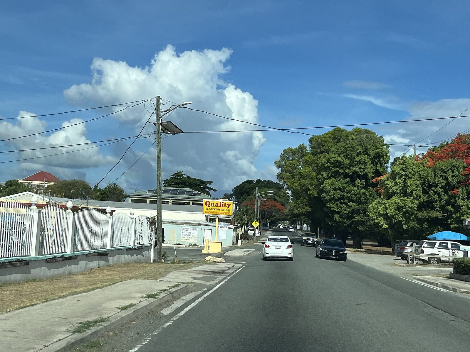
A road on St. Croix's north side: two lanes, little or no shoulder, and traffic keeping left in left-hand-drive cars.Photo: Андрей Бобровский (CC BY 3.0)
The first ten minutes
The adjustment happens in the rental lot, and it happens once. You get in on the familiar side, everything in the car is where it should be, and then you pull out of the space and every instinct says to drift toward the right-hand lane. The single most useful line we found is a memory aid: keep your shoulder to the shoulder. In a left-hand-drive car on a left-hand road, the driver's shoulder belongs next to the road's edge or curb and the passenger belongs next to the centerline. If the centerline is on your side of the car, you are in the wrong lane, and you should fix it before the next bend rather than after.
Turns are the test. A left turn is the easy one; you stay tight to the near curb and slot straight into the left lane. A right turn crosses the oncoming lane, so you wait for a real gap, swing wide, and finish in the left lane on the new road, not the right one. Say "left lane" out loud as you complete the turn for the first day. Pulling out of a side road, the near lane carries traffic coming from your right, so look right first, then left, then right again. Crossing a street on foot in Christiansted, do the same.
The trap is not traffic; it is the absence of it. With cars around, you follow them and the lane takes care of itself. On an empty stretch of the East End Road at seven in the morning, habit puts you gently back on the right and you may not notice until a pickup appears around a curve, on the correct side, and gives you a short, polite horn. Passengers earn their keep here: let the person in the front seat chant "left, left" after every stop and turn until it stops being funny, which is roughly lunchtime on day one.
By the second morning it is automatic. The last place it catches people is the trip home, when right turns in Charlotte or Newark feel briefly wrong for a day. That is the whole cost of the custom, and it is smaller than jet lag.
Speed limits and the rules that get enforced
The limits are low, and the island is built for them. The working numbers are 20 mph in the towns unless otherwise posted, 35 mph on most other roads, and 55 on the Melvin H. Evans Highway, the one four-lane divided road. On that highway the 55 applies to passenger vehicles and drops to 40 for heavy trucks and buses. On the rest of the island speed limits rarely exceed 35 mph, and on tight corners you should be down around 10.
Take the 35 seriously, not because a radar gun waits behind every mango tree but because the roads themselves enforce it. Two narrow lanes, hairpin bends in the hills that want about 15 mph, potholes that hide under puddles, and a steady supply of pedestrians and animals mean the posted number is close to the sensible one. Locals drive at island pace and will not thank you for pushing them.
Three rules do get enforced. Seat belts are required by law for the driver and front-seat passenger, and the local advice is blunt: expect a ticket if yours is not fastened. Talking or texting on a hand-held phone while driving is illegal; use the car's Bluetooth or let the passenger navigate. And the drink-driving rules are the same as home, with the same consequences, on an island where the sundowner is a way of life and the roads are dark. If you are the driver on a rum-tour day, you are the driver.
Your license is fine as it is. Both U.S. and foreign licenses are recognized; if yours is not in English, bring an International Driving Permit to keep a rental counter happy. A mainland license stays valid for 90 days after arrival, after which residents apply for a Virgin Islands license through the Bureau of Motor Vehicles (the St. Croix office answers at 340-713-4268). The BMV's website does not spell out a visitor period, so treat 90 days as the accepted guidance rather than a rule you can cite chapter and verse. For a two-week villa stay it will never come up.
LeftSide of the road
20 mphTown limit
35 mphMost roads
55 mphMelvin Evans Highway
90 daysHome license good for
NoneUber or Lyft
The roads by name and number
The territory numbers its roads in a way that is tidy on paper and invisible on the ground. Routes beginning 1 and 2 are on St. John, 3 and 4 on St. Thomas, and 5 through 8 on St. Croix; roads ending in zero are the major ones, and the lone exception is Route 66, the Melvin H. Evans Highway. Public Works maintains them all. In conversation, though, nobody says "Route 70." They say Centerline, or Northside, or the East End Road; the numbers live on the occasional small sign and on your maps app. Learn the names.
The spine of the island is Queen Mary Highway, universally called Centerline Road (Route 70), which runs east to west through the middle from the edge of Christiansted to Frederiksted, past Sunny Isle, La Reine (the farmers market and the Chicken Shack) and Estate Whim near its western end. It was under Public Works repair through much of 2025, so expect fresh patches. Its faster modern twin is the Melvin H. Evans Highway (Route 66), which gets a section of its own below. Between them they carry almost everyone going west.
The coast roads are the pretty ones. The East End Road (Route 82) leaves Christiansted at Gallows Bay and follows the north shore east past the Buccaneer, Green Cay Marina, Teague Bay and Cramer's Park to Point Udall; it is the villa's road and the one you will know best. Going the other way, Northside Road (Route 75) heads west out of Christiansted toward Salt River, and the North Shore Road (Route 80) carries on along the water to Cane Bay and Carambola. Mahogany Road (Route 76) climbs from Centerline near Grove Place west through the rainforest and drops to Route 63, the west-coast road that runs north from Frederiksted toward Sprat Hall, Butler Bay and the Ham's Bluff lighthouse trail.
Two more matter for one specific reason. Route 64, Airport Road, links the terminal to the highway (both West and East Airport Road meet Route 66). And Creque Dam Road (Route 58 on the maps) climbs from Route 63 into the forest, where the unpaved Scenic Road takes off along the ridge toward Mount Eagle. Those last two are the only roads in this guide where the kind of car you rented actually matters; the rainforest guide covers them properly.
Road
Number
Runs
Good to know
Melvin H. Evans Highway
66
Edge of Frederiksted to edge of Christiansted, 9.3 miles
Centerline near Grove Place west through the rainforest to Route 63
20–30 minutes end to end, narrow, blind curves
West coast road
63
Frederiksted north past Sprat Hall and Butler Bay
Turnoff for Creque Dam Road and Ham's Bluff
Creque Dam Road and the Scenic Road
58 / unpaved
Up from the coast into the forest and along the ridge
4x4 territory above the paved section
Airport Road
64
Terminal to the Melvin H. Evans Highway
West and East Airport Road both meet Route 66
The Melvin H. Evans Highway
If St. Croix has a freeway, this is it, and it is a modest one. The Melvin H. Evans Highway is 9.3 miles long, running from Route 661 (Hannahs Rest Road) on the edge of Frederiksted to a junction with Route 70 near Christiansted. It is one of the few divided highways in the territory and the fastest road on the island and in the whole territory, with that 55 mph limit for cars. It is not, formally, an expressway: every junction is at grade with a stoplight, so you will stop several times between the two ends, and the light at the airport road catches everyone.
The name is worth knowing. Melvin H. Evans was the territory's first elected governor, and the highway that carries most of the island's east-west traffic was named for him. Its useful junctions, west to east, are West Airport Road (Route 64) at mile 3.4, East Airport Road (also Route 64) at mile 6.2, and Route 75 at mile 7.7 in the Clifton Hill area, just before the road ends near Christiansted. Off it are the Captain Morgan Visitor Center at Estate Annaberg and Shannon Grove, the turn for Sandy Point at the far west end, and the airport in the middle.
It has been a construction zone on and off for years. A multi-phase rebuild to federal highway standards, with new pavement, safety improvements and lighting, was reported in local coverage as nearing completion in spring 2026, but detours and lane closures have been a regular feature of island news, so do not be surprised by cones. When they appear, Centerline runs parallel a mile or so north and takes only a few minutes longer.
Two practical notes. First, 55 is a ceiling, not a floor, and the road narrows back to two lanes and 35 mph without ceremony at both ends. Second, the highway is the way west for almost everything in this site's guides: Frederiksted and its pier, Sandy Point, the distilleries, the airport. From the East End you reach it by going through or around Christiansted, and that town, not the highway, governs your drive time.
Junctions, the few roundabouts, and the honk that means hello
People arrive braced for roundabouts, because that is where left-side driving is hardest to fake. On St. Croix you can relax a little: the island has very few circles of any size, and the territory's better-known roundabouts are on St. Thomas and St. John. Where you do meet one, the rule is the same as anywhere they drive on the left. Traffic circulates clockwise, you yield to cars already in the circle, and you go slowly. The best advice is the simplest: follow the car in front of you for as long as you can, and if nobody is around, you have nothing to worry about.
What you will meet constantly are T-junctions and stoplights, and those are where the first-day mistakes happen. Approaching a junction, plant yourself in the left lane early. Turning left, hug the curb. Turning right, wait for a genuine gap, because you are crossing the lane of oncoming traffic, then finish in the left lane, not the right one, which is the classic error on an empty road. Some streets in the towns are one-way and not all of them are marked as such, so watch for parked cars all facing the same way before you commit.
The rest is culture, and the culture is kind. Crucian drivers yield to let others into traffic even when they have the right of way, and a short tap on the horn is a greeting or a "go ahead," not a complaint; return it with a wave. Letting someone out of a side road is standard practice, and so is stopping in the lane for a moment to talk to a friend, which will test your patience exactly once. Nobody is in the hurry you brought with you.
Signal early, drive defensively, and stay alert for the hazard the locals warn about most: other visitors who have forgotten to keep left. On the East End in high season, plenty of the cars around you were rented that week, so give oncoming traffic room on blind curves.
Potholes, goats, deer, chickens and the rest of the road
The potholes are no joke; some are big enough to swallow a car. Away from the highway, the roads are narrow two-lane asphalt with poor lane striping, patchy signage, no sidewalks to speak of and, after heavy rain, holes you cannot see under the water. The paved surfaces on the main routes are generally decent and the pothole situation improves after each round of Public Works paving, but the East End Road and the coast roads have stretches where 35 mph is fast and 25 is right.
Then there is the wildlife, which does not yield. The road-crossers are iguanas, deer, mongoose, chickens, goats and donkeys, plus the occasional cow. Chickens are everywhere and mostly get out of the way. Goats graze the verges mid-island and on the East End and step out without looking. The deer are the real hazard: St. Croix has a white-tailed deer population, they are most active around dusk and dawn, and a deer on the East End Road at 6 pm is a real possibility, not a story. Our wildlife guide has the full cast; here the point is simply to keep your speed where you can stop.
Pedestrians are part of the road too. Without sidewalks, people walk on the pavement's edge, children wait for school buses on the shoulder, and joggers use the East End Road in the cool of the morning. Slow down for all of them, give a wide berth, and expect the car ahead to stop without much warning to let someone cross. In the hills, take the hairpins at about 15 mph; the mountain roads north and west of Centerline are where that applies, and where the drop on the passenger side makes the point for you.
One mechanical note: check that your rental has a spare and the tools to change it, and after any pothole strike that makes you wince, pull over somewhere safe and look at the tire and the rim before you drive on.
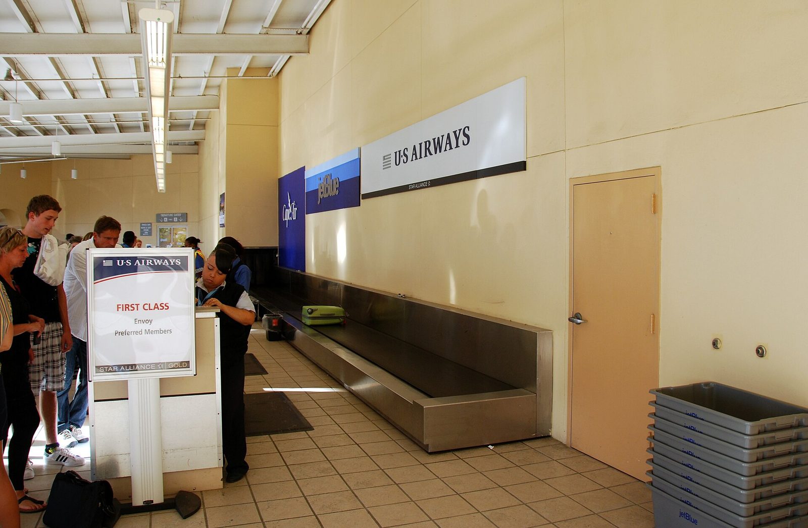
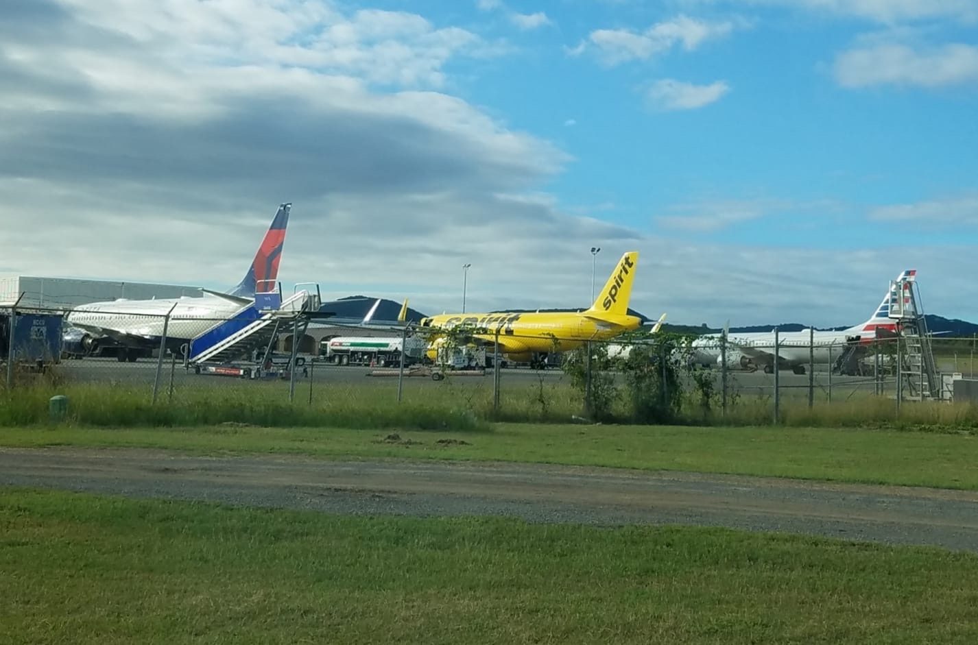
Henry E. Rohlsen Airport, on the south shore about six miles southwest of Christiansted: nearly every visitor's first mile on the left starts here.Photo: Lars Schmidt (CC BY-SA 3.0)
Renting a car: who is at the airport and who delivers
You will want a car from the day you land. The villa is 15 to 20 minutes from Christiansted and 35 to 40 from the airport, the beaches and trailheads are spread along a coast road with no bus to speak of, and there is no Uber. Book the car when you book the villa; winter cars sell out. Most agencies require the driver to be 25, and as of 2026 a typical airport rental runs roughly $60 to $100 a day, more for Jeeps and in high season. Prices move; treat those as a range.
At Henry E. Rohlsen Airport the rental windows are outside the terminal as you exit toward baggage claim, and the names there as of August 2026 are Budget, Hertz and Centerline Car Rentals; Avis is listed at the airport by the major booking sites, so confirm the counter on avis.com when you reserve.
Budget has been an independent franchise on St. Croix since 1977 and also keeps offices in downtown Christiansted across from the seaplane ramp and in Frederiksted across from the pier. Hertz lists cars, Jeeps, SUVs and minivans. Centerline, locally owned and on island since 1990, calls itself the largest independent rental company in the USVI, meets every flight at its terminal location, and has a second office in Christiansted across from the seaplane dock and a third mid-island at La Reine.
The local companies are the other half of the picture, and for a villa stay they are often the better half. Olympic Rent-A-Car, on island since 1973 and the oldest independent agency, is next to the Richmond post office in Christiansted, meets flights and offers free pickup at the airport and most hotels. Judi of Croix, established in 1984 at Estate La Grande Princess, rents late-model automatic sedans, SUVs and vans (mostly Toyotas) with unlimited mileage and free delivery and pickup anywhere on the island, which means the car can be waiting at the villa gate.
Skyline Car Rental, in the La Reine Kingshill Commercial Park, rents cars, SUVs, Jeeps, minivans and trucks and delivers to the airport and seaport free on rentals of more than three days; its office runs weekdays 8 to 5, Saturdays 11 to 4, and by reservation otherwise.
Three counter-side details save trouble. Ask whether your credit card's rental coverage applies in the U.S. Virgin Islands before you decline the waiver; a phone call from home is cheaper than guessing. Photograph every panel of the car before you leave the lot, since island cars carry island scars. And confirm the spare. Our car rentals directory keeps the current list, and the concierge can arrange delivery to the villa so your first left-side mile happens on a road you have already seen.
1917Transfer Day: Denmark hands the islands to the United States, and the left-hand rule of the road stays
1970Melvin H. Evans becomes the territory's first governor elected by its voters
1973Olympic Rent-A-Car opens in Christiansted, now the island's oldest independent agency
1977Budget's St. Croix franchise begins
1984Judi of Croix starts renting cars with free island-wide delivery
1990Centerline Car Rentals opens
Aug 27, 2015The VI Taxicab Commission publishes the per-person tariff still in circulation
2017Ferry service between St. Croix and St. Thomas resumes
Oct 31, 2026United's Saturday Newark nonstop begins, the first New York-area nonstop in more than 30 years
Do you need a 4x4? No, with two exceptions
Every rental page on the island will happily upgrade you to a Jeep, and every visitor forum has someone insisting you cannot see St. Croix without one. Here is the straight version. Every beach, town, distillery, restaurant and trailhead in this site's guides sits on a paved road: the East End Road to Cramer's Park and Point Udall, the North Shore Road to Cane Bay, Northside Road to Salt River, Centerline to Estate Whim, the highway to Frederiksted, Mahogany Road through the rainforest, the roads to the East End trailheads. A normal sedan does all of it, potholes included, and it does it on less gas.
The exceptions are real but specific. The Scenic Road, the unpaved track along the island's spine toward Mount Eagle, and the upper reaches of Creque Dam Road above the paved section both want clearance and four-wheel drive, especially after rain, when the mud is real and the tow trucks are busy. Every season somebody follows a maps app up the Scenic Road in a compact and spends the afternoon waiting; our rainforest guide says it twice because it matters. If the ridge is on your list, rent the Jeep for that day, or for the trip if the budget allows, and enjoy the extra clearance everywhere else.
Otherwise choose the car by taste and headcount. A soft-top Jeep is fun at 35 mph and lets in the sun and, in a squall, the rain; a minivan swallows a family of six and their snorkel gear; a sedan is the quiet, cheap default. For a villa that sleeps twelve, two ordinary cars beat one large one, because the group never wants to leave the beach at the same time.
The Cerulean
Plan it from the villa.
Five bedrooms, a private swimmable beach, and all of this within a day trip.
Henry E. Rohlsen Airport is on the south shore, about six miles southwest of Christiansted, named for a St. Croix native who flew with the Tuskegee Airmen in the Second World War. It has one long runway and a single, small terminal, so the arrival is quick: bags come out, the rental windows are just outside toward baggage claim, and the local companies that meet flights are waiting with a sign. Ten minutes after the door opens you are looking at a car with the wheel on the familiar side.
The route east is simple and almost all on two roads. Leave the lot keeping left; the terminal road brings you out to the Melvin H. Evans Highway (Route 66) within a couple of minutes, and you follow the signs for Christiansted, which puts you on the eastbound side. Ride the highway east through a handful of stoplights past the Route 75 junction to its end near Christiansted, where the road becomes Route 70 and the town's outskirts begin.
From there your maps app will most likely take you around the south side of town on the bypass and drop you onto the East End Road (Route 82) near Gallows Bay. If it routes you through downtown instead, follow it patiently; the streets are narrow and some are one-way, and it is only a few blocks.
The East End Road is the last and best leg: a coast road at 35 mph past the Buccaneer's gate, Green Cay Marina, Teague Bay and the Reef golf course, with the sea appearing on your left as the houses thin out. Sterling Point sends the exact final turns with your arrival details, and the villa's gated drive is the end of the line. All in, plan on about 20 road miles and 35 to 40 minutes without stops, less on a clear midday and more at school-run time. If you want groceries before you settle, the supermarkets on Christiansted's outskirts are on the way; our provisioning directory has them, and the concierge can pre-stock the kitchen instead.
Airport to The Cerulean
Collect bags
the rental windows are outside the terminal toward baggage claim, and delivery companies meet you at the curb.
Leave the lot keeping left and follow the terminal road to the Melvin H. Evans Highway (Route 66)
take the signs for Christiansted, eastbound.
Ride the highway east through its stoplights, past the Route 75 junction, to its end near Christiansted, where it becomes Route 70.
Let your maps app take you around the south side of town on the bypass to the East End Road (Route 82) near Gallows Bay.
Follow Route 82 east along the coast past the Buccaneer, Green Cay Marina and Teague Bay at 35 mph.
Take the final turns from Sterling Point's arrival email to the villa's gated drive
about 20 miles and 35 to 40 minutes door to door.
Taxis, VITRAN, and why there is no Uber
Ride-share does not exist here. As of 2026 neither Uber nor Lyft operates in the U.S. Virgin Islands, and the taxi system is the deliberately old-fashioned kind: not metered, priced per person and per destination on a tariff set by the VI Taxicab Commission, with the same fare whether you flag a car at the airport or the seaplane terminal or at the stand in Christiansted. There is also a local app called VI Hail; we have not used it, so treat it as an option to test rather than a plan to rely on.
The rate card is the catch. The tariff, published by the commission on August 27, 2015, is the one still circulating: airport to Christiansted $16 for one or two people or $9 per person for three or more; airport to Frederiksted $12 or $6; airport to the East End, listed as Cotton Valley or Divi Carina Bay, about $24 for one or two or $11 to $12 per person for a group; Christiansted to Frederiksted $24 or $11. Luggage was $2 a bag, waiting time $1 a minute after five free minutes, and a taxi booked by phone carried a one-third surcharge.
By 2026 the figure quoted for airport to Christiansted is about $15 per person, so the working numbers have crept up. Ask the fare before you load the bags; drivers expect the question.
For a villa group the math is clear: use a taxi for the one evening everyone wants to drink in Christiansted, and rent for the rest. There is public transport, for the record. VITRAN buses are run by Public Works, and shared taxi vans run the Centerline corridor between Frederiksted and Christiansted for a flat fare of a few dollars ($2.50 at last count). Neither serves the East End in any way you would plan a vacation around. If you would rather not think about it, the concierge arranges airport transfers.
St. Croix is 84 square miles, about 22 miles long (some sources say 28) and about 7 wide, so nothing is far in miles. Everything is governed instead by two facts: 35 mph, and Christiansted. The villa sits east of town, and every destination west of it, which is most of the island, means going through or around Christiansted first, which adds ten minutes at school-run and lunch hours and nearly nothing at 7 am. The times below are approximate, assume no stops, and use road miles rounded to a sensible number; add time on cruise-ship days if you are heading west.
The pattern is worth internalizing. Anything on the East End is a ten-to-fifteen-minute hop: Point Udall for sunrise, Cramer's Park, the trailhead for Jack and Isaac Bay, dinner at Teague Bay or Green Cay. Christiansted is a fifteen-to-twenty-minute errand. Salt River, La Reine and the mid-island distilleries are a comfortable half hour to forty minutes. Cane Bay, Estate Whim, Frederiksted and Sandy Point are the forty-five-to-fifty-five-minute trips that deserve a whole afternoon and, ideally, a sunset. The west end beaches and the Frederiksted guide are built around that last number.
Destination
About miles
About minutes
Road
Christiansted (Gallows Bay)
8–10
15–20
Route 82
Point Udall
5
10–15
Route 82 east
Cramer's Park
4
10
Route 82 east
The Buccaneer / Shoys Beach
6
10–12
Route 82
Henry E. Rohlsen Airport
18–20
35–40
82, 70, 66
Salt River Bay
14–15
35–40
82, Northside Rd (75), 80
Cane Bay
19–20
45
82, 75, North Shore Rd (80)
La Reine (market, Chicken Shack)
15
30–35
82, Centerline (70)
Cruzan Rum, Estate Diamond
21
40
70 or 66
Estate Whim
24–25
45
Centerline (70)
Frederiksted
26–27
45–50
82, 70, 66
Sandy Point refuge
29–30
50–55
66, then the refuge road
“pure perfection… amazing snorkeling off the reef… 5 min to Jack's & Isaac's”
Emily, guest review, April 2026
Parking in Christiansted and Frederiksted
Christiansted is the town you will park in most, and it is small enough that one decision covers it: park once, walk everywhere. Our Christiansted guide lays out the three reliable options. The government lot near King Cross and Strand Streets runs about $1 an hour or $5 a day and is open roughly 7:30 am to 6 pm. The National Park Service lot beside Fort Christiansvaern is limited to two hours and must be empty by 4:30 pm, and towing there is enforced. And there is a small free lot on Prince Street across from the seaplane terminal at the west end of town, the best choice for a boardwalk evening or a seaplane day, since the government lot's day ends at 6.
On the street, two-hour parking is enforced on parts of Company and Queen Cross Streets. Curb paint means what it means at home: red and yellow are no, blue is handicapped only. The streets are narrow and some are one-way, so do not try to nose into a half-space; drive one more block. After 6 pm the town loosens up and street spots near the restaurants are usually findable for dinner. Leave nothing visible in the car anywhere on the island.
Frederiksted is easier still. The historic town is a flat, compact grid where everything worth walking to sits on Strand Street or within a few blocks of it, and street parking near the waterfront is generally straightforward on an ordinary day. The exception is a cruise-ship day, when the pier sends a few thousand people and their tour buses into a town of a few streets; check the ship calendar, and if one is in, arrive before 10 or after 3, or aim for Rainbow Beach just north of town instead.
Driving at night
Night is the part of island driving that deserves real respect. Poor nighttime lighting is one of the hazards, and it is an understatement outside the towns: the East End Road and the coast roads have long stretches with no streetlights at all, the lane striping is faint where it exists, and the road edge, the goats and the walkers all arrive in your headlights at the same moment. Add the deer, which move at dusk and dawn, and a rain squall that turns the asphalt to glass for ten minutes, and the case for 30 mph after dark makes itself.
The habits that help are simple. Use high beams on the empty stretches and dip them early for oncoming cars, which is both courtesy and safety, since a dazzled visitor drifts right. Keep the windshield clean inside and out; salt haze and headlight glare are a bad combination. Do not follow your maps app onto an unfamiliar shortcut at night, and if you find yourself on gravel, turn around. Leave dinner in Christiansted with a designated driver who has been on the left for at least a day, and give yourselves the full 20 minutes home; the East End Road at night is beautiful and completely unforgiving of a car on the wrong side.
The reward is real: on a clear night the drive back east has almost no traffic, and the villa's own pool deck is where the night sky is best enjoyed with a drink, not a steering wheel. Plan the late nights so the driving part is short and the sitting part is long.
Gas stations and the fuel plan
Fuel is not complicated, but it rewards a habit. The gas stations cluster where the people are: around Christiansted and its outskirts, along Centerline Road and the highway through the middle of the island, and around Frederiksted. We have not verified a station east of Christiansted's edge that you can count on, so the working rule from the East End is simple: fill up when you pass through Christiansted, and never leave for the West End or a rainforest day with the needle below half. Stations keep their own hours and many close in the evening; treat a late-night fill-up as unlikely.
Two practical points. Rentals usually come with a full-to-full fuel policy, so top up on the highway corridor on the way to the airport rather than counting on a pump at the terminal. And carry a card and some cash both, since a pump that has decided not to read cards is a normal island event. Gas prices are island prices; we have not tracked them for this guide, so budget with that in mind and be pleasantly surprised if you are.
The car will use less than you expect at 35 mph on an island 20-odd miles long. The exception is a Jeep on the ridge roads, which drinks in low gear; if you rent one for a rainforest day, fill it in Frederiksted before you climb.
Getting to St. Thomas without an airport: seaplane and ferry
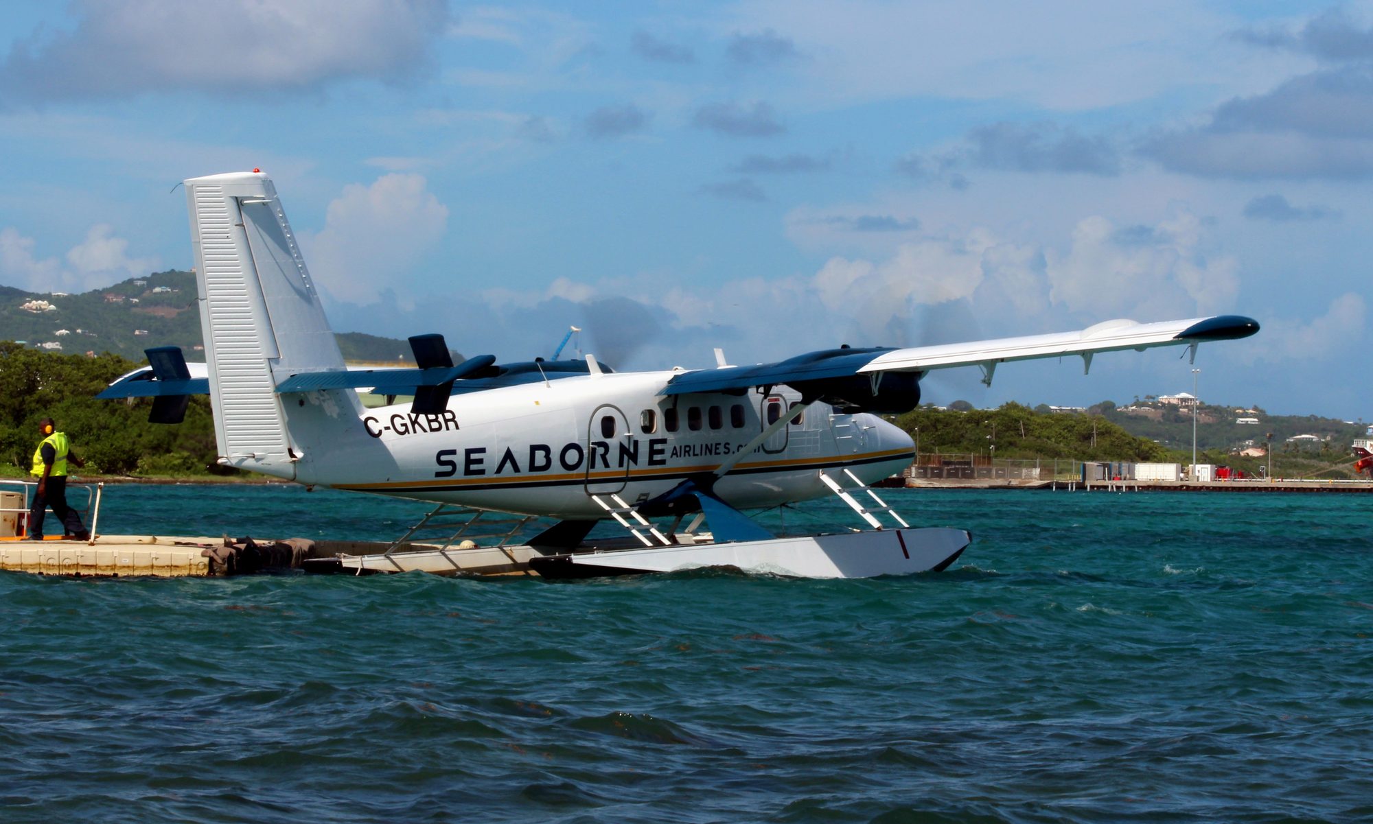
If a St. Thomas or St. John day is on the list, you do not need to go anywhere near Henry E. Rohlsen. Both ways across leave from Christiansted, 15 to 20 minutes from the villa, and both are the kind of trip people remember. Seaborne Airlines flies a seaplane from the terminal on Christiansted harbor to the St. Thomas waterfront; the booking sites list the hop at about 25 minutes, and it lands you in Charlotte Amalie with no airport, no shuttle and a view of the whole East End on the way out. Park in the free lot on Prince Street across from the terminal and walk in.
The ferry is the slow, cheap version. Service between the two islands resumed in 2017, and as of 2026 the QE IV leaves Gallows Bay in Christiansted at 8 am, arrives at the Blyden terminal in Charlotte Amalie about 10:10, and comes back at 3 pm, arriving about 5:10, Wednesday through Monday with no Tuesday sailing, for about $70 one way per the operator's site. That is a two-hour crossing each way, so it makes a long day trip rather than an easy one, but it puts you and your day bag on St. Thomas by mid-morning without touching a rental car on either side. Schedules and fares change; check before you plan a day around them.
Whether to bother is its own question; our St. Croix vs. St. Thomas guide makes the comparison fairly. The short driving-guide answer is that both crossings start with the same easy 20-minute run to Christiansted, and that either way you leave the left-side driving on St. Thomas to the people who do it every day.
The seaplane on Christiansted harbor: the quick way to St. Thomas, about 25 minutes wharf to wharf, with a free lot across the street from the terminal.Photo: Prayitno (CC BY 2.0)
Mistakes to avoid
Most driving trouble on St. Croix comes from six habits, and all six are avoidable before you leave the airport lot.
Finishing a right turn in the right-hand lane. It is the classic error, it happens on empty roads, and the fix is the passenger's job: say "left lane" until it sticks.
Trusting the maps app over the road surface. If the app sends you onto gravel as a shortcut, especially the Scenic Road, decline in a normal car.
Driving the East End Road at 45 after dark. Deer, walkers and potholes all live there; 30 is the number.
Getting into a taxi without asking the fare. Rates are per person and per destination and the printed card is old; ask, then load the bags.
Landing without a car in high season. Winter rentals sell out and the East End has no useful bus; book the car with the villa.
Rum-tour driving. The distilleries pour, the roads are dark, and the rules are the same as home. Name the driver before you leave.
Only the first is unique to St. Croix, and it fades by day two. What you are left with is a small island at 35 mph, which is a good speed for looking at it.
Questions people ask
Do you really drive on the left in St. Croix?
Yes. The U.S. Virgin Islands is the only part of the United States where traffic keeps to the left, and it does so in ordinary left-hand-drive American cars, because nearly every vehicle is imported from the mainland. That puts the driver next to the road's edge and the passenger next to the centerline, the mirror image of Britain. Most people are comfortable within ten minutes and automatic by the second day; the tricky moments are right turns, which cross oncoming traffic, and empty roads, where habit pulls you right.
What are the speed limits on St. Croix?
Low. It is 20 mph in the towns unless otherwise posted and 35 mph on most other roads, and on the Melvin H. Evans Highway, the one divided road, the limit is 55 mph for passenger vehicles and 40 mph for heavy trucks and buses. In practice hairpin corners in the hills want 10 to 15 mph. Seat belts are required for the driver and front passenger, and talking or texting on a hand-held phone while driving is illegal.
Is my U.S. driver's license valid in the U.S. Virgin Islands?
Yes. A valid license from any U.S. state is accepted, and foreign licenses are recognized too (bring an International Driving Permit if yours is not in English). A mainland license is good for 90 days after arrival, after which residents get a Virgin Islands license from the Bureau of Motor Vehicles; the BMV's own site does not spell out the visitor period, so treat 90 days as the usual guidance rather than statute. Rental companies mostly require drivers to be 25 or older.
Do I need a 4x4 or Jeep on St. Croix?
Not really. Every beach, town, distillery, restaurant and trailhead in our guides sits on a paved road: the East End Road, the North Shore Road to Cane Bay, Centerline Road to Estate Whim, the highway to Frederiksted, Mahogany Road through the rainforest. The exceptions are the unpaved Scenic Road along the island's spine and the upper reaches of Creque Dam Road, which want clearance and four-wheel drive, especially after rain. Rent a Jeep for that day if you want it; a normal sedan does the rest, potholes included.
Which car rental companies are at the St. Croix airport?
As of August 2026 the counters at Henry E. Rohlsen Airport are Budget, Hertz and the locally owned Centerline Car Rentals, which also has offices in downtown Christiansted and at La Reine; Avis is listed at the airport by the major booking sites, so confirm on avis.com. Olympic Rent-A-Car, on island since 1973, meets flights with free airport pickup, Judi of Croix delivers anywhere on the island for free, and Skyline Car Rental delivers to the airport and seaport on rentals of more than three days. Book winter cars early.
How long is the drive from the airport to the East End?
About 20 road miles and roughly 35 to 40 minutes without stops, a little less on a clear midday and a little more at school-run time. The terminal road puts you on the Melvin H. Evans Highway (Route 66) heading east; the highway ends near Christiansted, your maps app takes you around town onto the East End Road (Route 82), and that coast road brings you out past the Buccaneer, Green Cay and Teague Bay to the villa's turn. Sterling Point sends the exact final directions with your arrival details.
Are there taxis and Uber on St. Croix?
Taxis, yes; Uber and Lyft, no. As of 2026 neither operates in the U.S. Virgin Islands, though there is a local app called VI Hail. Taxis are not metered: fares are set per person and per destination by the VI Taxicab Commission. The tariff still circulating dates from August 2015, when airport to the East End (Cotton Valley or Divi Carina Bay) was about $24 per person for one or two riders, less per head for groups, plus $2 a bag. Expect more now; ask before you get in.
Where do you park in Christiansted?
Three reliable options, per our Christiansted guide: the government lot near King Cross and Strand Streets (about $1 an hour or $5 a day, roughly 7:30 am to 6 pm), the National Park Service lot beside Fort Christiansvaern (two hours, empty by 4:30 pm, towing enforced), and the small free lot on Prince Street across from the seaplane terminal. Two-hour limits on parts of Company and Queen Cross Streets are enforced; red and yellow curbs mean no. Frederiksted has street parking near the waterfront; on cruise-ship days arrive early.
Can I get to St. Thomas without driving to an airport?
Yes, two ways, both from Christiansted. Seaborne Airlines flies a seaplane from Christiansted harbor to the St. Thomas waterfront in about 25 minutes, and the QE IV ferry leaves Gallows Bay at 8 am and arrives at the Blyden terminal on St. Thomas about 10:10, returning at 3 pm, Wednesday through Monday, for about $70 one way per the operator's site as of 2026. There is a free lot across from the seaplane terminal on Prince Street. Schedules and fares change; check before you plan a day around them.
Driving from The Cerulean
The villa is a good place to learn the island's roads because it sits at the end of the easiest one. From the gated drive you are on the East End Road within minutes, and that road runs at 35 mph past everything the East End has: Point Udall for sunrise about ten to fifteen minutes east, the trailhead for Jack and Isaac Bay a five-minute drive away, Cramer's Park, the Buccaneer, Teague Bay's restaurants, and Christiansted 15 to 20 minutes west. Your first day on the left can be a loop of ten miles with a beach at each end, and by the time you head west for the rainforest or Frederiksted the lane will have stopped being a thought.
A few villa-specific notes. The house sleeps twelve, and for a group that size two rental cars are better than one big one; the concierge can have both delivered to the gate or met at the airport, and can book taxis for the nights nobody wants to drive. The getting-here page covers the flights themselves, including the Miami daily and the winter nonstops from Charlotte, Chicago, Atlanta and Newark, and the fly-from pages walk each market through the day of travel. Everything after touchdown is this guide: about 20 miles, 35 to 40 minutes, keep left.
The best drive of the week is the shortest. Leave the villa in the dark, follow the East End Road east with nothing coming, and be at Point Udall as the sun comes up over the easternmost point of the United States; the Point Udall guide and the journal tell you what to expect. Then drive home slowly on the left, with the sun behind you and the sea on your right, and put the kettle on. That is the island at its own pace, and it is the pace the roads were built for.
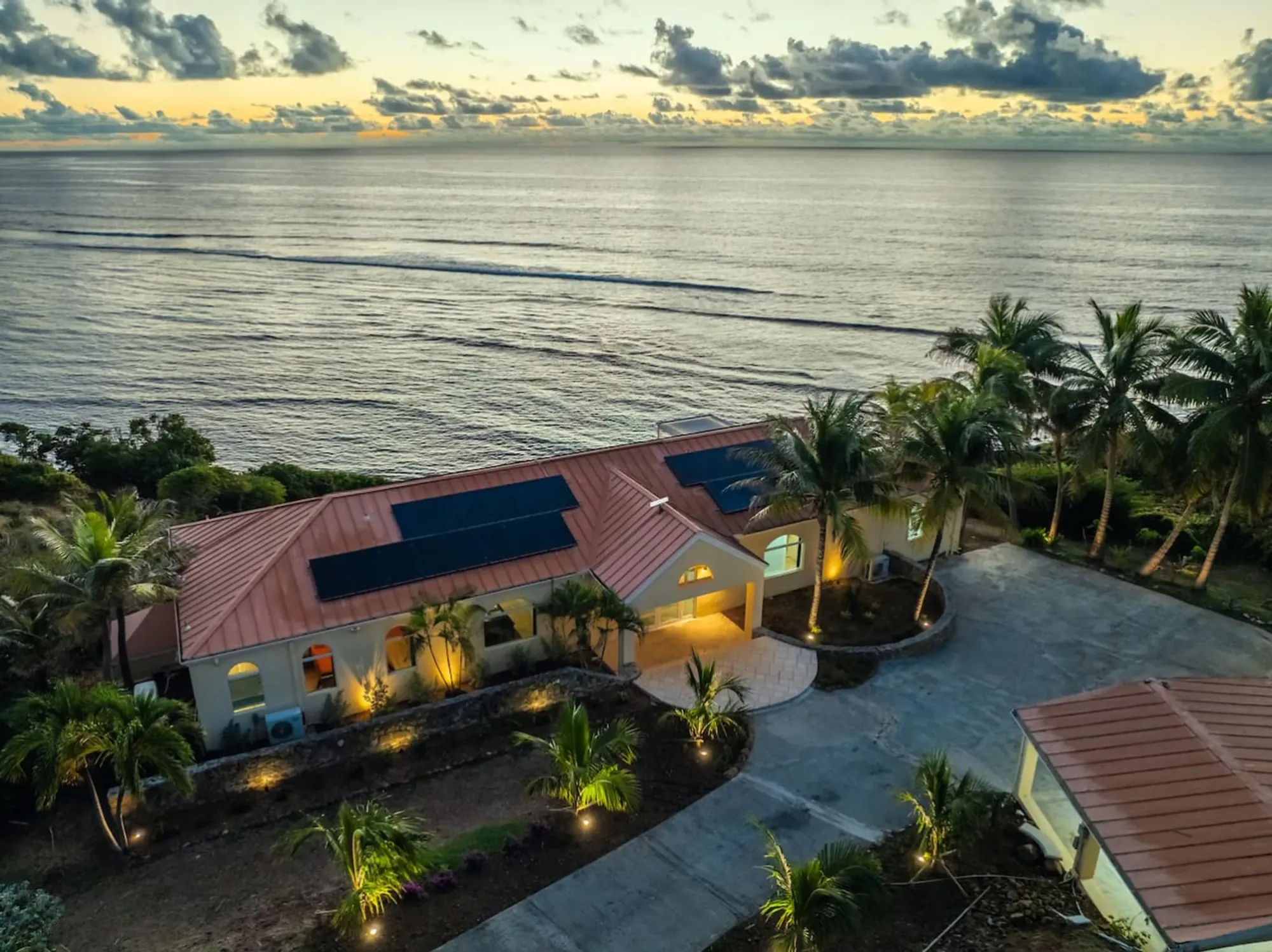
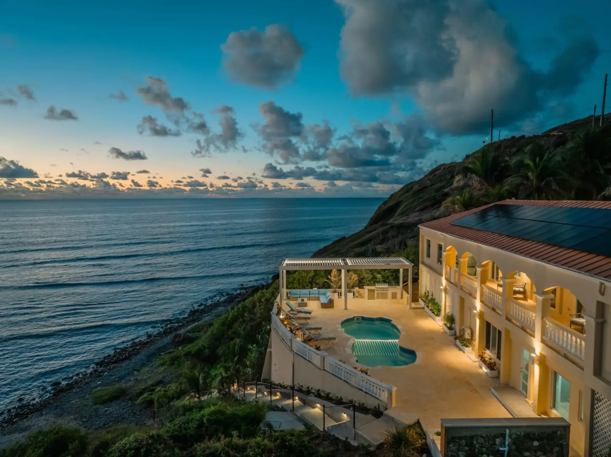
The Cerulean from the air at dusk, on its point above the sea on St. Croix's East End: 15 to 20 minutes from Christiansted and about 35 to 40 from the airport, keeping left the whole way.Photo: The Cerulean
The Cerulean
Twelve of you, one private beach.
The Cerulean sleeps twelve on St. Croix's quiet East End — check your dates.