

The CeruleanSt. Croix · U.S. Virgin Islands
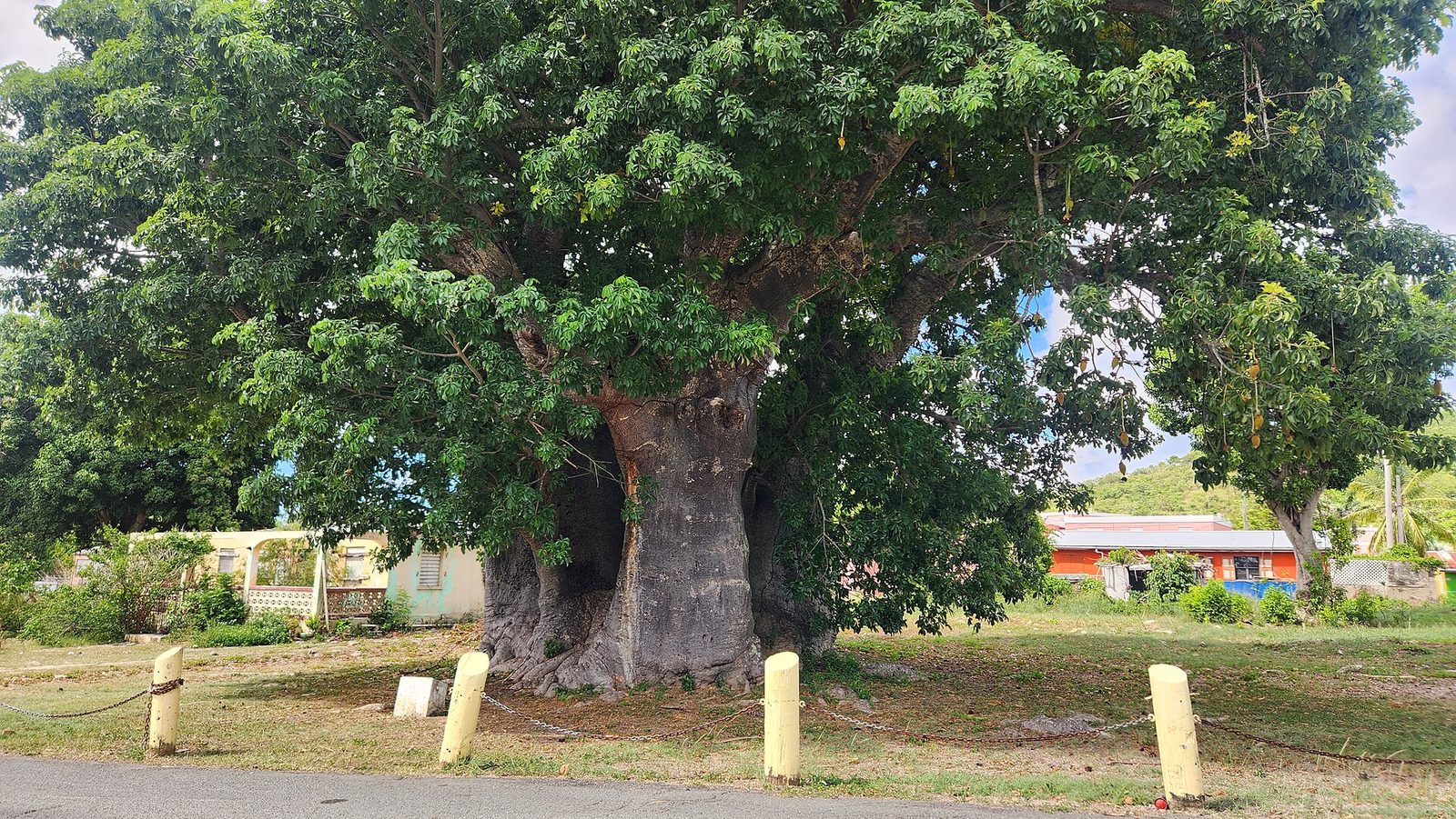
Baobab 20230926 100500

The Rainforest & Mahogany Road: St. Croix's Green Northwest

The wet, green corner of a dry island: Mahogany Road under the canopy, the old Creque Dam, Mount Eagle, a mahogany workshop and a bar with beer-drinking pigs.

Photo: CaptJayRuffins (CC BY-SA 4.0)

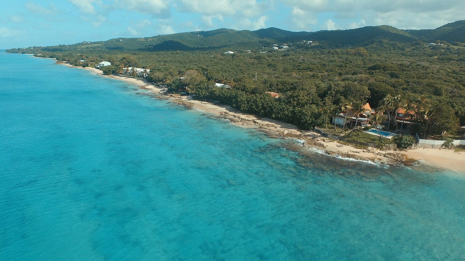
The East End, where the villa sits, is the sunny end of St. Croix: low coastal hills, golden grass, sea grape and wind. Drive an hour west and the same island turns green and shaded, with a closed canopy over the road and water in the guts after rain. Islanders call the northwest hills the Rain Forest. It is not a rainforest by the textbook, and this guide says so plainly, but it is the wettest, coolest, most different corner of the island, and Mahogany Road runs right through the middle of it.

Where it is on St. CroixChristianstedFrederikstedPoint UdallThe CeruleanMahogany Road and the northwest forest
Where it is. Island outline © OpenStreetMap contributors (ODbL).

What people mean by the rainforest

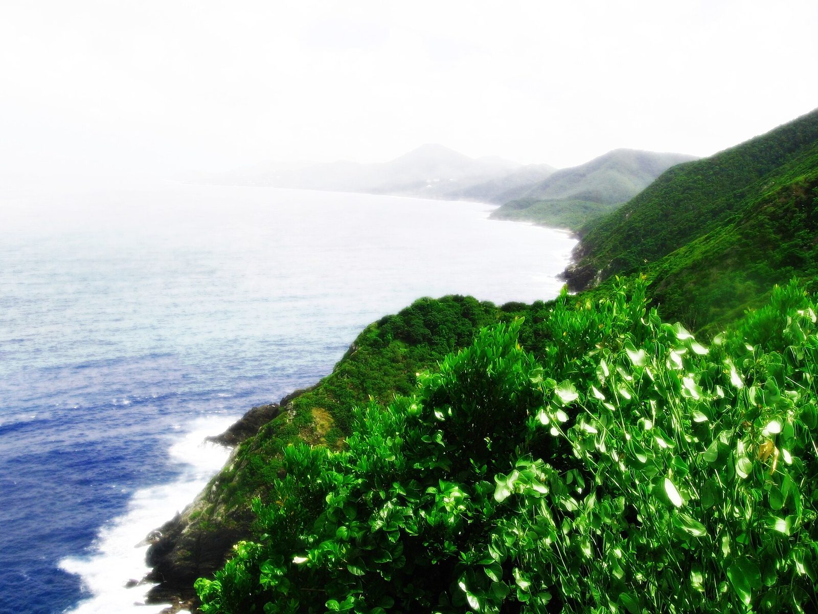
St. Croix is 84 square miles, and the two ends of it get very different weather. Annual rainfall is about 50 inches in the northwest against 25 to 38 inches in the east, with an island average around 40. The Virgin Islands wildlife plan describes the same thing as a distinct east-west gradient, wetter along the northern and central hills. Fifty inches on hills that face the trade winds is enough to keep a real forest closed overhead all year. That forest, in the ridges and valleys above Frederiksted, is what everyone here means by the Rain Forest.

The honest label is subtropical moist forest. A true rainforest gets a great deal more rain than this and has no dry season; the northwest of St. Croix has a wet season that runs roughly late summer into December and a dry stretch after New Year, and guidebooks have been pointing out for decades that it is "not technically a rainforest." None of that matters much on the ground, where what you notice is the shade, the sound, the humidity, and the fact that the light goes green. Nobody on the island will correct you if you call it the rainforest, and neither will we.

Where exactly is it? Roughly the northwest quarter of the island: the hills that rise behind Frederiksted and run east along the north side toward Blue Mountain, cut by valleys called guts that carry water toward the coast. Mahogany Road (Route 76) is the spine of it, running from Grove Place in the middle of the island west and down to the coast road a couple of miles north of Frederiksted. Creque Dam Road climbs into the forest from the west coast, and the unpaved Scenic Road (Route 78) rides the ridge above both. Between them are the things this guide is about: a 1926 dam, a mahogany workshop, a bar with pigs, the island's highest point, a seasonal waterfall, and a botanical garden at the forest's southern edge.

How big the forest is depends on who is counting and where they draw the line; guidebooks quote figures we could not confirm, so we will not repeat them. What we can say is that from the top of Mahogany Road to the coast you are under trees for most of the drive, and that on foot the forest closes in within a few steps of the road.

About 50 in/yrNorthwest rain
25–38 in/yrEast End rain
1,165 ftMount Eagle
1926Creque Dam
Since 1971Domino Club

Why the northwest is lush and the East End is sunny

The mechanics are simple. St. Croix sits in the trade winds, which blow from the east and northeast most of the year. Air coming off the sea has to rise over the island's north-side hills, and rising air cools and drops its water. The geography explains a lot: most of the East End is hilly and steep, and so is the north side from Christiansted west, while from the north-side hills a fairly even plain slopes down to the south coast. The northwest has the highest ground on the island, Mount Eagle at about 1,165 feet, so it wrings the most rain out of the wind; the East End is lower, and the wind arrives there dry.

The result is two islands in one. The East End is the island's sunny, California-like side — lower rainfall, low coastal hills and sea grape along the bays — and it is why the East End light is so bright and clear. Our beach and pool deck sit in that sunshine. Forty minutes west along Centerline Road the roadside turns from thorn to big trees, and on Mahogany Road the temperature has dropped a few degrees and the air has weight to it.

Timing matters more here than anywhere else on the island. The wettest months run from late summer through December; the driest stretch is late winter into spring. In the wet months the guts run, the Caledonia falls has water, the road surfaces are slick with leaves, and the forest is at its greenest. In the dry months the forest is still shaded and still cooler than the coast, but the streambeds are damp rather than flowing and the waterfall is a rumor. Our month-by-month weather guide has the whole year; for this drive, the short version is that a grey day is a good day.

One practical consequence: rain in the northwest does not mean rain at the villa. It is common to leave the East End in full sun, drive into drizzle on Mahogany Road, and come home to a dry pool deck.

2008-07-17 St. George Village Botanical Gardens St. Croix USVI
Canopy at St. George Village Botanical Garden, at the southern edge of the forest country off Centerline Road. Photo: Jpheym Jason P. Heym / Seascape Pool Center Inc. (CC BY-SA 3.0)

Mahogany Road, Route 76

Mahogany Road is the drive. It is a narrow, two-way, paved road that leaves the middle of the island at Grove Place, climbs into the hills, and winds west and down through the forest to meet the coast road north of Frederiksted; it twists and turns its way through the island's small rainforest. Officially it is Ethel McIntosh Memorial Drive, and if you see that name on a Department of Public Works notice, it is the same road: the department was doing drainage improvements along it in late 2025 with daytime closures, so expect patched surfaces and the occasional cone.

The canopy is the reason to be there. For long stretches the trees meet overhead and the road runs through a green tunnel: mahogany, kapok with its buttressed trunks, turpentine trees (islanders also say red birch), saman, and vines and ferns filling everything in between. There are houses along it, and farms, and a few gates; this is not a park road, it is a country road that happens to be beautiful, and people drive it to work, so pull over to gawk, do not stop in the lane.

Two businesses on the road are destinations in their own right and get their own sections below: St. Croix LEAP, the mahogany woodworking yard about two miles up from the coast side, and the Mt. Pellier Domino Club at number 49, home of the beer-drinking pigs. Everything else along the road is either private, a trailhead, or a view. The forest is loud with birds and quiet of everything else, and the best way to drive it is with the windows down and no schedule.

Without stops, Mahogany Road takes twenty to thirty minutes end to end, depending on how often you slow for a curve or a goat. With stops it takes as long as you have. It connects at its west end to Route 63, the coast road, which takes you south into Frederiksted in about ten minutes or north toward Sprat Hall, Butler Bay and the turn for Creque Dam Road.

The trees overhead

You do not need to be a botanist to enjoy Mahogany Road, but knowing five trees turns a drive into a walk. The first is the one the road is named for. West Indian mahogany is the dark, straight-grained hardwood that Danish-era furniture was built from, and mature trees still stand along the road and in the forest around it. On St. Croix, mahogany is protected, which is why the LEAP workshop below works only with wood from trees that came down in storms or had to be trimmed. A big mahogany has a grey, fissured trunk and a broad crown of small glossy leaflets, and it drops woody, pear-shaped seed capsules that split into five and scatter winged seeds.

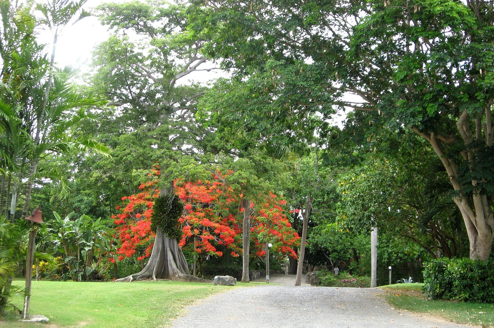
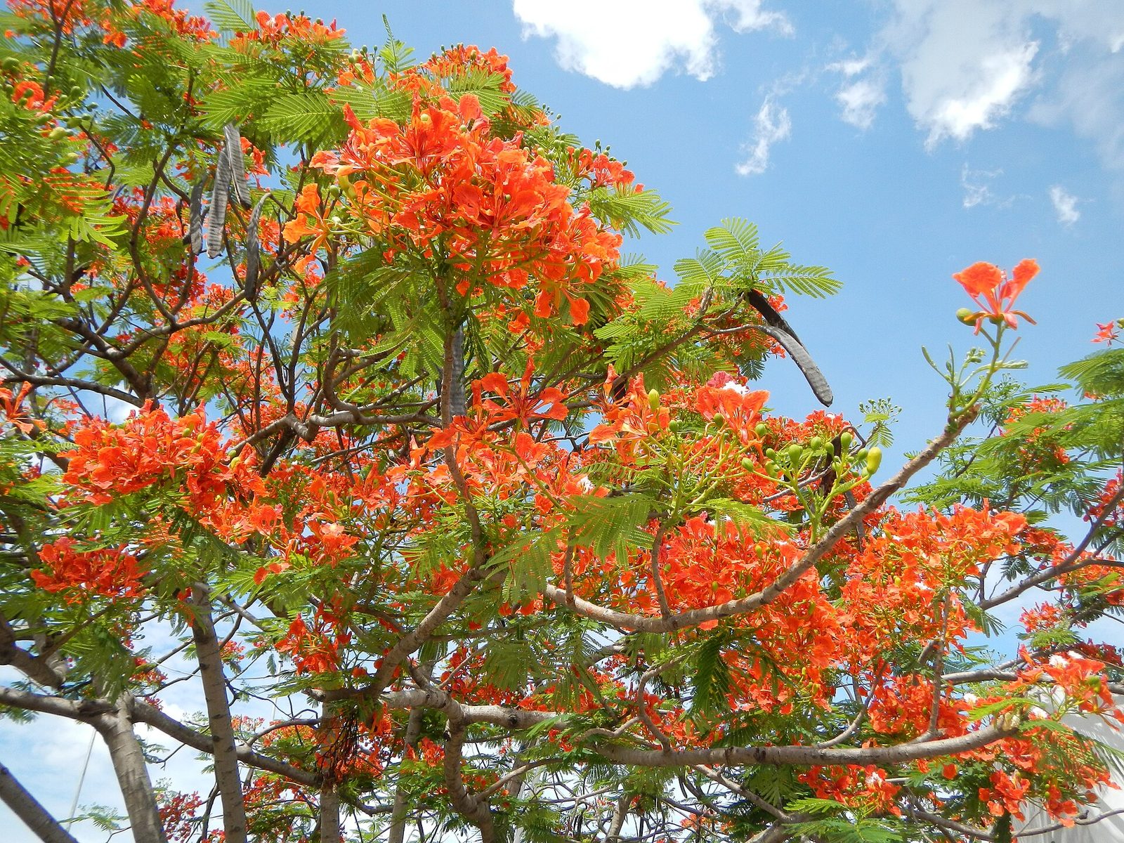
The second is kapok, the silk-cotton tree, which is the one you will point at: a huge pale trunk flaring into flat buttress roots at the base, sometimes with thorns on the young bark, and pods that split to release the fluffy fiber that used to stuff life jackets. Third is the turpentine tree, which islanders also call red birch; the trunk is copper-red and peels in papery sheets, and it is one of the commonest trees in the island's forests. Fourth is saman, the rain tree, with the wide umbrella crown that shades pastures across the Caribbean; LEAP works saman and thibet alongside mahogany. Fifth, in early summer along the roads and in every town, is flamboyant, the red-flowering tree that is nobody's idea of forest but is everyone's idea of the Caribbean.

Below the canopy the forest is fruit as much as timber. VI Eco Tours describes its rainforest walk as passing through kapok, mango groves, cocoa plants and rare royal palms; a lot of what grows in these valleys was planted by people, on estates that were farmed and then let go. The forest looks ancient and much of it is a recovery, which does not make it less green.

The strangler figs deserve a word too: they start as seeds dropped high on a host tree, send roots down its trunk, and eventually enclose it, and along Mahogany Road you will see the lattice of a fig around a trunk that may or may not still be alive inside. It is the slowest violence in the forest, and it explains a lot of the road's shapes.

AguinaldoShrinejf0866 03
Flamboyant (Delonix regia), the red-flowering roadside tree of early summer across the tropics. Photo: Ramon FVelasquez (CC BY-SA 3.0)

LEAP, the mahogany workshop

St. Croix LEAP is the Life and Environmental Arts Project, a woodworking yard on Mahogany Road about two miles up from the coast north of Frederiksted, west of the Domino Club. Its own description, repeated in every directory, is that it is dedicated to manual work, environmental conservation and self-development, and the practical version of that is an open-air workshop stacked with slabs of salvaged native wood, mahogany above all, being cut and finished into serving boards, tables, clocks, wall hangings, wind chimes and small pieces you can fit in a suitcase. It has been a stop on the St. Croix Heritage Trail for years.

The wood is the point. Because mahogany is protected here, LEAP works with trees that fell in storms or had to be taken down, plus saman and thibet, and you can see the whole chain in one place: raw logs, rough slabs, half-finished tables, and the shelf of finished boards by the door. Reviewers over the years describe a friendly, unhurried visit; several mention Vincent, who runs the yard, walking them through projects and answering questions. If you have any interest in wood, it is worth an hour. If you do not, it is a ten-minute stop and a cutting board.

Now the honest part. LEAP was still listed and reviewed in 2026, and directories give its hours as Monday through Saturday, roughly 10 am to 5 pm, closed Sunday. But the reviews of the last couple of years are mixed: some visitors describe the same warm workshop, at least one in 2024 found the place badly run down and said so bluntly. It is a working yard in the woods, not a boutique, and it has never pretended otherwise; go for the wood, not the presentation, and call (340) 772-0421 before you drive out so you are not standing at a closed gate.

Prices are what you would expect for solid hardwood made on site: small boards are an affordable souvenir, tables are not, and shipping a big piece home is a conversation to have there. Cash is wise. If the gate is shut, the Domino Club is minutes east.

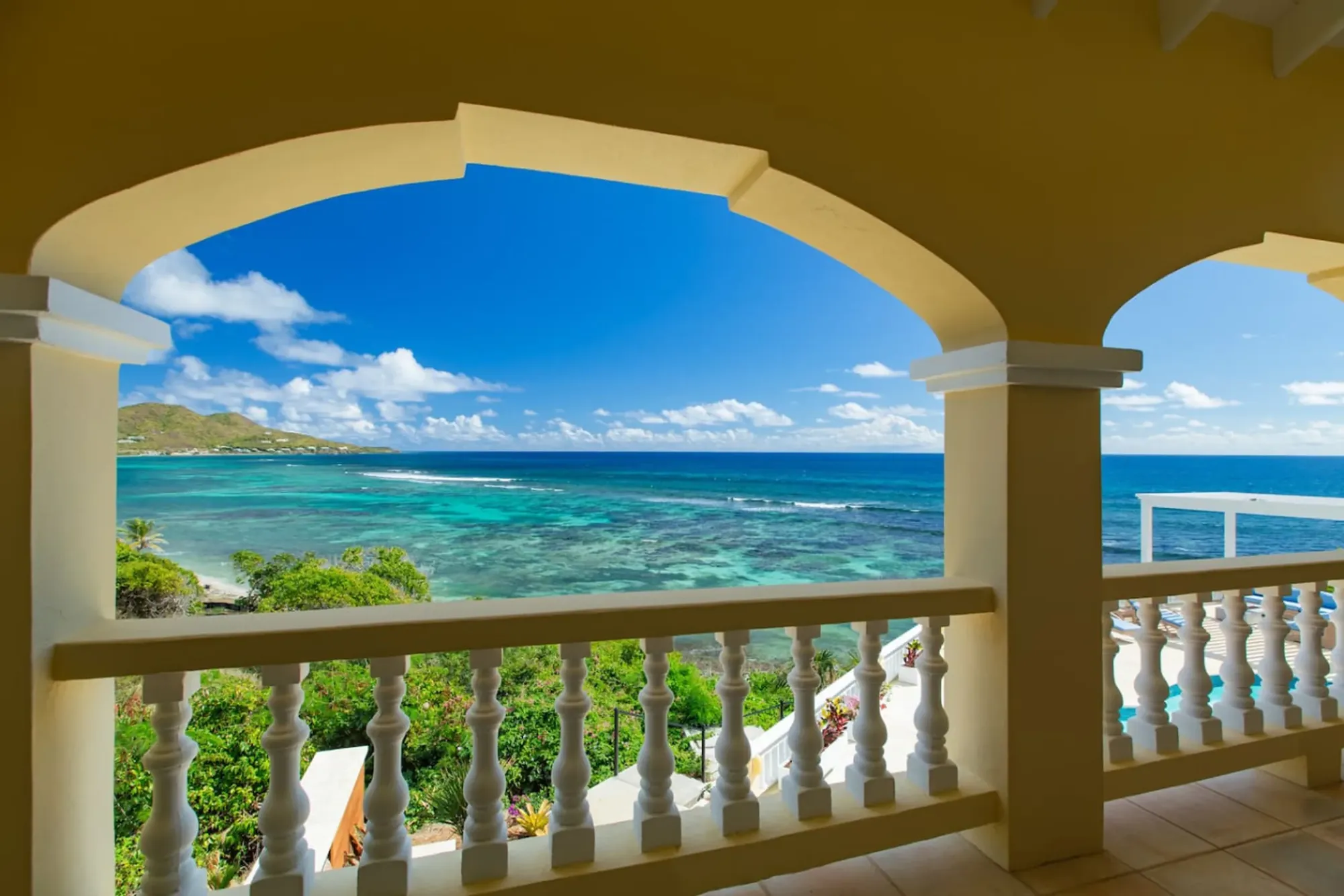
Turquoise bay framed by the villa's arched veranda
The Cerulean

Plan it from the villa.

Five bedrooms, a private swimmable beach, and all of this within a day trip.

Sleeps 12 · 4.90 ★ · rates by season

The Domino Club and the pigs

The Mt. Pellier Domino Club, at 49 Mahogany Road, is the most famous bar on St. Croix and one of the odder ones in the Caribbean. It is an open-air roadside bar under a roof in the forest, known to islanders as Norma's after longtime proprietor Norma George, and it dates its license to 1971 and the pig farm behind it to the 1950s. It lists hours of Tuesday through Sunday from 8 in the morning "until," pig feeding from 10 am to 5 pm, and it is closed Mondays. Cash only, no ATM, and the food, in the club's own words, runs out when it is gone.

The pigs. There are pens beside the bar with resident pigs; the current roster on the club's site includes Hamilton, called Hammy, Chester, Kevin Bacon, Willis, Big Sip, Lil Trouble and Miss Pigsworth, and older write-ups remember Buster Pig and Ms. Piggy. For a dollar or two you go in, buy a can of non-alcoholic beer for $2 to $4, hold it out, and the pig takes the whole can from your hand, crushes it, drinks, and drops the flattened can. The tradition started when the original Buster helped himself to a visitor's beer; the non-alcoholic part is not a technicality, it is O'Doul's or the equivalent.

It is a spectacle, and it is honest to say people react two ways. Children and most adults find it very funny. Some adults find feeding animals for entertainment uncomfortable and would rather not. Both are reasonable. The pigs are farm animals on a family property that has kept pigs for seventy years, there is no alcohol involved, and nobody makes you go to the pens; plenty of visitors have a drink under the roof, watch a domino game, and skip the animals. Whatever you decide, feed them only what the bar sells, and keep small hands outside the rail. A pig that crushes a can is not gentle.

The other house specialty is MamaWanna, an infused rum the club describes as a blend of rum, honey, roots, herbs and secret spices in the Caribbean bush-rum tradition, made on site for years and now also bottled; there is even a MamaWanna imperial stout made with Leatherback Brewing. It is strong. Fresh banana daiquiris are the gentler order, and the food, when there is food, is Caribbean plates from the kitchen. Assign the driver before MamaWanna, not after; from here it is winding road in every direction.

“The food runs out when it's gone.”

The Domino Club's own website, 2026

Creque Dam and Creque Dam Road

Deep in the trees above the west coast stands the forest's best ruin. Creque Dam is an arch dam about 45 feet high, built in 1926 to hold roughly nine million gallons of drinking water for Frederiksted, back when the U.S. Navy administered the islands and the town needed a reliable supply from the wet hills. It did its job for a while and then the hills did what hills do: by 1939 the Governor's annual report was recording that "silting and increasing seepage endangered the dam structure," and the Works Progress Administration was sent in to strengthen the footing and clean out the reservoir. That New Deal repair is why the dam is still standing, and the Living New Deal project keeps a page on it.

Today it is retired. The reservoir behind it is hit or miss, sometimes a green pool and sometimes a mud flat, because the dam leaks, and moss and roots have moved onto the wall. It is not fenced off as an attraction and there is no sign, no parking lot and no ranger: a curved grey wall in a valley of kapok and mango, ferns in the seep lines, and the odd feeling of a piece of 1920s municipal engineering that the forest has decided to keep. It is a short walk from Creque Dam Road if you know where to leave the road, and a confusing one if you do not, so go with a map downloaded, in daylight, in shoes with grip.

Creque Dam Road itself (Route 58 on the maps) climbs from the coast road north of Frederiksted, past the old estates, up into the forest and across to Mahogany Road, and its upper reaches are where the unpaved Scenic Road takes off along the ridge. A normal rental car will manage the paved lower section on a dry day; the higher you go the more you want clearance, and after rain the mud is real. It is one of the best walking roads on the island because so few people drive it.

If you would rather be led, VI Eco Tours runs a three-hour guided rainforest hike out of Frederiksted, described as moderate with gentle inclines, uneven terrain and muddy patches, passing kapok, mango groves, cocoa and royal palms, stopping at estate ruins including an old dam and aqueduct, and ending at an overlook. As of 2026 it is listed at about $159 per adult, ages 8 and up, minimum four people, mornings, with pickup at the Frederiksted cruise pier. It is built around cruise-ship mornings, but anyone can book. The St. Croix Hiking Association also posts group hikes in these hills, and their reports are the best free description of the trails you will find.

  1. 1926Creque Dam built above Frederiksted, a 45-foot arch dam for nine million gallons of drinking water
  2. 1939Works Progress Administration strengthens the leaking, silted dam under the New Deal
  3. 1950sThe Mt. Pellier pig farm that became the Domino Club is running on Mahogany Road
  4. 1971The Domino Club is licensed as a bar
  5. 2017Hurricanes Irma and Maria hit the island and the storms expose old estate ruins along the Caledonia gut
  6. 2025Public Works begins drainage improvements along Mahogany Road, Route 76
  7. 2026St. George Village Botanical Garden holds its 30th Mango Melee in July

The Scenic Road, Mount Eagle and Blue Mountain

Above Mahogany Road runs the road that guidebooks have called one of the best little-traveled four-wheel-drive roads on the island, and they are not wrong, with a condition attached. The Scenic Road, Route 78, is unpaved dirt and rock along the ridge of the northwest hills, in and out of forest, with views down both sides of the island when the trees open. In dry weather a high-clearance 4x4 in low gear does it without drama. After rain it is ruts and clay, and it can be impassable in places; nobody grades it on a schedule you can plan around. Check whether your rental contract allows unpaved roads at all, because many say no, and read our driving guide before you commit to it.

The reason to go up is Mount Eagle. It is the highest point on St. Croix, listed variously at 1,165 feet (355 meters) and 1,160 feet; either way it is the top of the island, and a hiking trail to the summit begins at the West Scenic Road.

By local accounts it is a short climb for a big view rather than a technical hike ("little effort, big reward," one hiker's write-up calls it), and from the highest ground on the island you get the shape of the whole place: the north coast one way, the plain sloping south the other, and on a clear day the East End far off, where the villa is. If you have done Goat Hill on the East End, this is its wetter, taller twin.

Blue Mountain is the other summit people ask about, in the north-central hills east of the forest proper, and it is the one you can pick out from anywhere: it is the peak with the towers on it. Its height is quoted anywhere from about 1,070 to 1,096 feet depending on the source, so call it eleven hundred and change. It is not really a rainforest destination, more the point where the wet hills start to dry out toward Christiansted, but from either summit the pattern behind this guide is plain: the north faces green, the south faces browner, the wind coming over the top.

A word about doing this in a normal car. Do not. Every season somebody follows a maps app up the Scenic Road in a sedan and spends the afternoon waiting for a tow. If you did not rent a proper 4x4, park at the bottom and walk a stretch of the ridge instead; the forest is the same on foot and the views arrive sooner than you think. Our trails directory lists the guided options if you would rather not navigate at all.

Caledonia Valley and the gut

Caledonia is the valley in the island's northwest corner where the forest is at its thickest and where the island's one real candidate for a waterfall lives. A gut, in Virgin Islands usage, is a stream valley, usually dry, that carries water after rain, and the Caledonia gut is the wettest of them. Locals will tell you it holds pools of fresh water even in a drought and that there is a falls of around fifty feet a half-mile up; we have not measured it and would not swear to the height. What is well documented is the walk, thanks to the St. Croix Hiking Association, which has run it as a group hike.

Their description is the honest one. They rate it moderate to difficult, about an hour to reach the waterfall and about two and a half hours in all. If water is flowing you will walk in it, knee-deep in places; if it is not, you follow a damp streambed. Either way you will "crawl over and under trees, and bushes," and since the 2017 hurricanes there are estate ruins in the valley that the storms exposed. Their meeting point for the hike was the beachfront parking lot just north of Fort Frederik, which tells you how close all this is to town.

The land is understood locally to be territorial, a public gut rather than someone's yard, but there is no signed trailhead and the paths toward it may cross private land. That is the argument for going with the hiking association or a guide the first time, and for going after rain, when the falls is a falls rather than a wet rock. Never go up a gut in heavy rain or when heavy rain is forecast upstream; guts are how the hills shed water, and they do it fast.

Caledonia is also where this landscape meets the island's hardest history. The steep, roadless northwest, from the wet Caledonia valley over to Annaly and the drier Maroon Ridge above Ham's Bluff, is where people who escaped the plantations hid, and the ridge carries the name Maroon Ridge because of it. That story deserves telling properly, and we tell it in our Ham's Bluff and Maroon Ridge guide, which also covers the lighthouse hike on the coast just north of here; the Annaly tide pools, reached by a forest trail from Carambola, are the coast-level version of the same wild shore. Walk the gut knowing that the same thickness of forest that makes it hard going today is exactly what made it a refuge.
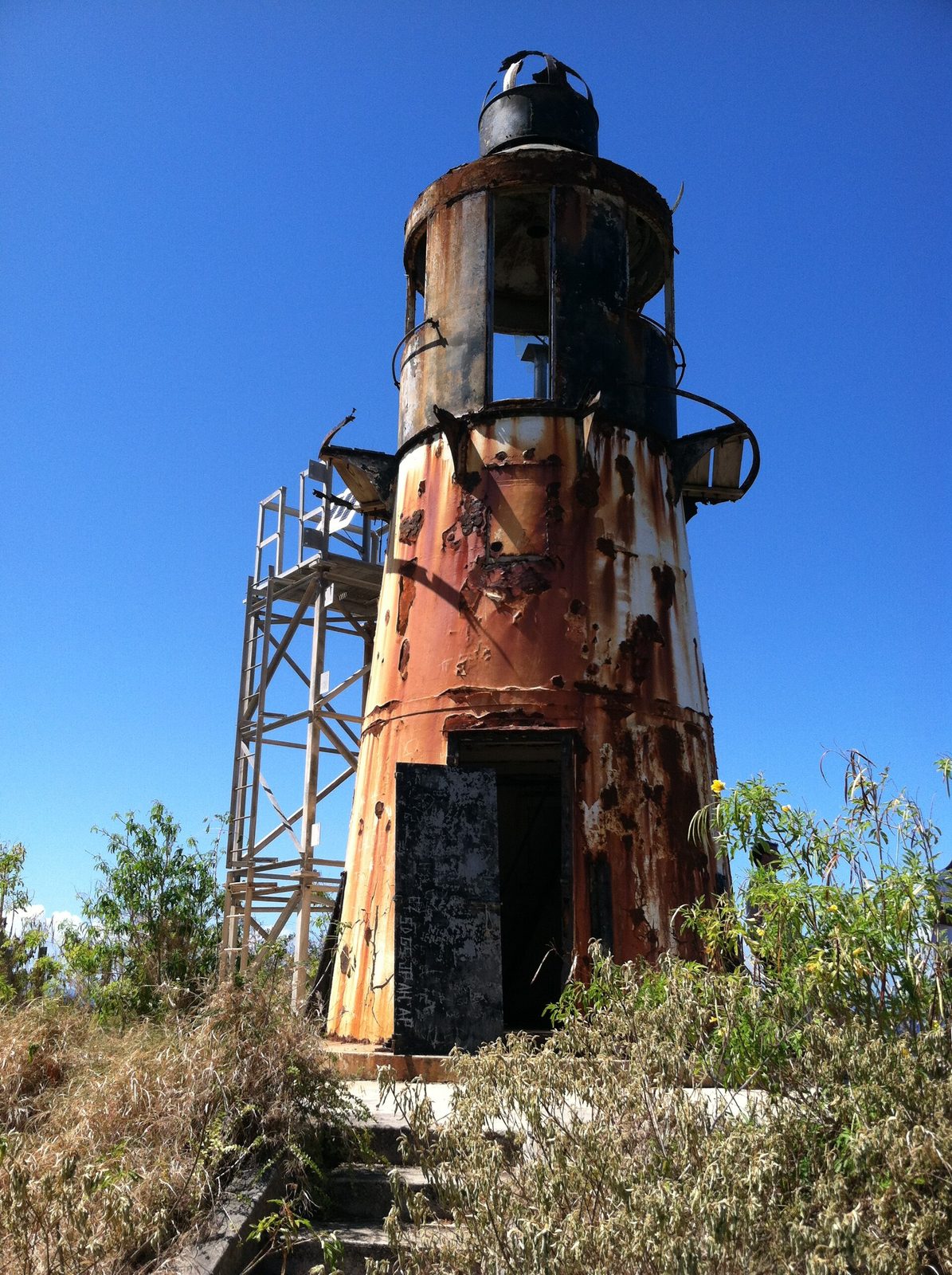
Hams-bluff-light2
Ham's Bluff light stands on the northwest corner, above the coast where the forest hills run down to the sea. Photo: Eoghanacht (CC0)

St. George Village Botanical Garden, at the forest's edge

If the forest is the wild version, the garden is the labeled one, and it belongs on the same day. St. George Village Botanical Garden sits at 127 Estate St. George off Centerline Road a few minutes east of Frederiksted, on the flat ground where the wet hills give out, and it is 16 acres of gardens laid out among the ruins of an 18th-century Danish sugar estate. The site has, by the garden's account, about 2,000 years of documented human history, from a pre-Columbian settlement to the plantation village whose factory walls and repurposed buildings you walk through. The whole property is on the National Register of Historic Places.

The plants are the reason it is here. The garden says it grows more than a thousand Caribbean and pan-tropical plants and trees, and it is much more than a pretty walk: it keeps a herbarium of more than 6,000 dried specimens representing roughly 80 percent of the plant species of the U.S. Virgin Islands, runs a seed bank, belongs to the Virgin Islands Rare Plant Initiative, and was recently accredited at Level 2 by the ArbNet arboretum program. Two self-guided tour maps are downloadable from its site, a general tour and a botanical highlights tour; take the second and you will recognize the trees on Mahogany Road afterward.

The practical facts as of 2026: open daily 9 am to 3 pm, closed Christmas Day; general admission $15 for adults, $10 for seniors and military, $2 for children under 10, with lower rates for USVI residents; phone (340) 692-2874. There is a small museum in a restored worker's cottage, and the garden hosts events through the year, the biggest being Mango Melee, its mango festival, which held its 30th edition in July 2026. Hours and prices change; check the site before you go.

Give it an hour and a half at a walking pace, and go early or late: 3 pm closing is earlier than most visitors expect, and midday sun on the open lawns is fierce even here. It pairs naturally with Estate Whim, the sugar-plantation museum a few minutes along Centerline, and it is the one stop on this loop that works fine in light rain, since the paths are short and there is roof to duck under. Children like the ruins more than the plants; that is fine, the ruins are the history.
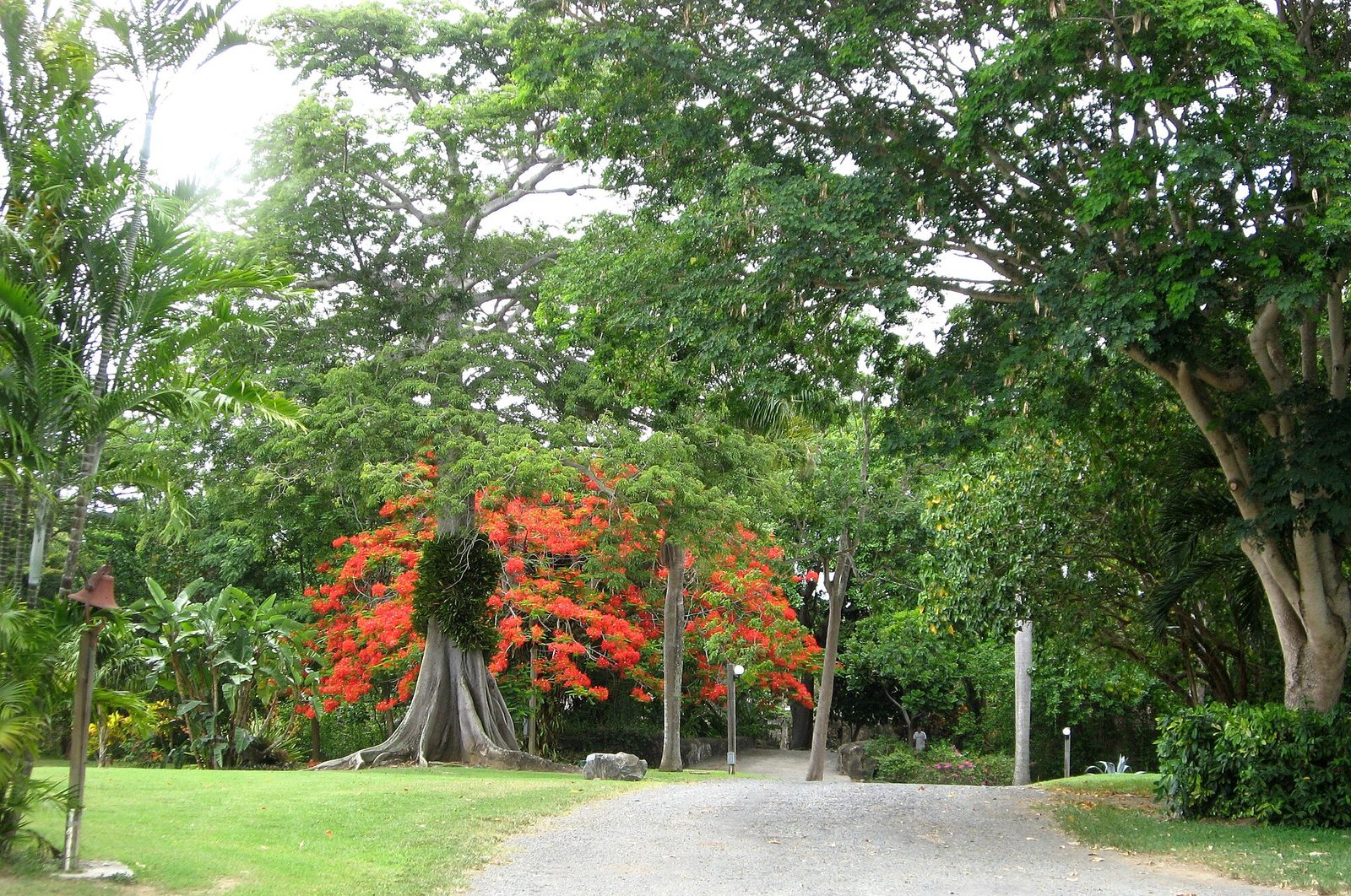
2008-07-17 St. George Village Botanical Gardens St. Croix USVI
St. George Village Botanical Garden grows among the ruins of an 18th-century sugar estate at the forest's southern edge. Photo: Jpheym Jason P. Heym / Seascape Pool Center Inc. (CC BY-SA 3.0)

Birds, deer, frogs: what lives here

The forest is loud, and most of the noise is birds. You will hear far more than you see, because the canopy is high and closed, but a slow walk on Creque Dam Road at first light or in the hour before dusk will show you doves on the road edges, hummingbirds at anything flowering, and, when you come out of the trees above the coast, frigatebirds hanging over the water. We keep the species list, with the ones you are likely to meet where, in our wildlife guide; bring binoculars and go quietly.

The four-legged surprises are deer. St. Croix has wild white-tailed deer, introduced long ago, and the guides who walk these valleys list them alongside the birds, lizards and frogs you can expect. You will see them most often at the edges, where forest meets pasture, and most often early. Frogs you will hear after rain, a whistling chorus that starts at dusk; lizards are everywhere, from the little anoles doing push-ups on trunks to the occasional iguana sunning at the forest edge. None of it will hurt you. There is nothing venomous in these hills, and the animal to respect is the mosquito, which the wet forest grows in numbers the East End never sees.

What you should not expect is a wildlife park. This is a working landscape of forest, small farms, houses and old estates, and the animals are wary of people for good reason. The best sightings come to people who stop the car, turn it off, and sit for ten minutes; the forest rewards patience and punishes schedules.
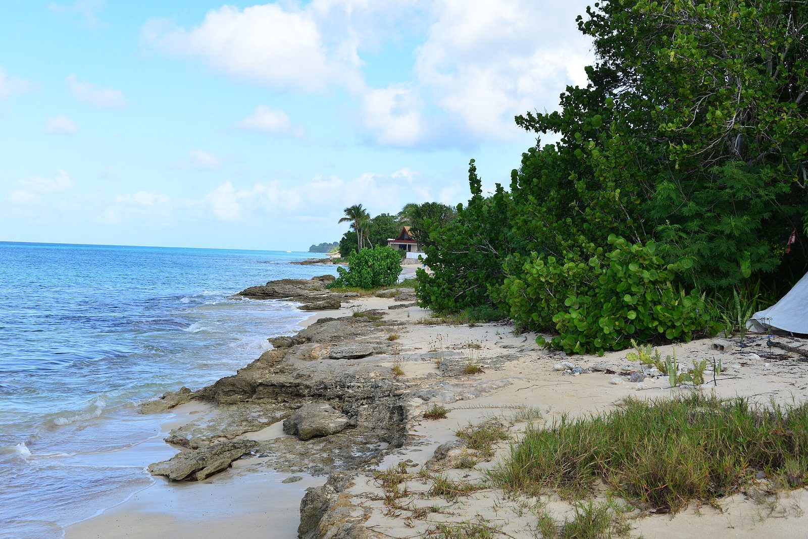
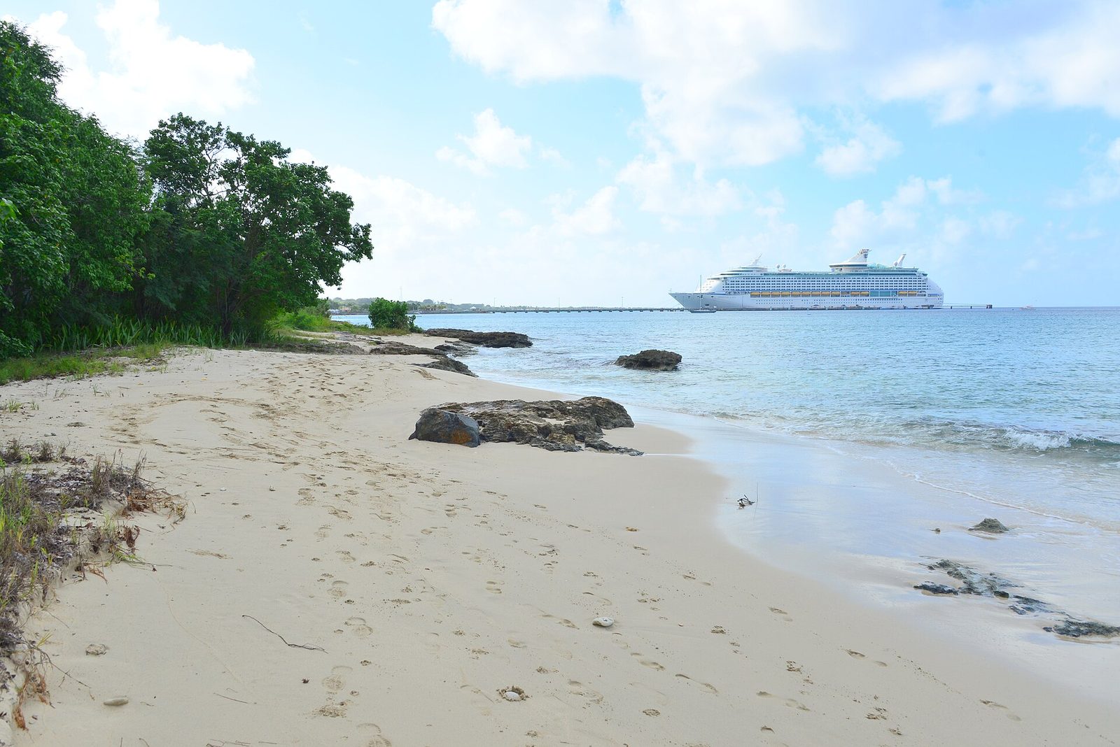
Northwest, St Croix 00840, USVI - panoramio (20)
Photo: Андрей Бобровский (CC BY 3.0)
Northwest, St Croix 00840, USVI - panoramio (24)
Photo: Андрей Бобровский (CC BY 3.0)
Northwest, St Croix 00840, USVI - panoramio (25)
Photo: Андрей Бобровский (CC BY 3.0)

The loop from the East End

Here is the day as we would do it from the villa. Leave after breakfast, because pig feeding at the Domino Club opens at 10 and the botanical garden closes at 3, and those two clocks shape everything. Take Centerline Road (Route 70) west through the middle of the island; it is the fast, flat spine, and it passes La Reine, where the La Reine Chicken Shack was still turning out spit-roasted chicken and johnny cakes as of late 2025 if you want lunch to go. At Grove Place, where the mid-island roads meet, turn for Mahogany Road, Route 76; your maps app knows the turn. From the villa to that turn is about 45 minutes.

Then slow down. Mahogany Road climbs into the trees and everything from here on is at the forest's pace: the Domino Club at number 49, LEAP a little further west, pull-offs where the canopy opens, and, if you have the vehicle and the weather, the turn up Creque Dam Road toward the dam and the Scenic Road. Come down the west end of Mahogany Road to Route 63 on the coast. From there Frederiksted is about ten minutes south for the fort, the pier and a late lunch, and the botanical garden is a few minutes back east on Centerline; do the garden first if it is after 1 pm, because it closes at 3.

The way home is a choice. The fast way is the Melvin Evans Highway (Route 66) along the south of the island, about 45 to 55 minutes from Frederiksted back to the East End, and it is the right call after a sunset at Rainbow Beach.

The pretty way is over the north side: from Frederiksted your maps app can take you up the coast on Route 63 and then inland over the hills to the North Shore Road (Route 80) at Cane Bay, then east past Salt River to Christiansted and home. It is slower and twistier, with junctions that are not signed the way you are used to, and it adds half an hour or more, but you get Cane Bay for a swim and the north coast in late light. Do it in daylight the first time.

The rainforest loop from the villa

  1. Leave the East End after breakfast with a full tank, cash, water and closed shoes.
  2. Centerline Road west about 45 minutes to Grove Place, then turn onto Mahogany Road (Route 76).
  3. Drive Mahogany Road slowly west: the Domino Club at number 49 (Tue–Sun, pigs from 10), then LEAP a little further on (Mon–Sat, call first).
  4. Optional, 4x4 and dry weather only: Creque Dam Road up to the dam and the Scenic Road toward Mount Eagle.
  5. Come down to Route 63 on the coast: Frederiksted is ten minutes south, the botanical garden a few minutes back east on Centerline (closes 3 pm).
  6. Late afternoon in Frederiksted, sunset at Rainbow Beach, then the highway (Route 66) home in about 50 minutes, or the slower North Shore Road by daylight.
StopWhatTime to allowNotes
Grove Place turnWhere Mahogany Road leaves the middle of the island (the Grove Place baobab is nearby)Drive-byAbout 45 min from the East End
Domino Club, 49 Mahogany RdOpen-air bar, pigs, MamaWanna30–60 minTue–Sun from 8 am, pigs 10–5, cash only, closed Mon
St. Croix LEAPMahogany woodworking yard, boards and tables20–60 minListed Mon–Sat about 10–5, call (340) 772-0421 first
Creque Dam1926 arch dam in the forest off Creque Dam Road1–2 hrs on footUnmarked, go with a map or a guide, shoes with grip
Scenic Road and Mount EagleUnpaved ridge road and the island high point, about 1,165 ftHalf a day4x4, dry weather, rental contract permitting
Caledonia gutSeasonal waterfall walk in the northwest valleyAbout 2.5 hrsModerate to difficult, wading, best after rain, guide advised
St. George Village Botanical Garden16 acres of gardens in sugar-estate ruins, Centerline RdAbout 1.5 hrsDaily 9–3, adults $15, kids under 10 $2 (2026)
Frederiksted and Rainbow BeachTown, fort, pier, sunset beach bar2–3 hrsAbout 10 min from the foot of Mahogany Road, then 45–55 min home

What to bring, and what to leave

Bring cash. The Domino Club takes nothing else and has no ATM, and small workshops in the woods are not places to wave a card. Bring closed shoes with grip even if you only plan to drive; the moment you step off Mahogany Road the ground is roots, leaf mulch and, after rain, clay, and the dam and the gut are not sandal walks. Bring more water than you think, because there is nowhere to buy it between Grove Place and the coast except the bar. Bring insect repellent, because the wet forest raises mosquitoes in numbers the East End never manages. And bring a rain shell or accept getting wet; the point of the place is that it rains here.

Bring a downloaded map. Phone signal in the valleys can drop, the back-road junctions are not signed the way you are used to, and the map is the only thing that will tell you which unmarked pull-off is the dam. Bring binoculars if birds interest you, and patience for the drive, which is the whole reason to come.

Leave the sedan's ambitions at the bottom of the Scenic Road. Leave nothing visible in a parked car anywhere on the island, forest included; it is ordinary sense, not a comment on the neighborhood. Leave the pigs' diet to the bar. Leave the sea shoes at the villa and pack real ones; the forest is the one day of a Cerulean week that wants long pants.

A rainy day or a cool afternoon

Most St. Croix rain is a twenty-minute performance, loud and warm and gone, and our rainy-day guide covers the forts and tasting rooms for the days the sky commits to grey. But there is one outing that gets better as the weather gets worse, and this is it. The forest in cloud is the forest at its most itself: the canopy drips, the guts start to run, the light goes green and soft, and the road empties out because everyone else went to the beach. Creque Dam in mist is the picture people frame; the same dam in noon sun is a grey wall.

The stops on this loop are built for weather. The Domino Club is under a roof, and there are few better places on the island to sit out a downpour than a bar stool in the trees with a domino game clicking behind you. LEAP is an open-air workshop with cover. The botanical garden's paths are short and there is roof to duck under. Even the drive is better wet, as long as you slow right down: leaves on the road are slick, the curves are blind, and the guts can put water across the low points quickly.

What rain rules out is the high ground and the gut. The Scenic Road turns to clay, and a gut in heavy rain is not a place to be; save Mount Eagle and Caledonia for the day after, when the water is still up but the sky has cleared. And a cool afternoon, the kind the East End gets in December and January when the Christmas winds blow, is the other perfect day for this: the forest is a few degrees cooler still, the walking is easy, and you get back to the villa in time for the fire pit.

North side road in St Croix, USVI
St. Croix's northwest is the green end of the island; the North Shore Road is the slow way home from the forest. Photo: CrucianCarolinian (CC0)

Mistakes to avoid

The first is arriving on the wrong day. The Domino Club is closed Mondays and LEAP is closed Sundays, so a Sunday loop gets the pigs but not the wood and a Monday loop gets neither; Tuesday through Saturday is the safe window, and a phone call the morning of costs nothing. The second is arriving without cash, covered above and worth repeating. The third is expecting Costa Rica. This is a small subtropical moist forest on a small dry island; people who come looking for waterfalls and monkeys go home disappointed, and people who come for a green road, an old dam and a strange bar go home happy.

The fourth is the car. Do not take a two-wheel-drive rental up the Scenic Road or the top of Creque Dam Road, and do not assume the rental contract allows unpaved roads even if the car could handle them; read it, or ask. The fifth is the timing at the garden: it closes at 3, and more than one family has driven Centerline to a locked gate. The sixth is MamaWanna at noon with a driver who has not been chosen; pick the driver before the bar, and remember that the roads out are the same winding roads in.

The seventh is treating the gut like a trail. Do not go up Caledonia in heavy rain or with heavy rain forecast, do not go alone the first time, and do not expect a marked path; go with the hiking association or a guide. The last is the small one that spoils the most days: driving the loop fast, windows up, on a schedule. Give the forest the day, and it gives you the best drive on the island.

Questions people ask

Is the St. Croix rainforest a real rainforest?

Not by the textbook. The northwest hills get roughly 50 inches of rain a year against 25 to 38 inches on the East End, which is enough to grow a closed-canopy moist forest with mahogany, kapok, turpentine and saman trees, but a true rainforest gets far more rain and has no dry season. Botanists file it under subtropical moist forest. Islanders have called it the Rain Forest for generations, and the name has stuck; it is green, shaded and cool, and it is the wettest place on the island.

Do you need a four-wheel drive for Mahogany Road?

No. Mahogany Road (Route 76) is a paved, if patched, public road, narrow and winding but driven daily by ordinary cars; the Department of Public Works was doing drainage work on it in late 2025, so expect rough spots. The Scenic Road (Route 78) and the rougher stretches of Creque Dam Road are a different matter: unpaved, rutted, and best in a high-clearance 4x4 in dry weather, and only if your rental contract allows unpaved roads. In a normal car, stay on Mahogany Road and walk from there.

Is the Domino Club with the beer-drinking pigs still open?

Yes, as of 2026. The Mt. Pellier Domino Club at 49 Mahogany Road lists hours of Tuesday through Sunday from 8 am until it closes, with pig feeding from 10 am to 5 pm, and it is closed Mondays. It is cash only with no ATM, and the food is done when it runs out. Call (340) 713-9052 before you drive an hour, and check that the day's plan does not depend on lunch there.

What do the pigs actually drink?

Non-alcoholic beer, sold at the bar for about $2 to $4 a can, with a dollar or two to enter the pen area. The pig takes the can from your hand, crushes it and drops the flattened can. It has been the house act for decades, but there is no alcohol involved, and nobody makes you visit the pens; you can have a drink under the roof, listen to the dominoes, and skip the pigs entirely if feeding animals for entertainment is not your thing.

Is St. Croix LEAP still open?

It was still listed and reviewed in 2026, but reviews over the last couple of years are mixed and it is a working yard rather than a polished shop. Directories list it Monday through Saturday, roughly 10 am to 5 pm, closed Sunday, on Mahogany Road about two miles up from the coast north of Frederiksted, west of the Domino Club. Call (340) 772-0421 before you go, and go for the mahogany, not for the presentation.

How long is the rainforest loop from the East End?

Budget a full day. Frederiksted is about 45 to 55 minutes from the East End by the highway; Grove Place, where Mahogany Road begins, is closer to 45. Driving Mahogany Road itself takes about 20 to 30 minutes without stops, and the stops are the point: the Domino Club, LEAP, the botanical garden, a walk toward Creque Dam. Add an afternoon in Frederiksted and a sunset at Rainbow Beach and you are home an hour or so after dark.

Can you walk to Creque Dam on your own?

Yes, from Creque Dam Road, but do it with a map, daylight and shoes with grip: the dam is a 1926 arch dam about 45 feet high in the trees, the approach is unmarked, and the road up is rough. Guided is easier. VI Eco Tours runs a three-hour rainforest hike from the Frederiksted pier for about $159 per adult (ages 8 and up, minimum four people, mornings), and the St. Croix Hiking Association posts group hikes.

Is there a waterfall on St. Croix?

Sort of, and only sometimes. The Caledonia gut in the northwest has a falls that runs after heavy rain and dwindles to pools or a damp streambed in dry stretches. The St. Croix Hiking Association rates the walk moderate to difficult, about an hour to the falls and two and a half hours in all, with knee-deep wading when the water is up and some crawling over fallen trees. Do not expect a postcard cascade in March; go after rain, or go for the valley.

What are the botanical garden's hours and prices?

St. George Village Botanical Garden, at 127 Estate St. George off Centerline Road near Frederiksted, lists daily hours of 9 am to 3 pm, closed Christmas Day, with general admission of $15 for adults, $10 for seniors and military, and $2 for children under 10 as of 2026 (USVI residents pay less). It is 16 acres of gardens set among the ruins of an 18th-century Danish sugar estate, with a small museum, and it takes about an hour and a half at a walking pace.

Doing it from The Cerulean

From the villa the rainforest is the far end of the island, and that is part of its appeal: you wake in the driest, brightest corner of St. Croix, watch the sun come up over the water from the pool deck, and an hour later you are under a closed canopy with the windows down. It is the one day of an East End week that shows you the other island. Leave after breakfast, aim to be at Grove Place around 10, and let the loop run west; if you want to be back for a swim, skip Frederiksted and come home the fast way by mid-afternoon, and if you want the sunset, stay west for Rainbow Beach and drive home in the dark, which on the highway is easy.

The concierge can arrange the guided version if you would rather not navigate: VI Eco Tours' three-hour rainforest hike, a hiking guide for Caledonia or the ridge, or a driver for the whole loop so nobody has to abstain at the Domino Club. Ask about the 4x4 question when you book the car through our car rental directory, because whether the Scenic Road is on the table depends on what you rented and what the contract says. And if you are traveling with several generations, split the day: the grandparents take the garden and Frederiksted, the teenagers take the dam, and everyone meets at the pigs.

Back at the villa, the forest day ends the way it should: shoes off at the door, the kitchen stocked for a long dinner, and the fire pit lit while the trade wind that dropped all that rain on the northwest hills comes over the East End dry. One last practical note: mud from Creque Dam Road does not belong on the pool deck, so keep a bag in the car for the forest shoes and leave them by the door.

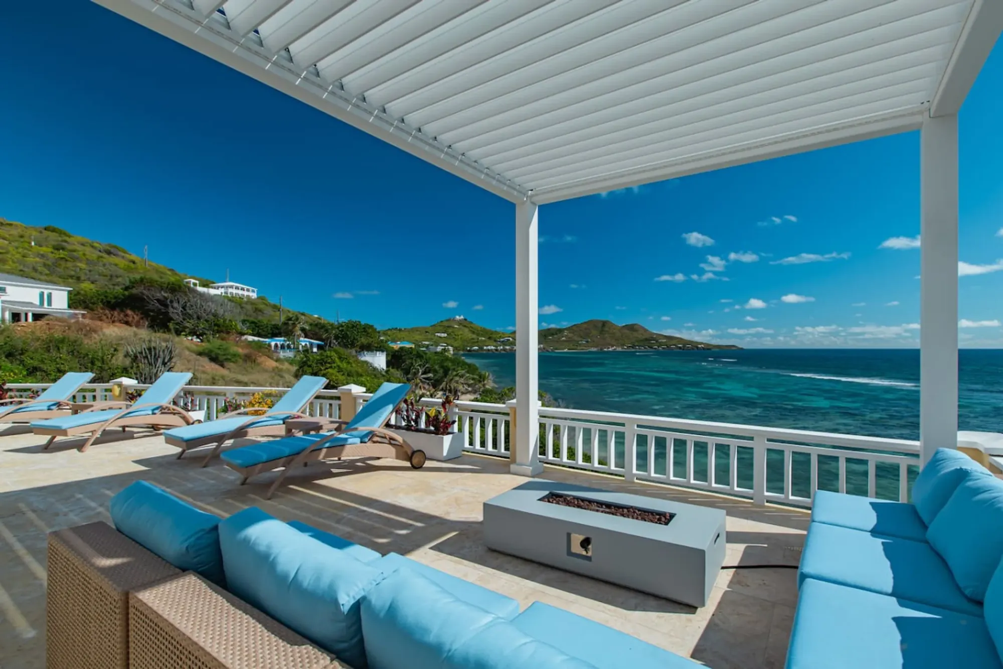
The fire pit terrace at The Cerulean, where a day in the northwest forest ends back on the dry, windy East End.
The fire pit terrace at The Cerulean, where a day in the northwest forest ends back on the dry, windy East End. Photo: The Cerulean
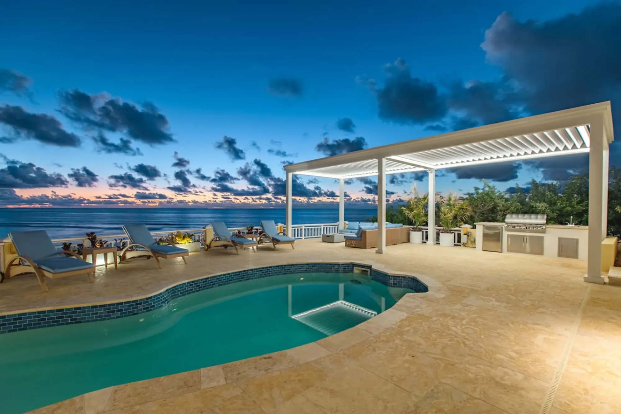
The Cerulean's pool at sunset above the sea
The Cerulean

Twelve of you, one private beach.

The Cerulean sleeps twelve on St. Croix's quiet East End — check your dates.

Sleeps 12 · 4.90 ★ · rates by season
Keep reading

Related guides.

The Cerulean villa at dawn above the sea
The Cerulean

Read it here. Live it from the villa.

Five bedrooms, a private beach, and all of this within a day trip.

Sleeps 12 · 4.90 ★ · rates by season