St. Croix Weather by Month: NOAA Temps, Rain Days, Sea & Wind
St. Croix guides · Plan your trip26 min readUpdated Aug 2026
The data reference: NOAA airport normals for all twelve months, rain days, sea temperatures, trade winds and the Christmas Winds, Saharan dust, sargassum, and sunrise on the East End.
This is the numbers page. If you want the opinionated calendar, read the best time to visit; this guide is what it leans on. Below are the NOAA 1991–2020 climate normals for St. Croix's airport, month by month: average highs and lows, rain inches, days with rain, plus sea temperature, wind, humidity, sunrise and sunset, Saharan dust, sargassum, and how the East End differs from the airport and the rain forest. Every figure has a source, and where sources disagree we say so.
How to read the numbers
Almost every St. Croix climate figure you will find online, including ours, comes from one weather station: Henry E. Rohlsen Airport, on the south shore just west of the island's middle. NOAA's National Centers for Environmental Information publish 30-year "climate normals" for it, station VQW00011624, currently the 1991–2020 set. Those normals give an average daily high and low for each month, an average rainfall total, and an average count of days with at least 0.01 inch of rain. We pulled them straight from NCEI's data service for this guide; the record extremes in this guide go back to 1951.
Three cautions before the table. First, a normal is a 30-year average, not a forecast: any given February can be wetter than any given October. Second, "rain days" count anything measurable, so a five-minute trade-wind shower at dawn counts the same as an all-day soak; that is why the winter months rack up 15 to 17 rain days on two inches of rain. Third, the airport is not the East End. The airport sits on the flat south coast; the villa sits on the dry, windy eastern tip, which gets less rain than the airport. Treat the temperatures as good for the whole island and the rainfall as an upper bound for the East End.
Sea temperature is a different kind of number. There is no NOAA normal for it in the same table, so we use ten-year monthly averages for Christiansted and note where one model runs about a degree cooler. Sunrise and sunset come from Christiansted tables cross-checked against the standard NOAA solar-calculator algorithm; the villa is about six miles east of town, which shifts them by less than a minute. Wind, humidity and cloud figures come from an airport-weighted model, with the airport station weighted at 95 percent, and they are the softest numbers here.
87.0°FAirport annual high
74.5°FAirport annual low
37.0 inRain per year
173Rain days per year
79–85°FSea range
The year in one table
Here is the whole guide in twelve rows. Highs, lows, rain and rain days are the NOAA 1991–2020 normals for Rohlsen Airport, quoted to the tenth as published; sea temperature is the ten-year monthly average for Christiansted, rounded to the degree; the notes are ours and are expanded in the month sections below. The airport's annual figures are an 87.0°F average high, a 74.5°F average low, 37.01 inches of rain and 172.7 rain days.
Second wettest. Calmest wind of the year. Still inside the peak.
November
86.8 / 74.4
5.30
16.8
~84
Wettest month. Earliest sunsets, about 5:40 pm. Trades return.
December
85.1 / 72.5
3.25
17.2
~82
Most rain days but light. Christmas Winds arrive. Shortest days.
Read across a row and the pattern is obvious: the thermometer barely moves. Read down the rain column and you see the two humps, a small one in May and a large one from September to November, with a dry pocket in June and July between them. Read the rain-days column and you find the surprise most guides miss: December, January and July have as many rain days as the wet months, but far less rain. Those are the trade-wind showers, quick, warm and mostly at night or first light. The rest of this guide is the explanation of those three columns.
January and February
These are the coolest months on paper and the ones most guests come for. The airport normals put January at an 84.2°F average high and a 71.2°F low, February at 84.6 and 71.4. The record low at the airport since 1951 is 60°F, and you will not see it; a normal winter night is low 70s, and the trade wind makes a light sweater useful on the veranda after dark. Days are short by island standards, about 11 hours 11 minutes in mid-January and 11 hours 34 minutes in mid-February, with sunrise near 6:50 am and sunset a little after 6 pm.
Rain is the interesting part. January averages 1.94 inches on 15.8 rain days; February drops to 1.35 inches on 12.6 days, the driest month of the year. Fifteen rain days in a two-inch month means the showers are brief and light: a squall line rides in on the trade wind before dawn, wets the deck, and is gone before breakfast. January is the clearest month of the year, with the sky clear or mostly clear about 80 percent of the time, and February the least muggy, with the fewest sticky days.
The wind is the other winter fact. The trade wind blows from the east most of the year, and in winter it is reinforced, in spells, by the Christmas Winds: cold fronts off the U.S. mainland that the National Park Service describes as pushing wind down from the north. The fronts do not bring cold air this far south, but they build large waves on north-facing beaches and add a day or three of stronger breeze. On the East End that shows up as a livelier sea in front of the house and a bumpier morning crossing to Buck Island; the leeward beaches on the west side stay calm.
The sea is at its coolest, about 79 to 80°F, which is still warmer than any New England beach in August. Swimming, snorkeling and boat days are all on, with the caveat that a Christmas Winds spell can stir the windward reef for a couple of days; the East End beaches guide explains which coves shelter from which direction.
March is the second-driest month, 1.62 inches on 12.0 rain days, with an 85.0°F average high and a 71.5°F low, and the trade wind steady from the east without the winter northers. It is the classic winter week extended: same temperatures as February, a touch more daylight (about 12 hours 2 minutes at the equinox, with sunrise around 6:27 am), and a sea still at about 80°F. If you want certainty about the weather and are indifferent to price, March is the month the numbers pick.
April warms a notch, to an 86.0°F high and a 73.4°F low, and adds rain (2.22 inches) while cutting rain days to the fewest of the year, 10.2. That combination, more inches on fewer days, means the showers are getting heavier and less frequent, which is the first sign of the wet-season pattern arriving. Sunrise moves to about 6 am and sunset to about 6:35 pm, so the day is longer than the night from here through September. The sea starts its climb, to about 81°F.
The National Park Service's Buck Island page calls April to June the stretch with "typically little rainfall," and while the May bump complicates that, April itself is a dry, settled month with the trade wind still doing its job and the sticky days still fewer than in summer. The practical reading for a villa week: every kind of day is on. Boat days are reliable, the reef in front of the house is usually clear enough for snorkeling straight off the beach, and evenings on the terrace need nothing heavier than a shirt. Easter demand is the only complication, and it is a calendar problem, not a weather one.
May and June
May is the small rainy peak, and it is real: 3.62 inches on 11.9 rain days, nearly double March. The average high reaches 87.1°F and the low 75.4°F, the sea moves to about 82°F, and the days are the longest of the spring at just under 13 hours, with sunrise now before 5:50 am. The rain comes as heavier afternoon or overnight showers rather than the winter's light squalls; a wet May day still usually has a dry, hot morning in it, which is why the mornings matter more here than anywhere.
June is drier again, 1.92 inches on 11.3 rain days, one of the driest months in the normals despite what the calendar says about hurricane season. The average high climbs to 88.7°F and the low to 76.9°F, and the sea to about 83°F. Sunrise reaches its earliest, about 5:44 am around the solstice, and day length its longest, about 13 hours 12 minutes. Two things start in June that are worth knowing. The Atlantic hurricane season opens on June 1, though NOAA's climatology puts most activity between mid-August and mid-October, and Saharan dust ramps up in mid-June per NOAA's AOML, bringing the first hazy-white days of the summer.
The wind picks up too. The windier part of the year runs from June 2 to August 25, with average speeds above 14 mph, peaking in July. Winter has the strong spells; summer has the steadier stiff breeze, and a June afternoon on the East End terrace is rarely still.
Sargassum, the drifting brown seaweed, is most likely from now into August. The University of South Florida's Sargassum Watch System says the Atlantic belt typically peaks in June or July, and recent years have been heavy. It lands on windward shores, which means the East End can get it and the west side mostly does not. Some weeks bring none, so it is a hedge, not a rule, and the pool is the fallback. Snorkeling and boat days remain good, and June is when the water is warm enough that nobody asks about a wetsuit.
The Cerulean
Plan it from the villa.
Five bedrooms, a private swimmable beach, and all of this within a day trip.
Full summer. July's average high is 89.2°F, August's 89.5, the warmest of the year, with lows around 77°F and a sea at about 83 to 84°F. July has 2.64 inches of rain on 16.7 rain days, August 3.23 inches on 15.6, which is the summer version of the winter pattern: many short showers, often overnight, between long bright hours. The record high at the airport since 1951 is 98°F; a normal August afternoon is high 80s with the trade wind taking a few degrees off it.
The wind is at its steadiest and strongest now by the airport averages, about 16 mph in July, and that is what makes the East End livable in August: the villa faces east into it, and the pool deck and terraces get the breeze first. Humidity is the highest of the year, with August carrying the most muggy days, so the useful hours are the early ones. Sunrise is around 5:52 am in mid-July and 6:01 in mid-August; sunset is at its latest, about 6:58 pm in early July, and still 6:45 in mid-August. There is a lot of day.
Saharan dust peaks now. NOAA's AOML puts the peak from late June to mid-August, with outbreaks every three to five days that can be as large as the lower 48 states, and a rapid decline after mid-August. In practice a dust week means a milky sky, softer horizons, orange sunsets, and, per NOAA, suppressed showers and storms while the layer sits overhead. Visibility for photographs drops; snorkeling is unaffected. Anyone with asthma should keep an eye on the air-quality forecast and take the pool over the trail on the heaviest days.
The storm calendar turns in the second half of August. NOAA's National Hurricane Center puts most of the season's activity between mid-August and mid-October, and the hurricane section below points to the guide that covers what that means for booking and insurance. Sargassum usually thins by late August. Boat days and snorkeling are excellent in the mornings, and the water is as warm as most people will ever swim in.
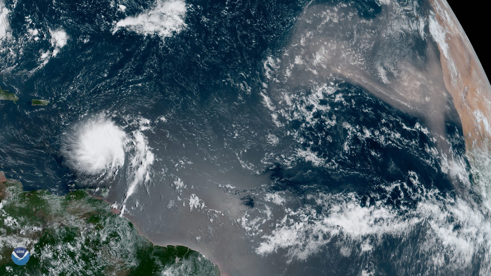
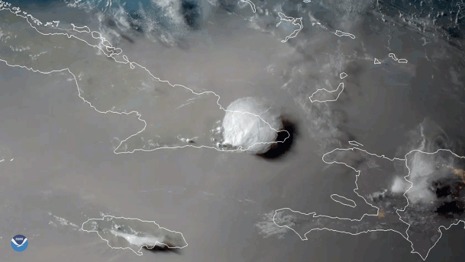
Satellite imagery is how the season is watched: NOAA and NASA track hurricanes and Saharan dust as they cross the Atlantic toward the Caribbean.Photo: NOAA Satellites (Public domain)
September and October
These are the two months the brochures skip, so here are their numbers plainly. September: 89.0°F average high, 76.6°F low, 4.89 inches of rain on 15.7 rain days, the warmest sea of the year at about 85°F, and the cloudiest month, overcast or mostly cloudy about two-thirds of the time. October: 88.4°F high, 76.0°F low, 5.03 inches on 16.9 rain days, sea still about 85°F, and the calmest wind of the year at the airport, an average around 12 mph. Sunrise slides from about 6:07 am to 6:12; sunset from about 6:21 pm to 5:57.
The rain is now the wet-season kind: heavier showers, more of them in the afternoon, and the occasional day that stays gray. Five inches in a month is not the Pacific Northwest, and most September days on the East End are hot and bright, but the odds of a rainy afternoon in your week are real, and the rainy-day guide exists for exactly these weeks. The lighter wind and warm sea also make the water in front of the house at its glassiest, which is why some regulars prefer these months for snorkeling.
The reason people hesitate is the tropics, and the numbers are the same for everyone: the season's statistical peak is September 10, and the NHC's 1991–2020 average season produces 14 named storms, 7 hurricanes and 3 major hurricanes across the whole Atlantic basin, most of them between mid-August and mid-October. St. Croix has been hit hard, Hugo in 1989 with Category 4 winds and Maria in 2017 with sustained winds over 150 mph, and it has had many quiet Septembers in between. That is what a peak means: higher odds, not certainty. Book with insurance and a loose plan, and read the hurricane guide linked below before you decide.
What the season gives back is warm, still water and empty beaches. Saharan dust is gone by now, sargassum is heading toward its winter minimum, the trade wind is at its softest, and the sea is as warm as it gets. The reef is also at its most heat-stressed in these months, which the sea-temperature section below explains; look, do not touch, and use mineral sunscreen.
November and December
November is the wettest month in the normals, 5.30 inches on 16.8 rain days, and also the month the winter starts to switch on. The average high drops to 86.8°F and the low to 74.4, the sea eases to about 84°F, and the trade wind comes back from its October lull. Days are short: sunrise around 6:24 am, sunset at its earliest of the year, about 5:42 pm in mid-November, for a day of about 11 hours 18 minutes. Hurricane season runs to November 30 on paper, but the NHC's peak window closes in mid-October and the odds fall off quickly.
December is a different animal from November despite being next to it. Rain drops to 3.25 inches, but the rain-day count is the highest of the year, 17.2. That is the trade-wind shower pattern returning: many brief squalls, mostly at night and dawn, between long clear stretches. The average high is 85.1°F, the low 72.5, the sea about 82°F. The Christmas Winds arrive in spells from December, and the clearer season begins in mid-November. Sunrise is about 6:42 am in mid-December, sunset about 5:46 pm; the shortest day, about 11 hours 4 minutes, falls near the solstice.
For a villa week the second half of December is the winter island: breezy, mostly clear, sea in the low 80s, and rain that has usually finished by the time the coffee is made. The first half of November is the wettest fortnight in the year's averages, and also, in most years, superb value with warm water. The best-time guide makes the case for the middle weeks of November as the winter island a month early; the numbers here support it as long as you accept a wetter afternoon or two.
One logistic follows from the sun. Because St. Croix does not change its clocks, December's 5:46 pm sunset feels early to a guest arriving from Eastern Standard Time, where the island is an hour ahead; plan to be back from Christiansted, about 15 to 20 minutes' drive, before dark on the first evening. The sunrise the villa is built around, meanwhile, comes at a civilized 6:40 to 6:50 am all winter.
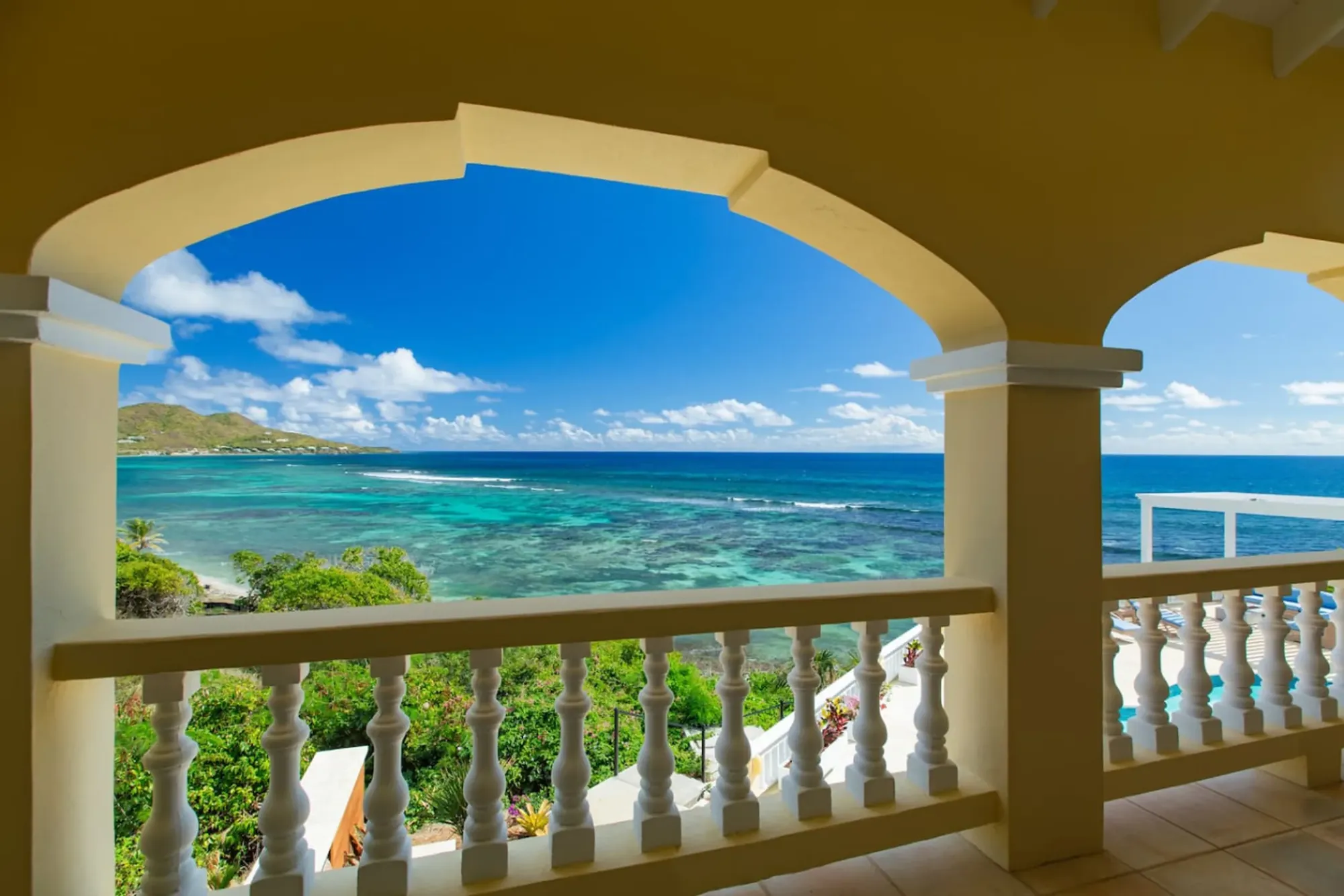
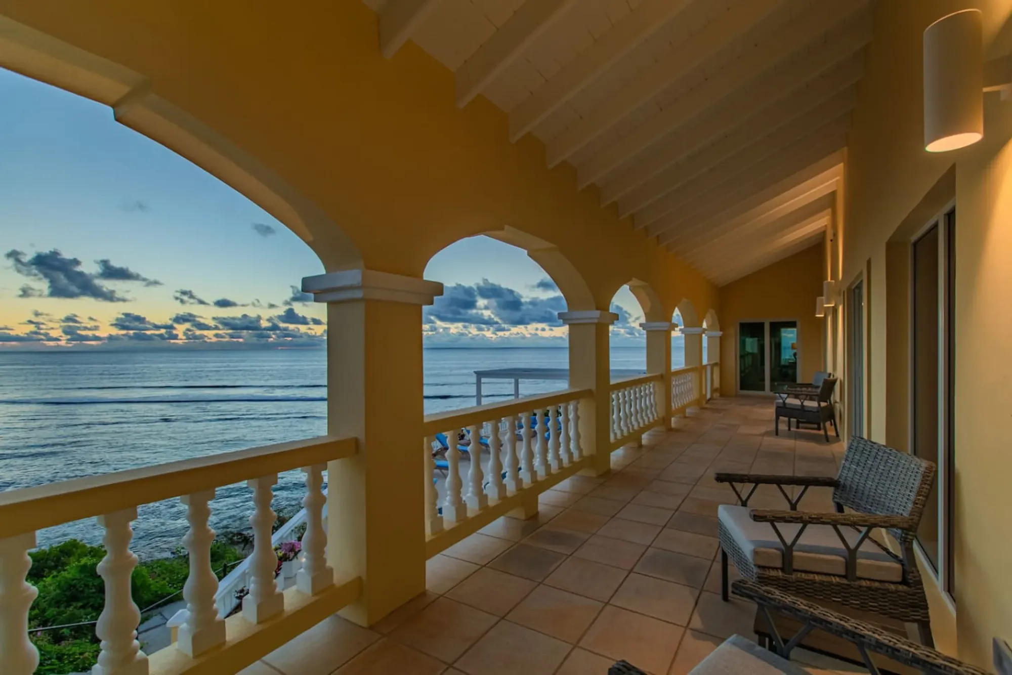
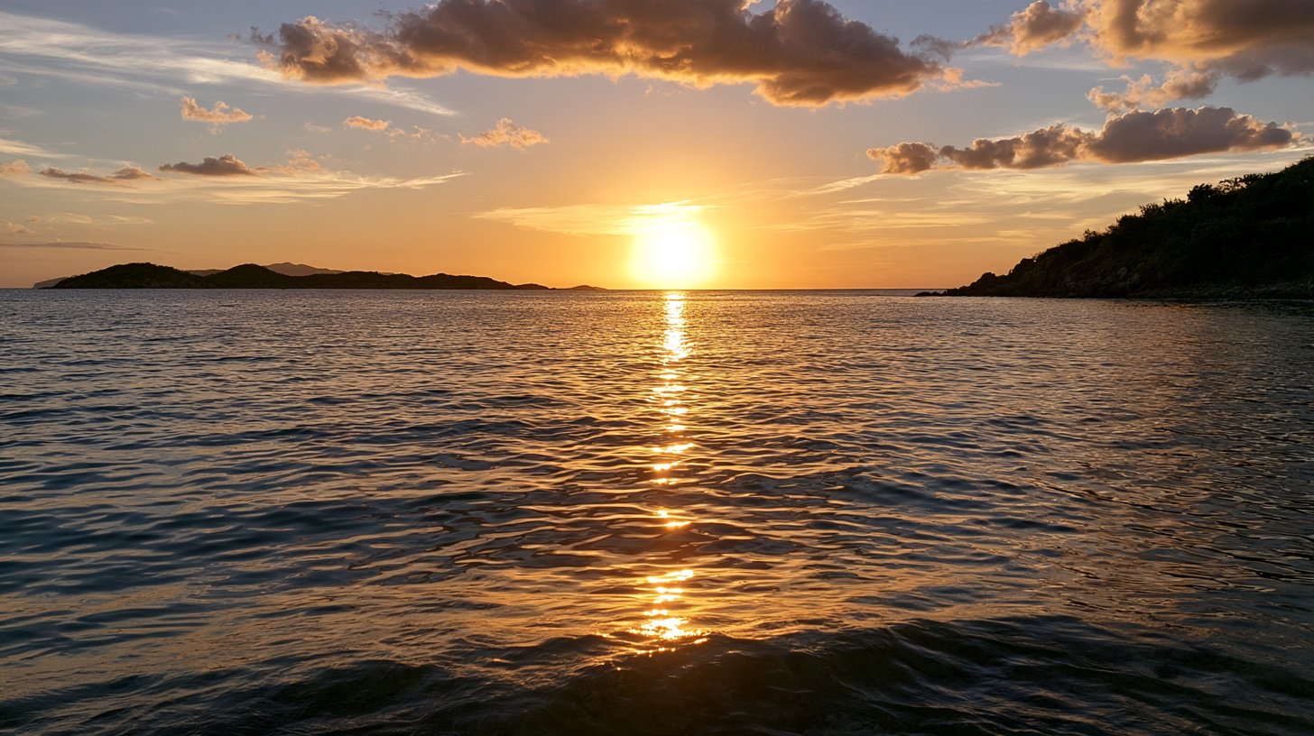
The villa's veranda faces east: sunrise comes up over the water in front of the house every month, between about 5:45 and 6:55 am.Photo: The Cerulean
The trade wind and the Christmas Winds
If temperature is the least of your worries on St. Croix, wind is the thing you should actually plan around, because it decides which beach is calm, whether the boat goes, and how the East End feels at 3 pm in August. The National Park Service's pages for both Buck Island and Virgin Islands National Park say the same thing in the same words: the trade winds, the Easterlies, blow east to west across the tropical Atlantic and dominate the islands' weather. They blow along the length of the island year-round. The East End is where they arrive first.
How strong depends on who you ask, and the disagreement is instructive. The Park Service says winter tends to bring stronger winds and less rain, summer more rain and lighter winds. By the airport-weighted averages, the windier part of the year runs from June 2 to August 25, with July the windiest month at about 16 mph and October the calmest at about 12 mph. Both are describing something real. Summer has the steadier stiff breeze, the trade wind at its most consistent. Winter has the spells, when a front off the mainland stacks the pressure gradient and the wind blows harder for two or three days, then settles.
Those spells are the Christmas Winds. The Park Service describes them as winter cold fronts moving off the continent that "sometimes bring the Christmas winds down from the north"; the fronts do not bring cold air as far south as the Virgin Islands, but they can create large waves breaking on north-shore beaches. They come mostly December through February, in episodes of a few days rather than continuously. On the East End they mean a livelier sea in front of the house, a breezier veranda, and a Buck Island crossing that the boats will happily tell you is bumpier than usual.
The practical rule for any month: mornings are calmer than afternoons, the west and south coasts are more sheltered than the north and east, and the villa's east-facing design turns the wind into a feature the rest of the year. If a boat day matters, book the earliest departure; if a still snorkel matters, go at first light or pick October.
St. Croix's rain does not come as one wet season and one dry one; it comes as two humps. The NOAA normals show it clearly. From September through November the airport averages 4.89, 5.03 and 5.30 inches, the three wettest months, together about 15 inches, or 41 percent of the year's 37.01. Then a fast decline: December 3.25, January 1.94, February 1.35, the driest, March 1.62. April rises to 2.22, May to 3.62, the smaller peak, and then June and July fall back to 1.92 and 2.64 before August's 3.23 leads into the big one. Two humps, two troughs.
The dry season, then, is roughly late January through April, with February and March the driest pair, and June is an honorary member. The wet season proper is September through November, with May as a warm-up act. This is why the "dry season equals winter" rule you hear across the Caribbean is only half right here: the driest month is February, but the second-driest stretch is early summer, and the wettest month is not September but November, when the trade winds are already returning and the storm odds are already falling.
The rain-days column adds the texture. Winter and midsummer months carry 15 to 17 rain days on two to three inches, which describes light, frequent trade-wind showers, usually before dawn or late in the day, that leave the deck wet and the morning bright. The autumn months carry the same number of days on five inches, which describes heavier showers and the occasional gray afternoon. April, with the fewest rain days of the year at 10.2, is the one month where showers themselves are rare. What the airport does not tell you is where it rains, and on St. Croix that varies more than when.
Where it rains: the East End versus the northwest hills
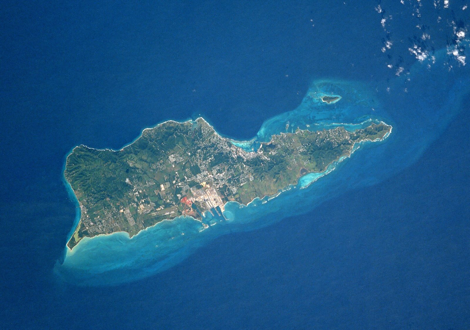
St. Croix is 22 miles long and 7 wide, with its high ground stacked in the northwest, where Mount Eagle reaches 1,165 feet, and its eastern third tapering through low, steep hills to Point Udall. The trade wind blows the length of it, so the northwest hills wring the moisture out of the air and the East End gets what is left. The island average is around 40 inches a year, the northwest about 50 inches, and the east 25 to 38 inches; an older USGS survey estimates the far east end at roughly 20 inches with the northwestern end above 50. The figures differ; the gradient does not.
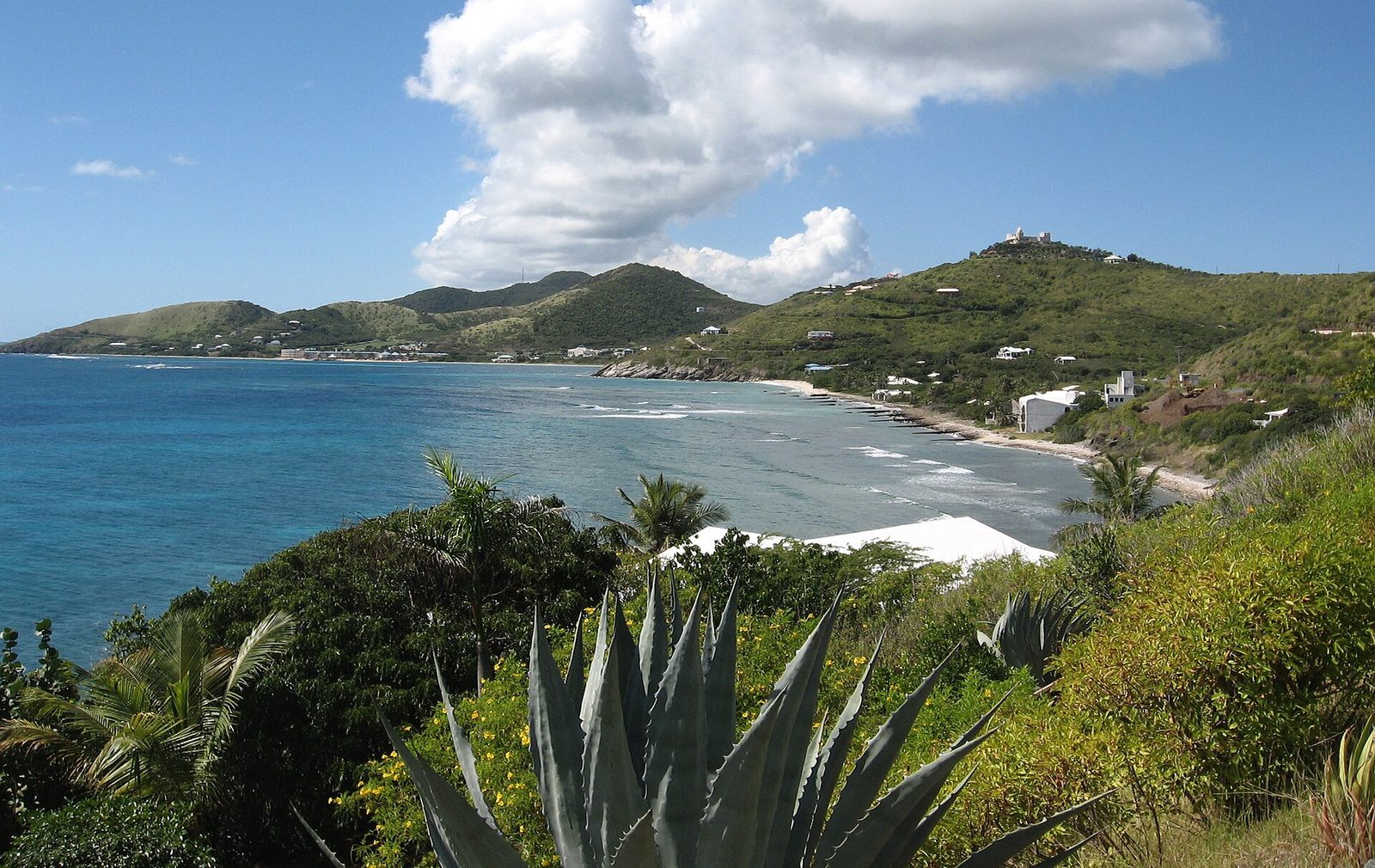
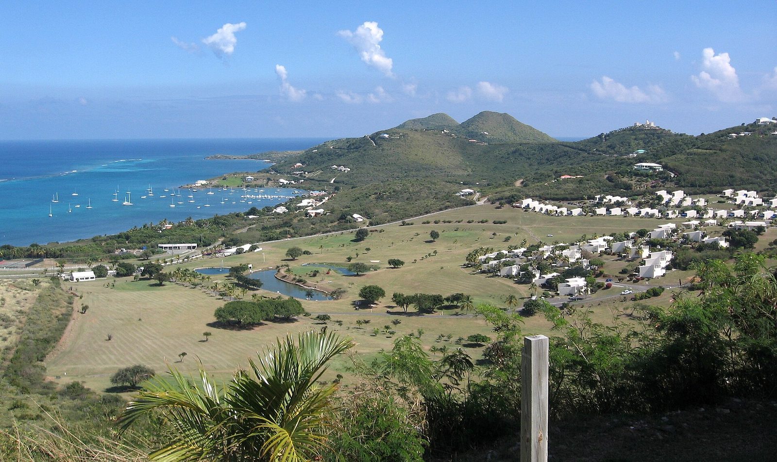
You can see it from the road. The west end has the island's rain forest and mahogany, the middle its old cane plain, and the East End is the island's sunny, California-like side: low coastal hills, agave, sea grape, and grasses that go gold between rains. It is also the sunrise side and the windward side, so it is drier, breezier and brighter than the airport normals suggest, with fewer of the heavy showers that stack against the hills. When the forecast says showers for St. Croix, the northwest usually gets more of them and the East End less.
For a guest this cuts both ways, and both are good. A day that is showery in the western rain forest is often dry at the villa, so the East End's morning is rarely lost. And the East End's dryness is what makes the sea in front of it clear: less runoff, less sediment, better visibility on the reef straight off the beach. The tradeoff is the wind and the sun; the East End has more of both. When you read a 37-inch figure for "St. Croix," think of it as the island's middle, with the villa on the dry side of it and the Annaly and Carambola hills on the wet side.
St. Croix from above, in NOAA imagery. The island's rain falls unevenly: most of it on the northwest hills, least on the East End.Photo: NASA (Public domain)
Sea temperature, month by month
The sea around St. Croix moves through about five or six degrees in a year, and it moves late: the coolest water comes in February and March and the warmest in September and October, weeks after the air's own extremes. The ten-year monthly averages for Christiansted run 80.4°F in January, 79.7 in February and March, 80.6 in April, 81.9 in May, 82.9 in June, 83.3 in July, 84.2 in August, 84.9 in September, 84.7 in October, 83.7 in November and 81.9 in December. One model runs about a degree lower across the board, 79 in February to 84 in September. Both describe open water; a shallow cove at 3 pm reads warmer.
The practical translation is simple. There is no month when the water is cold. Even the February low, 79 to 80°F, is warmer than the Gulf of Maine ever gets and roughly what South Florida sees in early summer. Most people snorkel in a rash guard year-round for sun rather than warmth, and the only guests who miss a wetsuit are the ones logging long dives on the wall in winter, when a thin shorty is enough. In September, the water is as warm as a bath, which is lovely for people and hard on coral.
That last point deserves a paragraph. Corals bleach when the water stays unusually warm for weeks, and the Caribbean's record marine heat of 2023 produced confirmed bleaching in the U.S. Virgin Islands, which NOAA listed among the affected territories when it declared the fourth global bleaching event the following spring. Some colonies recovered by early 2024; some did not. None of this changes whether you can swim in September; it does change how you should swim. Keep fins off the reef, do not stand on anything, and use only mineral sunscreen, which the territory has required since 2020. Warm months are the months the reef can least afford a careless kick.
For swimmers, the summary is one line: the sea in front of the villa is between about 79 and 85°F every day of the year, and the only question is how still it is, which the wind section above answers. For turtles, which use the East End reefs and seagrass year-round, the sea turtles guide has the nesting calendar and the rules.
~80°F, Feb–MarCoolest sea
~85°F, Sep–OctWarmest sea
About 5°FAnnual swing
~5:44 am, JuneEarliest sunrise
~6:58 pm, JulyLatest sunset
Sunrise, sunset and daylight
The villa faces east, so the sun is part of the weather here. St. Croix sits at about 17.7°N, close enough to the equator that day length changes only about two hours across the year, and it keeps Atlantic Standard Time (UTC-4) all year with no daylight saving. The table gives sunrise, sunset and day length for Christiansted around the 15th of each month, cross-checked with the standard NOAA solar-calculator method; the villa's times are within a minute of these.
Month
Sunrise
Sunset
Day length
January
~6:53 am
~6:04 pm
11 h 11 min
February
~6:46 am
~6:20 pm
11 h 34 min
March
~6:27 am
~6:29 pm
12 h 02 min
April
~6:03 am
~6:35 pm
12 h 32 min
May
~5:46 am
~6:44 pm
12 h 58 min
June
~5:44 am
~6:55 pm
13 h 11 min
July
~5:52 am
~6:58 pm
13 h 06 min
August
~6:01 am
~6:45 pm
12 h 43 min
September
~6:07 am
~6:21 pm
12 h 14 min
October
~6:12 am
~5:57 pm
11 h 45 min
November
~6:24 am
~5:42 pm
11 h 18 min
December
~6:42 am
~5:46 pm
11 h 05 min
A few things fall out of the table. The earliest sunrise of the year is about 5:43 am in late May and early June, not on the solstice, and the latest sunset is about 6:58 pm in early July; the latest sunrise is about 6:53 am in late January and the earliest sunset about 5:42 pm in mid-November. The longest day is about 13 hours 12 minutes around June 21 and the shortest about 11 hours 4 minutes around December 21.
For planning: a winter sunrise on the veranda is a coffee-in-hand affair at a reasonable hour; a summer one asks you to be up before six, and rewards you with the coolest, stillest hour of the day, the one the reef is clearest and the sea flattest. Sunset is on the other side of the island, so if you want it over water you drive west to Frederiksted, about 45 to 55 minutes, and in December you leave the East End by 4:30. The Point Udall guide covers the first-in-America sunrise, about five minutes from the villa.
Saharan dust and sargassum, the summer nuisances
Two things arrive on the trade wind in summer that no thermometer records. The first is Saharan dust. NOAA's Atlantic Oceanographic and Meteorological Laboratory describes the Saharan Air Layer as a mass of very dry, dusty air that forms over the Sahara and moves west over the tropical Atlantic with about half the moisture of the normal tropical atmosphere, riding a mile or more above the sea. Activity ramps up in mid-June, peaks from late June to mid-August, and subsides rapidly after mid-August, in outbreaks every three to five days that can be as large as the lower 48 states.
On the ground it looks like this: a milky-white sky instead of a blue one, a horizon that softens, an orange sunset, and, per NOAA, fewer clouds and showers while the layer sits overhead, because the dry, stable air suppresses them. It also suppresses hurricane formation, which is the reason locals speak of it almost fondly. Photographs lose their punch; the water does not, so a dust week is a snorkeling week. The one real caution is respiratory: NOAA advises people with asthma to limit time outdoors on heavy days. By late August the sky is usually blue again.
The second is sargassum, the brown seaweed that drifts across the Atlantic in a belt and beaches on windward shores. The University of South Florida's Sargassum Watch System, which tracks it by satellite, says the belt typically peaks in June or July with its minimum in winter, that 2018 and 2022 were record Junes, that 2017–2022 carried double the seaweed of 2011–2016, and that its July 2026 bulletin found amounts second only to 2025's records outside the Gulf, with beaching persisting across the Caribbean and Lesser Antilles. St. Croix's east- and south-facing shores catch it; the west side, in the island's lee, mostly does not.
The honest version for the East End is a hedge: some June and July weeks bring none, some bring a lot, and it changes with the wind in days. It is harmless to swim near and smells when it rots on a beach in quantity. If it lands during your week, the villa's pool and deck above the sea, a morning boat to the reef, or a drive to a leeward beach are the moves; the west end guide lists the sheltered ones. From September on it thins, and from November to April it is rarely a topic.
FebDriest month (1.35 in) and coolest sea (~80°F)
AprFewest rain days (10.2)
MaySmall rainy peak (3.62 in)
Jun 1Atlantic hurricane season opens
Jun–JulSargassum belt at its typical peak
Late Jun – mid-AugSaharan dust peak, outbreaks every 3–5 days
Sep 10Statistical peak of the hurricane season
OctSecond-wettest month, calmest wind, still inside the peak window
NovWettest month (5.30 in)
Nov 30Hurricane season closes
Hurricane season in the numbers
We keep this short because the hurricane guide tells the whole story, including insurance, how the island prepares and how locals actually think about it. The climatology, from NOAA's National Hurricane Center: the Atlantic season runs June 1 to November 30; its statistical peak is September 10; most activity falls between mid-August and mid-October; and the 1991–2020 average season produces 14 named storms, 7 hurricanes and 3 major hurricanes across the entire basin, from Africa to Texas. St. Croix is one small target in a very large ocean, and most seasons pass it by.
The record is the reason for respect. Hugo struck the island in September 1989 with Category 4 winds; Maria, in September 2017, brought sustained winds over 150 mph and damaged or destroyed about 70 percent of the island's buildings. Both were September storms, which is exactly what the climatology predicts, and both were followed by long stretches of quiet Septembers. The numbers do not say September is dangerous; they say September carries the year's highest odds of a disruption, and that the odds in June, July and November are low.
What that means for reading this guide's table: treat the June-to-early-August rows as normal summer weather with a low tail risk, the mid-August-to-mid-October rows as the window where you buy travel insurance and keep the plan loose, and November as a month whose risk is fading faster than its rain. And do not confuse the wet season with the storm season. They overlap in September and October, but November, the wettest month, sits at the tail of the season, and June, inside the season, is one of the driest months of the year.
Swimming, snorkeling and boat days, month by month
Here is how the numbers turn into a week's plan. Swimming is a yes in every month: the sea is between about 79 and 85°F all year, and the villa's beach is a reef-protected cove with direct water access. What changes is the surface. December through February, the Christmas Winds spells can put chop on the windward side for a few days at a time; March through May, the trade wind is steady and the mornings reliably calm; June through August, the breeze is at its steadiest and stiffest, so first light is the still hour; September and October are the calmest and warmest; November brings the wind back with the wettest afternoons.
Snorkeling follows the same curve with one addition: visibility. The East End's dry hills mean little runoff, so the water in front of the villa clears quickly after rain, and the best visibility tends to be in the drier, calmer mornings of March, April, June and again in September and October. Saharan dust does not affect the water; a Christmas Winds spell does, stirring the shallows for a day or two. An April 2026 guest, Emily, called it "amazing snorkeling off the reef," and the months above are when it is most reliably so.
Boat days, meaning Buck Island, the reef trips and the fishing and sailing charters, run year-round, and the operators cancel for weather rather than season. Book the earliest departure in any month; the sea is calmer before noon and the wind builds after it. Winter crossings can be bumpier in a Christmas Winds spell, summer ones are breezy but routine, and September and October are frequently the flattest water of the year with the fewest other boats.
The days that need a plan B are few and predictable: a wet October afternoon, a heavy dust day for someone with asthma, a sargassum week in July, a front in January that keeps the boats in. The rainy-day guide handles the first, the pool deck the second and third, and Christiansted's museums, forts and restaurants the fourth. None of them cancels a week; they move an afternoon.
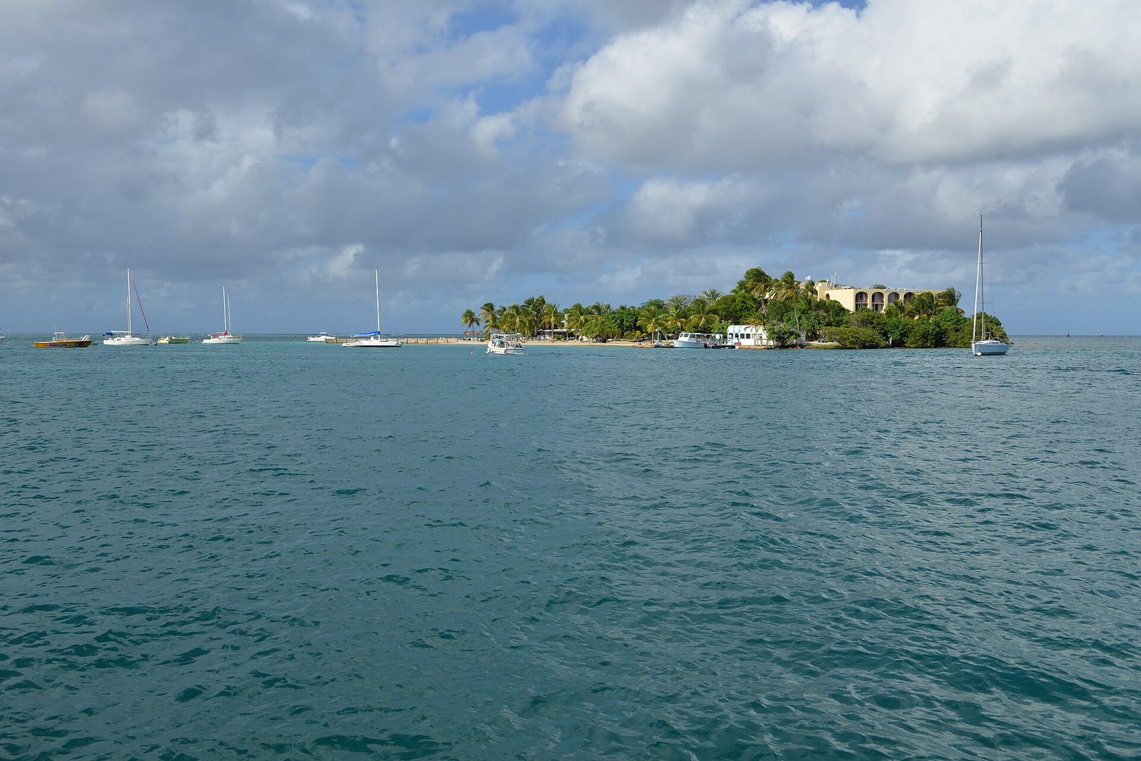
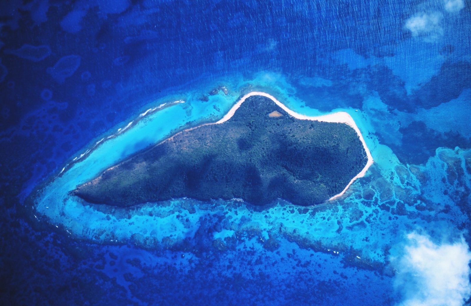
Buck Island off St. Croix's northeast coast; the crossing is calmest in the morning and bumpier during the winter's Christmas Winds spells.Photo: Wikimedia user Russavia (Public domain)
What the numbers mean for packing
The packing guide has the full list; the weather case for it fits in a paragraph. Because highs move only from 84 to 90°F across the year, one wardrobe covers every month: light, breathable clothes, a rash guard or two, and a hat with a real brim, since the sun at 17°N is high overhead every month and the UV index is a different animal from a mainland summer's. Because nights are 71 to 77°F and the East End is windy, one light layer for the veranda earns its place in every season, and in December through February you will use it.
Because the rain comes as showers rather than days, a light packable rain shell matters more than an umbrella, which the trade wind will not respect, and it matters more in September through November than in any other months. Because the sea is 79 to 85°F, nobody needs a wetsuit to snorkel; long-dive winter guests bring a shorty. Because the territory has banned oxybenzone, octinoxate and octocrylene sunscreens since March 2020, bring mineral sunscreen or buy it on island, and bring more than you think for July, when the sun is strongest and the days longest.
Two smaller things follow from the sun table: sunglasses matter more here than at home, especially at sea, and a small light is useful in winter, when it is dark by 6 pm. And one from the humidity: cameras and documents like a dry bag, and August is when they most want one.
Check the week before you fly
Open the NOAA/NWS San Juan forecast for St. Croix, which covers the USVI, about five days out.
In June through November, glance at the National Hurricane Center's two-day and seven-day outlook maps.
In June through August, check the air-quality forecast for Saharan dust if anyone in your party has asthma.
Look at the sunrise time for your dates and set the first morning's alarm for 20 minutes before it.
Ask the concierge which side of the island is calm that week before you book a boat day.
Questions people ask
What is the coldest month on St. Croix?
By the NOAA 1991-2020 normals for Henry E. Rohlsen Airport, January and February are the coolest months, with average highs of 84.2 and 84.6°F and average lows of 71.2 and 71.4°F. The sea is also at its coolest then, about 79 to 80°F. Records at the airport since 1951 have dipped to 60°F, but a normal winter night is low 70s, and a normal winter afternoon is mid-80s.
What is the hottest month on St. Croix?
August, narrowly. The airport normals put the average high at 89.5°F in August, 89.2 in July and 89.0 in September, with average lows around 77°F. The sea peaks a little later, about 84 to 85°F in September and October. Humidity is highest in late summer too, so August afternoons feel warmer than the thermometer says; mornings and the trade wind are the relief.
What is the rainiest month on St. Croix?
November, at 5.30 inches in the airport normals, followed by October (5.03) and September (4.89). May has a smaller peak of 3.62 inches. February is the driest at 1.35 inches, then March at 1.62. Note that rain days do not track inches: December averages the most days with measurable rain (17.2) but only 3.25 inches, which means frequent brief showers rather than washouts.
How warm is the water in St. Croix?
Warm enough to swim every month. Ten-year averages for Christiansted run from about 79.7°F in February and March to about 84.9°F in September; one model runs about a degree cooler, 79°F in February to 84°F in September. Either way the swing is roughly five degrees across the whole year, and even the coolest month is warmer than most mainland beaches in summer.
When are the Christmas Winds?
Roughly December through February, in spells rather than continuously. The National Park Service describes them as winter cold fronts off the U.S. mainland pushing wind down from the north; the fronts do not bring cold air this far south, but they strengthen the trade wind, and they can build large waves on north-facing shores. On the East End they mean breezier evenings and a bumpier Buck Island crossing for a few days at a time.
When is Saharan dust season in St. Croix?
Per NOAA's Atlantic Oceanographic and Meteorological Laboratory, Saharan Air Layer activity ramps up in mid-June, peaks from late June to mid-August, and subsides quickly after mid-August, with outbreaks about every three to five days. Expect stretches of hazy white sky and orange sunsets in July. The dry, stable air also suppresses storm formation. People with asthma should limit time outdoors on the heaviest days.
Does St. Croix get sargassum, and when?
Sometimes, mainly on windward east- and south-facing shores. The University of South Florida's Sargassum Watch System says the Atlantic belt typically peaks in June or July and is at its minimum in winter, though recent years (2018, 2022, 2025) set records and 2026 has run close behind. It comes and goes with wind and current, so a bad week can be followed by a clean one. Leeward west-side beaches and the pool are the fallbacks.
What time is sunrise on St. Croix?
Between about 5:45 am in late May and June and about 6:55 am in late January, with the sun setting between about 5:40 pm in mid-November and about 7 pm in early July. Day length runs from about 11 hours 4 minutes in mid-December to about 13 hours 12 minutes in late June. St. Croix stays on Atlantic Standard Time all year, so it matches Eastern Daylight Time in summer and runs an hour ahead of the East Coast in winter.
Is the East End of St. Croix drier than the rest of the island?
Yes, clearly. Rain on St. Croix follows the hills: the northwest gets around 50 inches a year and grows the rain forest, while the east end gets roughly 25 to 38 inches, and USGS estimates put the far east end lower still. That is why the East End is the island's sunny, dry side, why it is the windier side, and why the airport's 37-inch normal probably overstates what falls at the villa.
Doing it from The Cerulean
The villa was built for this weather rather than in spite of it. It sits on the East End's sunrise side, facing east into the trade wind, with a private beach and the reef directly in front, a pool and deck above the sea, and verandas and terraces that take the breeze first. On a January morning that means coffee on the veranda before 7 as the sun comes up over the water, in the water by 7:30, and a boat to Buck Island before the wind builds; on an August morning it means an earlier alarm, a stiller sea, and the pool deck for the hot hours.
The house also carries the fallbacks. Its east-facing design turns the summer breeze into cooling; the pool deck and terraces are the answer to a sargassum week or a dust day; the chef's kitchen, the outdoor kitchen and the fire pit terrace absorb a wet October afternoon without anyone leaving the property; and the separate guest cottage gives a big group room to spread out on the days the weather keeps everyone home. Christiansted, about 15 to 20 minutes away, has the museums, forts and restaurants for the rest.
The concierge can read the week for you: which beach is in the lee, which morning the boats are calmest, whether the reef is clear after a front, and how to reach Point Udall for the sunrise, about five minutes up the road. The Getting Here page has the flight calendar that goes with each season.
What the numbers say, finally, is that this is one of the least variable climates you can fly to from the mainland: a five-degree year, a sea that never cools, a wind you can count on, and rain that keeps to the mornings most of the year. The rest is what you do with the day, and the house faces the right way for it.
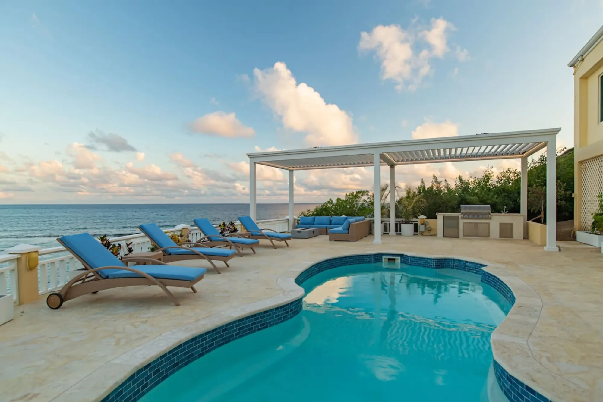
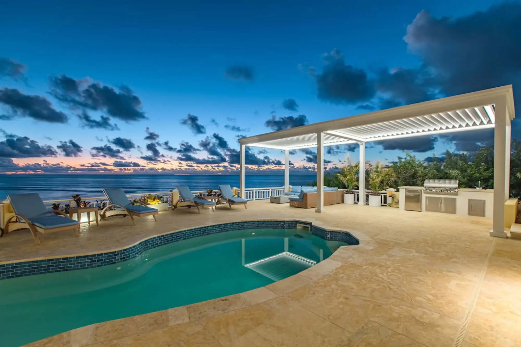
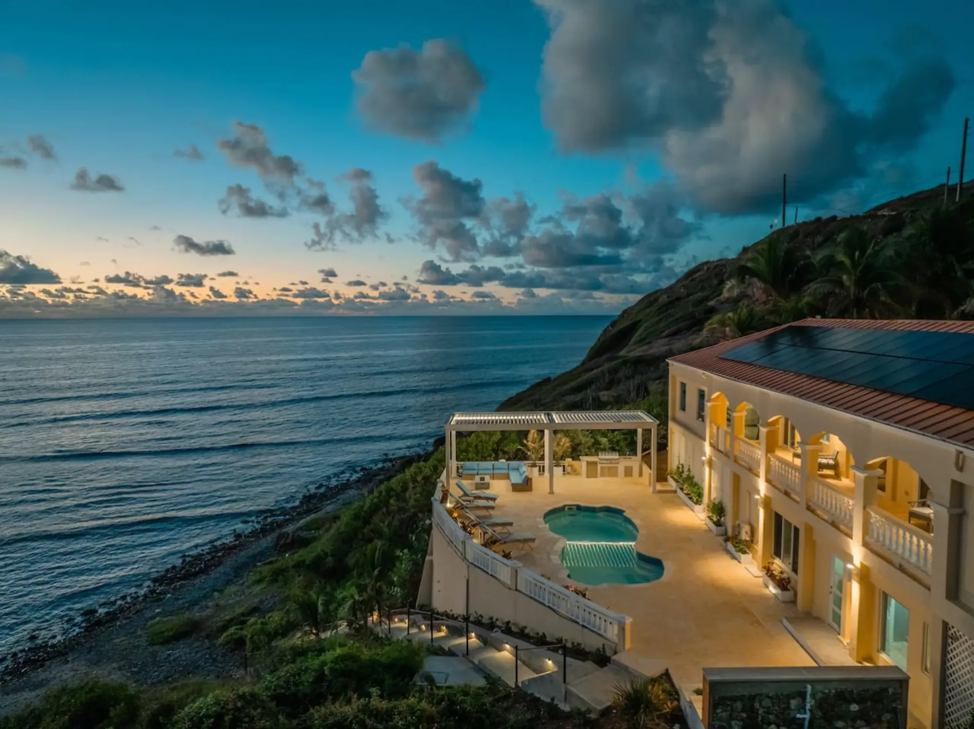
The pool deck above the sea, the villa's fallback on a breezy afternoon or a sargassum week; the East End breeze reaches it first.Photo: The Cerulean
The Cerulean
Twelve of you, one private beach.
The Cerulean sleeps twelve on St. Croix's quiet East End — check your dates.