

The CeruleanSt. Croix · U.S. Virgin Islands
Salt-River-Bay-1

Columbus at Salt River, 1493: The Landing, the Arrows & the Park

The one place under the U.S. flag where a Columbus landing is pinned to a marked point — and where the people already living there fought the boat off. What is documented, what is argued, and what you actually see.

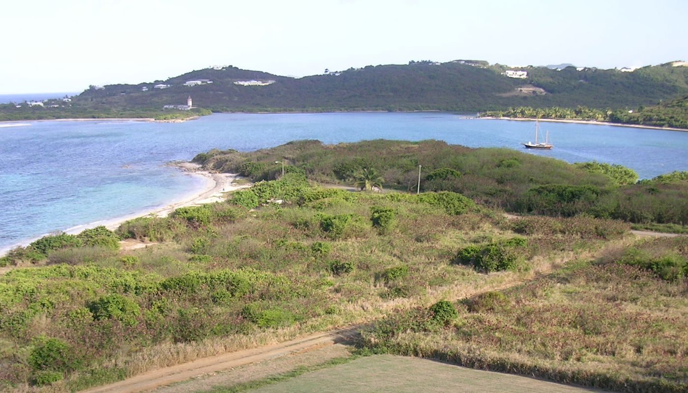
Photo: self (Public domain)

On November 14, 1493, seventeen Spanish ships stood off a bay on the north shore of St. Croix, and a boat went in for water. What followed — an abandoned village, captives taken, a canoe that would not run, arrows, a Spanish seaman dead within days — is the reason Salt River Bay is a National Historic Landmark and a national park. It is a quiet place now: a beach local families use, a sign, low earthworks on the point. This guide tells you what is documented, what is argued about, and how to see it from the villa in an afternoon.

Where it is on St. CroixChristianstedFrederikstedPoint UdallThe CeruleanSalt River Bay — the Columbus landing site
Where it is. Island outline © OpenStreetMap contributors (ODbL).

What happened at Salt River, in short

Columbus came back to the Caribbean in the autumn of 1493 with a very different fleet from the three ships of the year before: seventeen vessels, sailing from Cádiz on September 25 to plant a colony. He raised Dominica on November 3, worked north through the Lesser Antilles, and on November 14 the fleet stood off a large island he named Santa Cruz — Holy Cross — the island the Taíno called Ay Ay and we call St. Croix. He did not go ashore. He sent a boat, by the accounts about 25 men, into the bay we now call Salt River, to find fresh water and, by most accounts, people who could serve as guides.

The boat found a village on the shore whose people had already fled. The crew took captives — several women and boys, some of them Taíno held by the Kalinago (Island Carib) people who then controlled the bay. As the boat was returning, a canoe came around the point carrying a few Kalinago men, two women and two captive Taíno men. The Spanish boat rowed it down; the people in it, men and women both, shot arrows. Two Spaniards were hit and one died within days. At least one Kalinago was killed; the rest were taken. Columbus named the promontory Cabo de las Flechas, the Cape of the Arrows, and the fleet sailed on toward Puerto Rico.

That is the documented core, and it rests on two men who were there and wrote it down: the fleet physician, Dr. Diego Álvarez Chanca, in a letter of 1494, and Michele de Cuneo, a friend of Columbus's, in a letter of his own. The NPS calls the fight the first recorded conflict between Europeans and Amerindians in the New World, and the beach on the west side of the bay's mouth has been a National Historic Landmark since 1960. Since 1992 it has sat inside Salt River Bay National Historical Park and Ecological Preserve, about a thousand acres run jointly by the NPS and the Government of the Virgin Islands.

Two things to fix in your head before the detail. First, this is a story about people who were already home, not about a discovery. Second, the physical site is modest — a beach, a sign, some earthworks, a view — and it shares the bay with the bioluminescent lagoon most visitors actually come for. Go for both, and give the history a daylight hour.

09.07.2024 - NPS Kayak DRONE 05
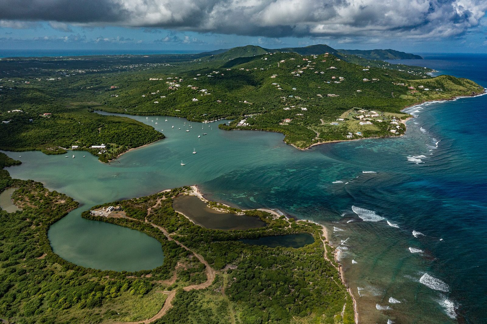
Salt River Bay, on St. Croix's north shore: the estuary Columbus's landing party rowed into on November 14, 1493. Photo: Alchematics (CC BY-SA 4.0)

The people who were already here

The NPS history page for the park says something that is easy to read past: every major period of human habitation in the Virgin Islands is represented at Salt River, and more than a dozen major archeological investigations have been made here since 1880. The park's own summary lists several South American Indian cultures, including the Taíno and the Island Caribs, then the 1493 encounter, then the Spanish capture and removal of the island's Amerindian peoples, then colonization attempts by several European nations, and then enslaved West Africans and their descendants. Salt River holds all of it.

The people who settled the Caribbean islands came up the chain from South America over centuries, and archaeologists sort them by their pottery and their villages. Their usual reading of Salt River is a sequence: earlier Arawakan-speaking farmers, the group archaeologists label Igneri; then a Taíno village on the west side of the bay's mouth, in use by the 1300s and important enough to have a ceremonial ball court, a batey, laid out beside it; and then, in the last decades before 1493, a Kalinago presence — the estimate you will see is around 1425 for the Kalinago taking the site, and it is an estimate, not a record. By the time the Spanish boat rowed in, the bay was under Kalinago control and some of the people in it were Taíno held against their will — Chanca's detail, written about people he had just fought.

The ball court is the thing that sets Salt River apart in the archaeology of the region. In 1923 the Danish archaeologist Gudmund Hatt excavated the site — St. Croix was Danish until 1917 and Danish scholarship followed — and found the court along with petroglyphs, zemis (carved spirit figures) and the stone belts associated with the ball game. Much of what he found is in the National Museum of Denmark. It is the only existing example of a ball court in the U.S. Virgin Islands; the NPS and most accounts go further and call it the only ceremonial ball court found anywhere in the Lesser Antilles. Either way, it means the village Columbus's men walked into was not a fishing camp. It was a place that mattered.

A word on names, because they carry weight. Chanca wrote "Caribs." The people themselves, and their descendants today, use Kalinago, and this guide does too, while keeping "Carib" where the sources or the NPS use it. Taíno is the name used for the Arawakan-speaking people of the Greater Antilles, whose world Columbus had entered the year before and whose captives were in the canoe. None of them left a written account of November 14, 1493. What we have is the Spanish version, and it should be read as one.

17Ships in the fleet
About 25 menLanding party
November 14, 1493Date
1960Landmark since
1992Park established
About 1,000 acresPark size

Seventeen ships: the second voyage before St. Croix

The first voyage had been three small ships feeling their way. The second was an invasion fleet dressed as a colony: two carracks and fifteen caravels — seventeen sail — carrying the people and supplies to plant a Spanish colony on Hispaniola. Chanca gives the count of seventeen himself. The flagship was the Marigalante, and the Niña from the first voyage came back out with the fleet, probably alongside a second Pinta. They left Cádiz on September 25, 1493, and crossed fast.

On November 3 they raised a rugged island Columbus named Dominica. From November 4 to about the 10th the fleet lay off Guadeloupe, and it was there, not at St. Croix, that the Spanish first walked into Kalinago villages and picked up the accounts of captives that Chanca repeats in his letter and that colored everything the fleet saw afterward. Sailing on, they sighted Montserrat, Antigua and Redonda among others, and on November 14 stood off the north shore of the large island they named Santa Cruz.

The fleet needed water, and it needed guides — people who could steer it toward Hispaniola and the Taíno world Columbus already knew. That combination explains the day: a boat went in for a practical reason, the men in it took people, and the people already there fought back. Hold the ordinary logistics of a big fleet and the human catastrophe together in one frame; the site asks for both.

Two men on that fleet matter to this guide more than Columbus does. Diego Álvarez Chanca was the fleet's physician; his long letter, dated 1494, is one of the fullest surviving accounts of the voyage's first months and is often described as the first written document on the natural history and peoples of the Americas. Michele de Cuneo, a friend of Columbus's since childhood, wrote a shorter, franker letter home. Between them we get the day at Salt River in more detail than we get most days of the fifteenth century.

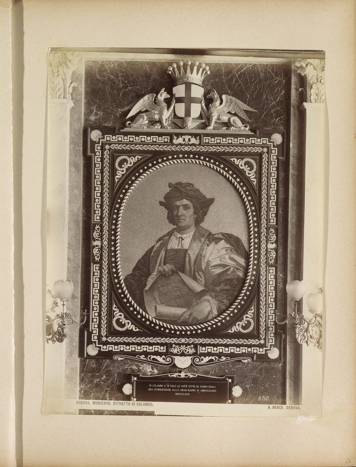
Mozaïek van een portret van Christoffel Columbus in het Palazzo Tursi in Genua Genova. Municipio. Ritratto di Colombo. (titel op object), RP-F-F01124-24
Christopher Columbus as an 1892 book illustration imagined him — an artist's idea of the man, four centuries after the second voyage. Photo: Rijksmuseum (CC0)

November 14, 1493: the boat goes in

Chanca says the island appeared populous and extensively cultivated as the fleet came along it — that is his phrase, and it tells you the shoreline the Spanish were looking at was farmed land, not wilderness. The fleet stood off the bay. Columbus stayed aboard; he sent in a well-manned boat, which the accounts put at about 25 men, to look for water and to take people who could serve as guides and interpreters.

The boat found a village near the shore. Its people had seen seventeen ships and had gone — the crew found the houses empty. What they did find and took were captives: five or six women and some boys, in the version Truthout draws from Chanca's translation, some of whom were Taíno the Kalinago had been holding. Where the village stood in relation to the ball court is inferred rather than recorded, but the sand at the mouth of the bay on the west side is where the archaeology and the story meet.

Then the canoe. As the Spanish boat was on its way back to the ships, a canoe came into view carrying, in Chanca's count, three or four Kalinago men, two Kalinago women and two Taíno men whom he describes as captives — and whom he says had been castrated, a detail he reports as fact and later historians repeat with more or less caution. What happened next is the line every account keeps. The people in the canoe saw the fleet and were, in the words of the old translation, "so stupefied with amazement" that they sat still for the better part of an hour.

The Spanish boat used that hour. It rowed at the canoe. When the people in it realized they could not get away, they took up their bows — the men and the women both, Chanca is specific — and shot. Two Spaniards were hit; the translations differ on exactly where, one having a man take two arrows in the chest, another describing an arrow that went through a shield. Chanca adds that if the men had not had shields and wooden bucklers, more of them would have been killed. This was a boat of about 25 armed men against a canoe of eight, and the eight fought.

The fight, and the dead

The Spanish boat closed on the canoe, and the fight ended in the water — the accounts have people swimming. Here the chroniclers agree on the outcome and disagree on the details, and the honest thing is to say so. Chanca has one Kalinago man run through with a lance, mortally, and the others taken. Cuneo's account is uglier: a wounded man thrown into the sea, seen crawling away holding his entrails, then killed with arrows; and a beheading. The NPCA's account has one Kalinago decapitated after trying to swim off. Read together, at least one and probably two of the people in the canoe died that day, and the rest — men, women and the two Taíno captives — were taken aboard the ships.

On the Spanish side, one of the two wounded men died a few days later. Columbus named the promontory near the fight the Cape of the Arrows, Cabo de las Flechas, and the accounts say he did it to mark that man's death. It is the only place-name from the day that stuck to the map, and it is on the east side of the bay's mouth, across the water from the landing beach.

One more thing has to be said plainly, because it is in the record and leaving it out would be a kind of lie. Michele de Cuneo wrote that after the fight Columbus let him keep one of the captured women as a slave, and his letter records that he beat and raped her. It is one of the first written accounts of what the conquest of the Americas would mean for the people on the receiving end, and it happened at Salt River. You will not find it on the landmark sign. It belongs in any honest telling.

The fleet did not linger. On November 17 it sighted the eastern coast of Puerto Rico, and on November 19 it made landfall there, at the Bay of Añasco by the usual account, and then went on to Hispaniola and the colony Columbus meant to build. Salt River was one bad day in a voyage full of them. It matters because it is documented, dated and findable — and because the people in the canoe fought.

“the first recorded conflict between Europeans and Amerindians in the New World”

National Park Service, Columbus Landing Site at Salt River Point

The Cape of the Arrows, and what "first" actually means

You will read three superlatives about Salt River, and each needs a qualifier. The first: the NPS calls the fight at the Cape of the Arrows the first recorded conflict between Europeans and Amerindians in the New World, and the National Parks Conservation Association calls it the first documented resistance by American Indians to European colonists. Strictly, Columbus's own first-voyage log records an earlier fight — on January 13, 1493, at a bay on the northeast of Hispaniola that he named the Golfo de las Flechas, the Bay of Arrows, where about seven Spaniards traded with and then fought a much larger group of Ciguayo people. Nobody on the Spanish side died there. So the careful version is this: Salt River is the first recorded fight in which a European was killed by the people of the Americas, and the first documented armed resistance on what is now United States soil.

The second superlative: that this is the only place under the U.S. flag where Columbus landed. Two corrections. Columbus himself stayed aboard; his men landed. And the NPS's own landmark page calls Salt River one of two documented sites on what is now U.S. territory where a Columbus expedition made landfall — the other being Puerto Rico, five days later. Most travel writing uses the older wording, that Salt River is the only known site where members of a Columbus expedition set foot on what is now United States territory. The two statements sit side by side, and the difference between them is about how precisely the Puerto Rico landfall can be placed. What is not in dispute: Salt River is the one place under the U.S. flag where a Columbus landing is tied to a specific, marked point on the ground and protected as a National Historic Landmark.

The third: that this is where "the New World began" for the United States. It is where a dated, chronicled European landing on what is now U.S. soil first happened, and that is a real distinction. It is not a beginning for the people who had lived at Salt River for centuries; for them it was the start of an ending, and by 1590, under Spanish pressure, the Kalinago had left St. Croix altogether.

Where, exactly, is the Cape of the Arrows? The NPS puts it on the east side of Salt River Bay, opposite the landing beach. Which exact headland Columbus meant is not recorded with a bearing, so treat "the east point of the mouth" as the best answer. From the landing beach you look straight across at it, and that view — the mouth, the point, the open sea beyond where seventeen ships waited — is the best interpretive exhibit the site has.

  1. c. 1300sA Taíno village and ceremonial ball court in use at Salt River
  2. Sept 25, 1493Columbus's second fleet, 17 ships, sails from Cádiz
  3. Nov 14, 1493The landing at Salt River and the fight at the Cape of the Arrows
  4. 1590The Kalinago leave St. Croix under Spanish pressure
  5. 1641–1650The earthen fort on the point: Fort Flamand, then Fort Salé under the French
  6. 1733France sells St. Croix to Denmark
  7. 1923Gudmund Hatt excavates the ball court
  8. Oct 9, 1960Columbus Landing Site named a National Historic Landmark
  9. Feb 24, 1992Salt River Bay National Historical Park and Ecological Preserve established
  10. 2020Salt River Bay appears on the America the Beautiful quarter
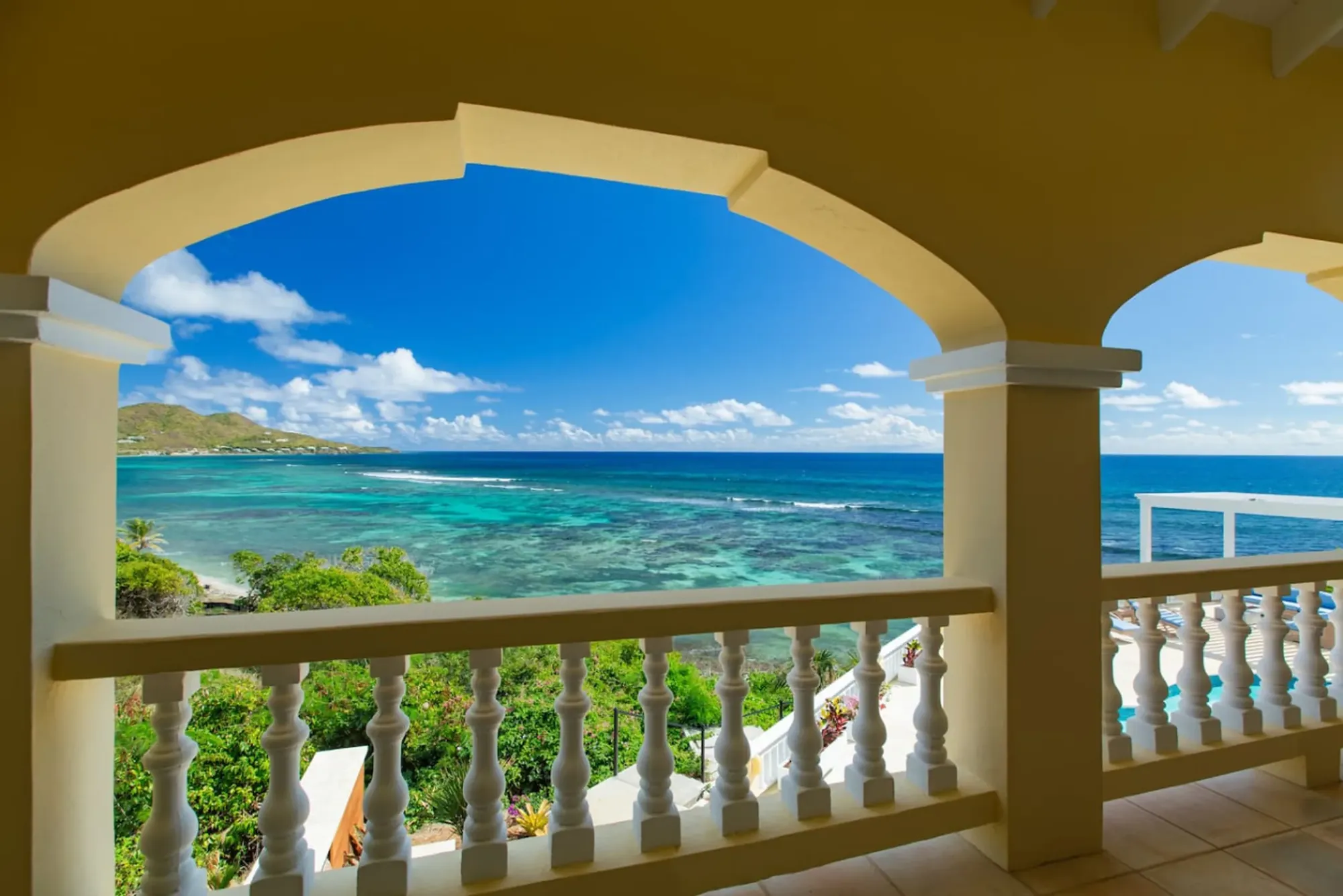
Turquoise bay framed by the villa's arched veranda
The Cerulean

Plan it from the villa.

Five bedrooms, a private swimmable beach, and all of this within a day trip.

Sleeps 12 · 4.90 ★ · rates by season

Who wrote it down: Chanca, Cuneo, and the gaps

The day-by-day story of Salt River comes chiefly from two letters written by men who were in the fleet. Chanca's is the long one — a report home to Seville, dated 1494, that walks through the crossing, the islands, the plants and animals and people, and the arrival on Hispaniola. It has been printed and translated many times; the Wisconsin Historical Society's American Journeys project has a public-domain nineteenth-century English translation online, and a scanned copy of the same translation circulates as a PDF. Cuneo's is shorter and rougher, the letter of a gentleman adventurer to a friend, and it is the source for the ugliest detail of the day.

Later chroniclers and historians built on those two, and the modern summaries on the NPS pages and in the NPCA piece all go back to them. That is why the numbers are so consistent: seventeen ships, about 25 men, three or four men and two women in the canoe, two Spaniards hit, one dead. When you see a different number, ask which letter it comes from.

Documented

The date, November 14, 1493. The size of the fleet. That Columbus stayed aboard and sent a boat. That the boat found a village emptied by its people and took captives. That a canoe carrying Kalinago men and women and Taíno captives met the boat, that both sides shot and stabbed, that Spaniards were wounded and one died in the days after, that at least one person in the canoe was killed and the rest were seized. That Columbus named the cape for the arrows. That the fleet was off Puerto Rico three days later.

Inferred, argued or simply unknown

The exact patch of beach the boat touched — the landmark is the west-side beach and point, on the strength of the archaeology and the geography, not a chart from 1493. Which headland is the Cape of the Arrows, beyond "the east side of the bay." Exactly how many people in the canoe died, because Chanca and Cuneo tell it differently. Whether the emptied village stood on the ball-court site itself or near it. Whether the fleet actually came inside the reef or stood off in open water. And the framing words — "first," "only," "discovery" — which, as the previous section shows, need qualifiers every time. A good visit holds the documented list firmly and the second list loosely.

After the ships: capture, removal, and 1590

The Spanish did not settle St. Croix. What the NPS history page records for the century after 1493 is one blunt line: the Spanish capture and removal of the island's Amerindian peoples. The Kalinago of St. Croix, who had fought a boat in 1493, faced Spanish ships for a hundred years, and the NPCA's account gives the end date: by 1590, under Spanish pressure, the Kalinago had left St. Croix altogether. The island that had appeared populous and extensively cultivated to Chanca went quiet.

That emptiness is the hinge of everything that came after. When Dutch, English and French ships began putting parties ashore in the 1600s, they found an island with no one to negotiate with and no one to fight — which is why the seven flags that flew over St. Croix in the next three centuries changed hands among Europeans, by force, treaty and purchase, rather than by conquest of a resident people. That conquest had already happened, here, in the sixteenth century, and it left almost no written trace beyond a date.

It also explains why the archaeology matters so much. With no continuous community to carry the story of the ball court and the village, the ground had to. Hatt's 1923 excavation, the dozen-plus investigations the NPS counts since 1880, the zemis and stone belts in Copenhagen — those are the record of the people who lived at Salt River, in the absence of their own account. When you stand on the beach, that is what you are standing on: not "the place Columbus discovered," but the last documented home of the people who met him.

The Taíno and Kalinago did not vanish as peoples; their descendants live across the Caribbean today. On St. Croix, though, the line between the people of 1493 and the people of the Danish era is a break, not a thread, and honest guides say so.
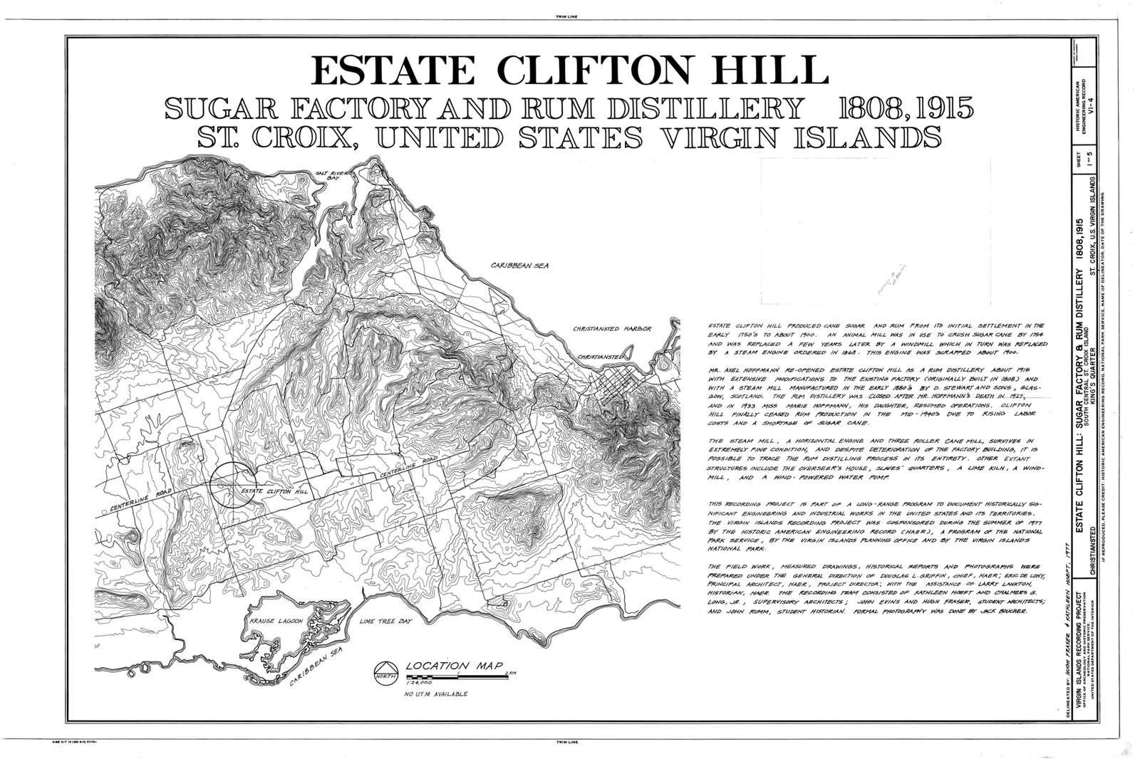
Estate Clifton Hill, Sugar Factory and Rum Distillery, Title Sheet - Estate Clifton Hill, Sugar Factory and Rum Distillery, South Central Street, Christiansted, St. HAER VI,1-KING,2-A- (sheet 1 of 5)
An early map of St. Croix, the island Columbus named Santa Cruz in 1493. Photo: Fraser, Hugh (Public domain)

The earthen fort on the point: Fort Flamand, Fort Salé

The one built thing you can see at the landing site is not from 1493 at all. On the point at the west side of the bay's mouth are the low banks of an earthen fort from the middle of the 1600s — the only known structure on St. Croix that survives from that first European period. It was a small, roughly triangular earthwork rather than a stone fort, and the sources do not agree on who threw it up: one account has the Dutch building it and calling it Fort Flamand, the Flemish Fort; another has the English starting it in 1641 and the Dutch finishing it in 1642. What the sources do agree on is that the French took over the site in 1650 and renamed it Fort Salé, and that name is the one on the map today.

Why here? Because Salt River was the harbor of those first European attempts: a sheltered estuary on the north coast, and the place the Dutch, English and French tried to hold in the 1640s — the fort is the proof. The seven-flags story on St. Croix begins at this bay, not at Christiansted or Frederiksted, which came later under the Danes. Whoever held the point at the mouth held the anchorage. An earthwork with a few guns on the point was the seventeenth-century answer, and it is still there because nobody bothered to build over it.

France's hold on St. Croix was never strong. In 1733 France sold the island to Denmark, and the Danes, whose interest was sugar and whose towns were Christiansted and Frederiksted, let Salt River go back to being a bay with plantations around it. The point stayed rural through the Danish centuries, through the American purchase in 1917, and into the modern era — which is the only reason a 1640s earthwork and a 1300s ball court were still in the ground for the archaeologists and the landmark surveyors to find.

What you see today is modest: grass-covered banks, a shape you read better from the air or a map than from the sand, and the position — the reason for the fort — which is obvious the moment you look at the mouth of the bay. Do not look for walls. Look for the ground rising, and then look at what it commands.

From landmark to national park: 1960 and 1992

The federal recognition came in two steps a generation apart. On October 9, 1960, the Columbus Landing Site was designated a National Historic Landmark — the federal designation for nationally significant historic places — for the 1493 landing and the fight at the Cape of the Arrows. For the next thirty years it stayed a landmark without a park around it, known to archaeologists and to the local families who used the beach.

On February 24, 1992, Congress created Salt River Bay National Historical Park and Ecological Preserve. Two things about the law are unusual. It protects nature and history in one unit — "Historical Park and Ecological Preserve" is the full name for a reason — and it is co-managed: the National Park Service and the Government of the Virgin Islands run it together, and the landing-site parcel is, per the NPS's own page, owned by the territorial government and co-managed with the park. The park is about a thousand acres (the NPS says 1,015; another source gives 985.76), and beyond the landmark it takes in some of the largest remaining mangrove forests in the Virgin Islands, coral reefs, a submarine canyon that drops to nearly 500 feet just off the mouth of the bay, and one of St. Croix's two bioluminescent lagoons.

It is a small park by the numbers. The NPS counted 12,126 visitors in 2025, against roughly 40,000 at Buck Island — and much of the Salt River count is people in kayaks after dark. There is no entrance gate and no fee booth at the landing beach; the park's mailing address is the NPS office at 2100 Church Street in Christiansted, and its phone number is (340) 773-1460. In 2020 Salt River Bay was put on a U.S. quarter, the 53rd in the America the Beautiful series.

The joint arrangement explains the state of the site. Two governments, a small budget and a hurricane in 2017 mean that improvements come slowly, the contact station has stayed closed for years, and the beach is first a community place and second a park exhibit. That is not a complaint; it keeps the place unpolished in a way that suits the story.
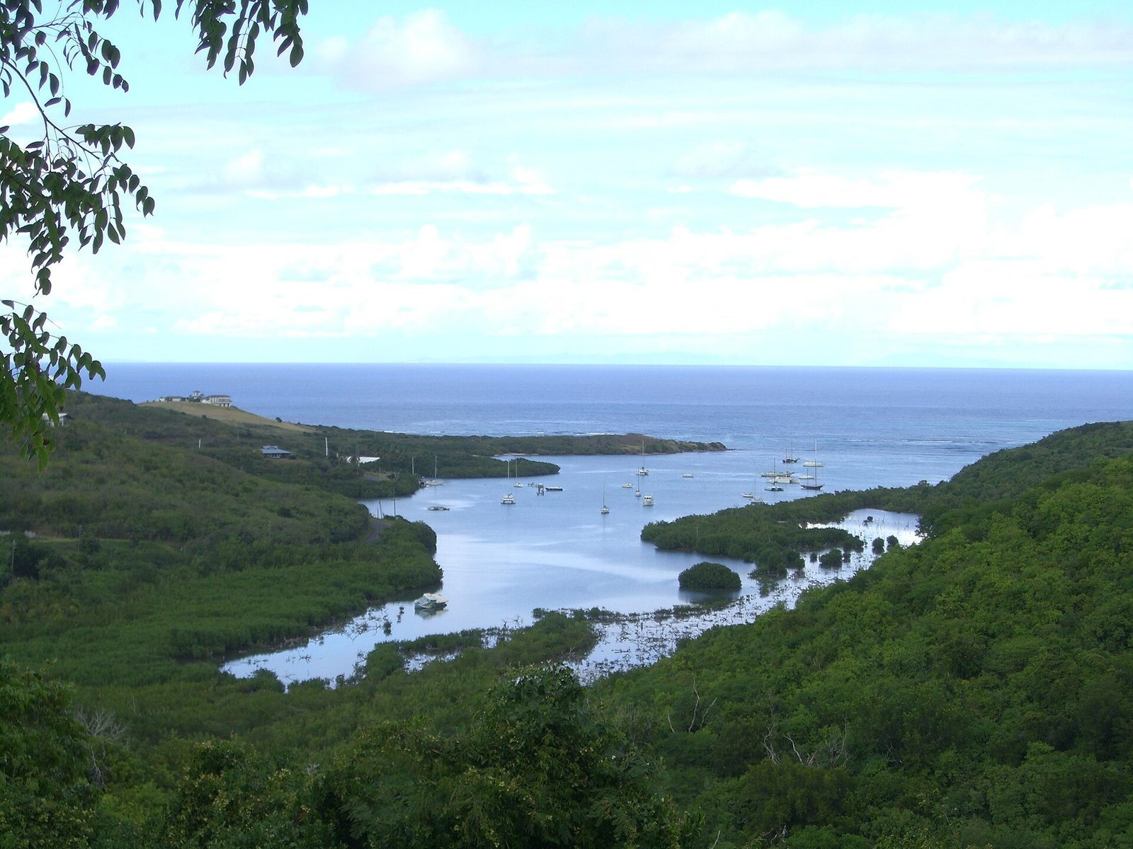
Salt-River-Bay-2
Photo: self (Public domain)
Salt river
Photo: Kborer (Public domain)
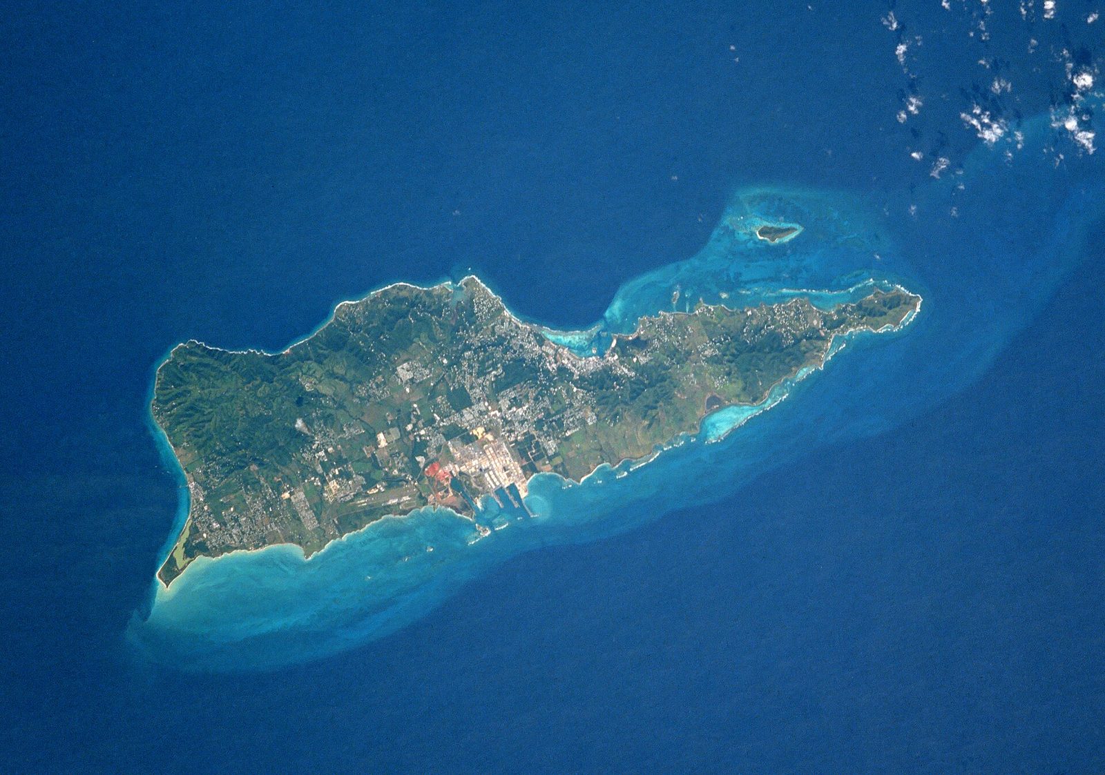
St Croix NASA
Photo: NASA (Public domain)

What you actually see today

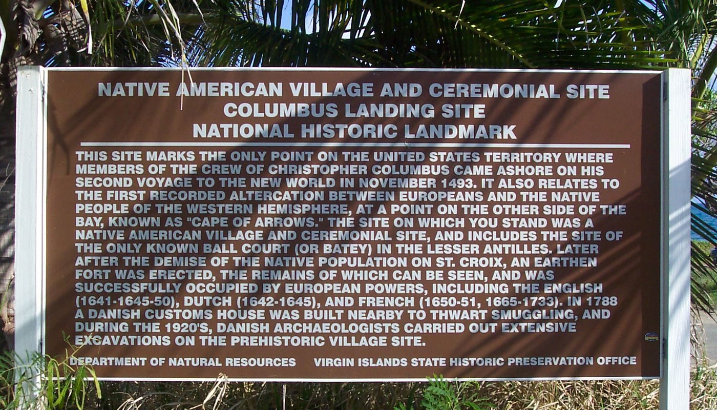
Here is the honest inventory. You come down to the west side of the bay's mouth and there is a beach — Columbus Landing Beach on most maps, Salt River Point on the NPS's — a sandy strand with mangroves at its edges that the park describes as an important local cultural resource for community use, which in practice means it is a beach Crucian families use and you are a guest on it. There is a National Historic Landmark sign. On the point are the earthworks of Fort Salé, low and grassed over. Across the mouth of the bay is the east side and the Cape of the Arrows.

That is the list. There is no reconstructed village, no statue, no walk-through exhibit and no ball court you can see; the excavation was a century ago and the finds are in Copenhagen. There is no on-site museum while the visitor contact station is closed. Some visitors are disappointed, and the disappointment usually comes from expecting a monument. Come expecting a place instead: the point is the same point, and the mouth still frames the open water where seventeen ships waited. It is a site for reading first and standing second.

The visitor contact station sits on the west side of the bay, in what was once a private house. As of the NPS hours page updated February 19, 2026, it is closed because of damage from Hurricane Maria in 2017, and the park sends visitors instead to the NPS visitor center at Fort Christiansvaern in Christiansted, which our directory lists as open daily from 8:30 am to 4:30 pm. That fort's desk is where you pick up the park brochure and ask a ranger about programs. Check nps.gov/sari before you drive out; if the station has reopened, plan a stop there.

The east side of the bay is a different visit. The NPS lists the trails and associated sites on the east side of Salt River Bay as open sunrise to sunset, along with a Well Tower off North Shore Road, and that side is where the promontory of the Cape of the Arrows is. It is walking country rather than a beach stop, worth an hour if the history has hold of you. If it does not, the west-side beach and the view across the water give you the shape of the day in thirty minutes.

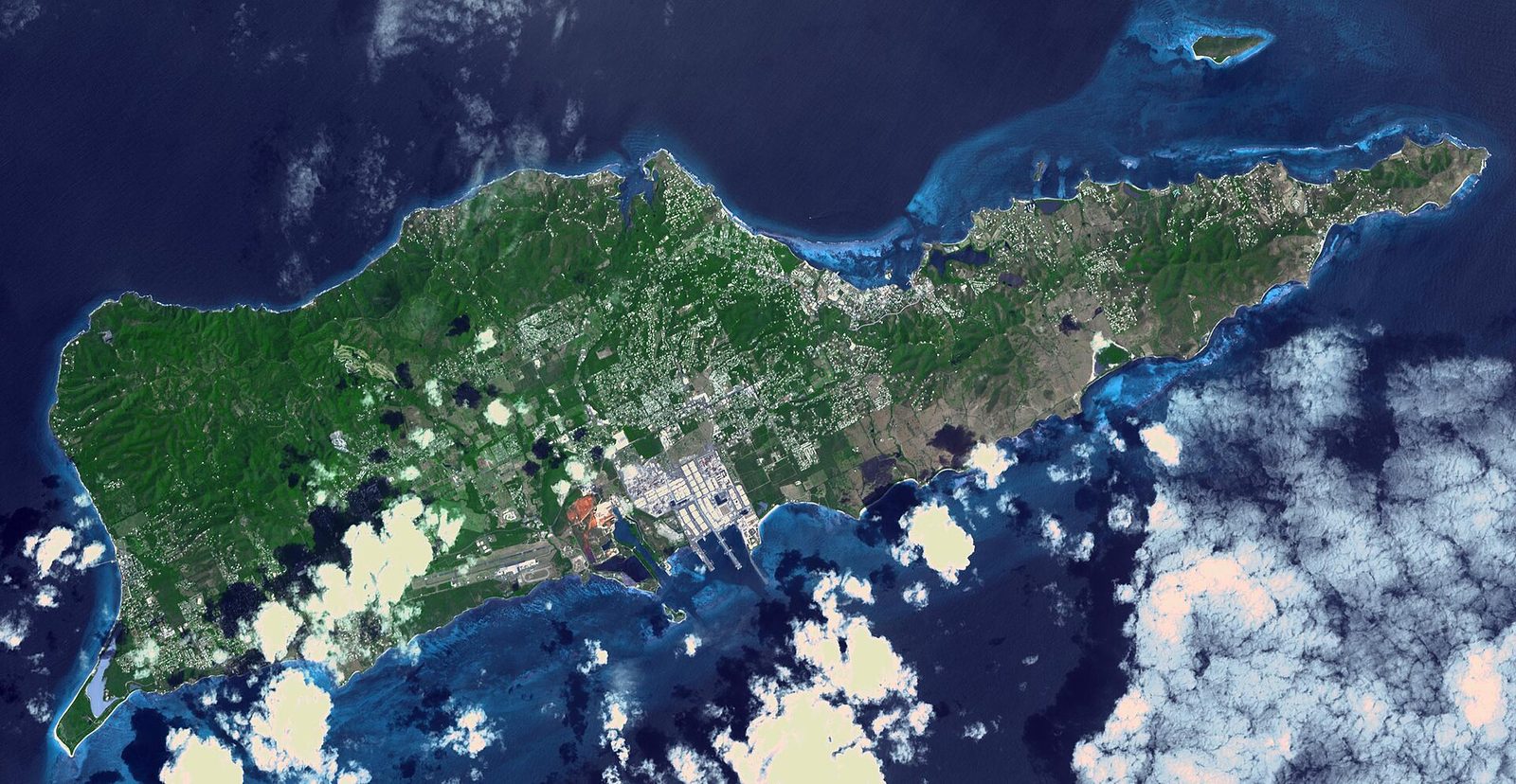
St Croix, US Virgin Islands (ASTER)
Salt River Bay from the air: the estuary's mangrove shoreline, the narrow mouth, and the low point on the west side where the landing party came ashore. Photo: NASA/METI/AIST/Japan Space Systems, and U.S./Japan ASTER Science Team (Public domain)

Getting there, hours, and what to bring

From the East End the drive is about 35 to 40 minutes: west through or around Christiansted, then out along the north shore road to the bay. Use your maps app and search for Salt River Bay National Historical Park or Columbus Landing Beach, because road signs for Salt River are scarce — more than one visitor has written that the maps are clear and the roads are not. If you have not driven the island yet, our driving guide covers the left-hand traffic.

Hours: the NPS lists the east-side trails and the Well Tower as open sunrise to sunset, and there is no gate at the landing beach; treat the whole site as a daylight visit and check the park's hours page for changes. There is no fee that we can find posted for the landing site, and no ranger on duty there day to day. Download the NPS pages before you go so you have the map offline.

Bring water, a hat and mineral sunscreen — the park's own advice is to cover up, wear a hat and use reef-safe sunscreen — because there is no shade to speak of on the point and no shop. Wear shoes you can walk grass and sand in. If you plan to swim, read the NPS safety note first: beware of hazardous surf conditions and crosscurrents, and do not swim alone. There are no lifeguards. Leave nothing visible in a parked car, and take your trash out with you.

Timing: mornings are cooler and emptier; late afternoon runs straight into a bio-bay tour from the marina. Midday is the worst of both — hot, bright and shadeless — and is the reason some people leave unimpressed. Give the site the first or last hour of a day and it gives back.

A two-hour visit to the landing site

  1. Stop at the Fort Christiansvaern visitor center in Christiansted for the Salt River brochure and any program news (the on-site contact station is closed as of 2026).
  2. Drive the north shore road to Salt River Bay and park at Columbus Landing Beach on the west side of the mouth.
  3. Read the landmark sign, then walk the beach with the mouth of the bay in front of you and the point to your side.
  4. Climb the low earthworks of Fort Salé on the point and look across the water at the east side, the Cape of the Arrows.
  5. If you have the time and the legs, drive around to the east-side trails, open sunrise to sunset, for the promontory itself.
  6. Finish at Salt River Marina, where the bio-bay kayaks leave after dark, or carry on west to Cane Bay for a swim.

Pairing it with the bio bay, the canyon and Christiansted

The reason most people are at Salt River at all is the glow. After dark, the lagoon on the bay's east side lights up when you move the water — the work of a dinoflagellate, Pyrodinium bahamense, in one of only a handful of year-round bioluminescent bays anywhere — and the night kayak tours leave from Salt River Marina on the same bay. Our Salt River bio bay guide covers the operators (Sea Thru Kayaks VI in clear kayaks, Virgin Kayak Tours in pedal-drive Hobies, BushTribe's sunset-to-dark trip), the moon calendar and what to expect, so we will not repeat it here. The pairing is obvious: landing site in the last hour of daylight, then the paddle. Virgin Kayak Tours also runs daytime historical and ecological paddles of the park, which is the one way to see the bay, the mangroves and both points from the water in daylight.

The second pairing is under the water. Just off the mouth of the bay the seabed drops into the Salt River Canyon, a submarine canyon that reaches nearly 500 feet, with an east wall and a west wall that divers work as separate sites; Anchor Dive Center, the only dive shop inside the park, dives them from the marina. That is a different day and a different guide — diving the wall — but if there is a diver in your group, Salt River can be a history stop for some and a two-tank morning for others, with everyone back together at the marina by lunch.

The third pairing is Christiansted, which you drive through anyway. Fort Christiansvaern's NPS visitor center is where Salt River's information desk lives while the contact station is closed, and the Danish town is the next chapter of the same story — the flags after Spain, the sugar, the harbor that replaced Salt River as the island's front door. Town in the morning, landing site in the late afternoon, bay after dark: five centuries in a day.

Salt River with kids and with a group

With children this is a short, good stop rather than an outing. They get a beach and a story you can tell in three sentences: a huge fleet came, a boat rowed in and took people, and the people who lived here fought the boat with bows and arrows from a canoe. Tell it that plainly; children handle "the people fought back" better than adults expect, and the site gives them a stage to picture it on. Ten minutes on the sand, ten on the earthworks, and a look across the water is a complete visit for a family with an eight-year-old. If they want to swim, remember the park's surf-and-currents warning and the absence of lifeguards, and hold the swim for Cane Bay or the villa's own beach.

With a mixed group — the pattern for a five-bedroom villa — the trick is to not force it. One or two people in any dozen care about 1493 enough to read the sign twice and climb the point; the rest will walk the beach and be ready in twenty minutes. Plan the stop as part of a north-shore afternoon that ends at the marina, and nobody feels dragged to a history site. Our St. Croix with kids guide covers how to run a day like that from the East End with two cars.

One thing about tone. Salt River is a community beach with a landmark on it, not an attraction with a gate: park sensibly, keep the music down, take your trash, and give the point and the earthworks the care you would give a churchyard. Rangers are not there to remind you.

WhereWhat is therePractical note
West side — Columbus Landing Beach / Salt River PointLanding beach, National Historic Landmark sign, Fort Salé earthworks, the excavated ball-court site (not visible)No gate or fee posted, daylight visit, NPS surf warning if swimming
East side — Cape of the ArrowsThe promontory of the 1493 fight, trails and associated sitesOpen sunrise to sunset per NPS
Salt River MarinaBio-bay kayak operators, Anchor Dive CenterNight tours book out — reserve ahead
Visitor contact station (west side)Former private house used as the park's stationClosed since Hurricane Maria per NPS (Feb 2026) — check for reopening
Fort Christiansvaern, ChristianstedNPS visitor center with Salt River informationDaily 8:30 am–4:30 pm per our directory — confirm

Mistakes to avoid, and how to read the place

The first mistake is expecting a monument. There is a sign, a beach and some earthworks; people who arrive wanting Plymouth Rock leave grumbling, and people who arrive knowing the story leave moved. The second is going at noon, when there is no shade and the light flattens everything; go early or late. The third is driving out expecting the contact station to be open — as of the NPS's February 2026 update it is not, and the information desk is at Fort Christiansvaern in Christiansted.

The fourth mistake is the word "discovery." Salt River is not where anything was discovered; it is where a fleet arrived at a settled, farmed bay and its people fought the landing party. Say "landing," say "encounter," say "resistance" — the NPCA's title for the place is a site of resistance — and you have the story right. The fifth is skipping the east side entirely if you have the time; the promontory is where the arrows flew, and the trails are open sunrise to sunset.

How to read the place, then: stand on the west-side beach with the mouth of the bay in front of you and the point at your shoulder, and picture seventeen ships in the open water beyond, a boat coming back from an emptied village with people in it who did not choose to be there, and a canoe coming around the far point into all of that. Everything documented about November 14, 1493 happens inside that frame. That is why the site is worth the drive, and why it needs nothing built on it. Then read the living side of the bay — mangroves, birds, the reef and the canyon — in the wildlife guide.

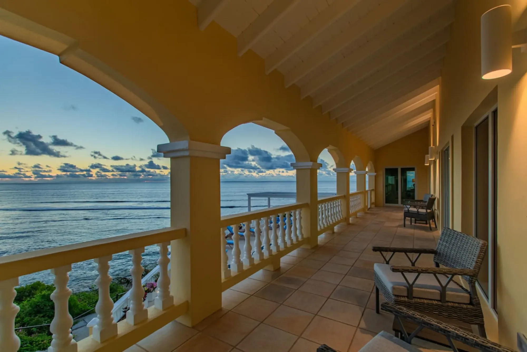
Sunrise from the villa's arched veranda on the East End: Salt River Bay is a 35-to-40-minute drive west from here.
Sunrise from the villa's arched veranda on the East End: Salt River Bay is a 35-to-40-minute drive west from here. Photo: The Cerulean

Questions people ask

Did Columbus himself set foot on St. Croix?

Not according to the men who were there. Dr. Chanca's letter and the accounts built on it have Columbus staying aboard while a boat with about 25 men went in for water on November 14, 1493. So the careful wording is that a Columbus expedition landed at Salt River, not that Columbus did. Some travel pages say he personally set foot here; the National Park Service says members of his second voyage landed, and that is the version the sources support.

Where exactly is the Columbus landing site at Salt River Bay?

The landing beach and the National Historic Landmark are on the west side of the bay's mouth, at Salt River Point, the strip of sand often called Columbus Landing Beach, where the earthworks of Fort Salé sit and where the Taíno ball court was excavated. The Cape of the Arrows, where the canoe fight happened, is the promontory on the east side of the bay. Nobody recorded the exact patch of sand the boat touched, so the beach is the documented area rather than a pinpointed spot.

Was Salt River really the first fight between Europeans and Native Americans?

The NPS calls it the first recorded conflict between Europeans and Amerindians in the New World, and that is the wording on the landmark. Strictly, Columbus's first-voyage log records an earlier fight, on January 13, 1493, at what he named the Bay of Arrows on Hispaniola, in which no Spaniard died. Salt River is the first recorded fight in which a European was killed, and the first documented armed resistance on what is now U.S. soil. Say it that way and you are on solid ground.

Is the Salt River Bay visitor center open?

As of the NPS hours page updated in February 2026, no. The visitor contact station on the west side of the bay is closed because of damage from Hurricane Maria in 2017, and the park directs visitors to the NPS visitor center at Fort Christiansvaern in Christiansted, which our directory lists as open daily 8:30 am to 4:30 pm. Check nps.gov/sari before you go, because a reopening would change the plan. The beach, the point and the east-side trails do not depend on it.

What is there actually to see at the Columbus landing site?

Be honest with yourself: it is a low-key place. You get a sandy community beach at the mouth of the bay, a landmark sign, the low grass-covered banks of a 1640s earthen fort on the point, mangroves, and the view across the water to the Cape of the Arrows. There is no reconstructed village, no monument of any size, and no on-site museum while the contact station is closed. Thirty to sixty minutes covers it. The value is standing where a documented, dated thing happened.

Can you swim at Columbus Landing Beach?

People do; the NPS describes the beach as an important local cultural resource for community use, and local families are the regulars. The park's own safety note asks you to beware of hazardous surf conditions and crosscurrents and not to swim alone. There are no lifeguards and no facilities. If you want a swim built into the day, most guests treat the landing site as the history stop and swim at Cane Bay a few minutes west, or back at the villa's own beach.

Can you see the Taíno ball court?

No, not as a ruin you can walk. Gudmund Hatt excavated the court in 1923; the finds, including petroglyphs, zemis and stone belts, are largely in the National Museum of Denmark, and the ground was not rebuilt as an exhibit. What you can do is stand on the beach where the village and court stood and know it is the only ball court known in the U.S. Virgin Islands and, by most accounts, the only one found anywhere in the Lesser Antilles.

How far is Salt River Bay from The Cerulean?

About 35 to 40 minutes by car from the villa on the East End, depending on Christiansted traffic. You drive west past or through Christiansted and then along the north shore road to the bay; put Salt River Bay National Historical Park or Columbus Landing Beach into your maps app, because road signs for Salt River are scarce. Cane Bay is a few minutes farther west, so the landing site pairs naturally with a beach afternoon there.

Can I combine the landing site with the bioluminescent bay?

Yes, and it is the best way to do Salt River. The night kayak tours leave from Salt River Marina on the same bay, so a late-afternoon visit to the landing site, an early dinner nearby or in Christiansted, and a bio-bay paddle after dark make one clean outing from the East End. Our Salt River bio bay guide covers the operators, the moon calendar and what to expect on the water; book the paddle first and fit the history around it.

Doing it from The Cerulean

From the villa the plan is simple. Salt River Bay is about 35 to 40 minutes west, past Christiansted, so it slots into a north-shore afternoon rather than eating a day. The version we would run: a slow morning on the private beach and the pool, an early lunch from the kitchen, then a 2:30 departure — Fort Christiansvaern's desk in Christiansted for the brochure, the landing beach and the point in the last good light, and Salt River Marina for a bio-bay paddle after dark. You are back on the East End by 9:30 or 10, which is why the outdoor kitchen and the grill are the right dinner plan for that night.

The concierge can book the night paddle — the clear kayaks and the pedal-drive boats fill in busy weeks — and can tell you which operator's meeting time works with the sunset that day. Ask for a moonless date if the glow matters to you; the bio bay guide explains why. If someone in the party dives, the concierge can set the Salt River Canyon morning with the shop in the park, and the rest of the group can meet at the marina at noon.

The history stop needs nothing from the villa but a car and the drive, and it holds up on a rainy afternoon — the beach and the point are the same in a shower, and Fort Christiansvaern is dry. If the story stays with you, the East End has its own quiet marker of what came before: Point Udall, the easternmost point of the United States, a short drive from the villa, where the sun comes up over the same sea the seventeen ships came out of.

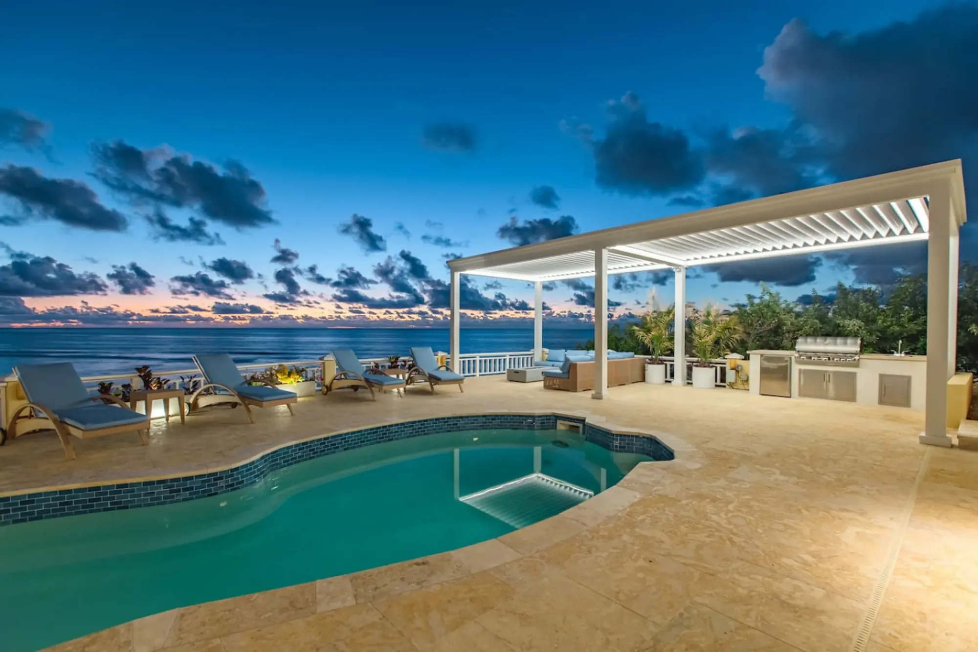
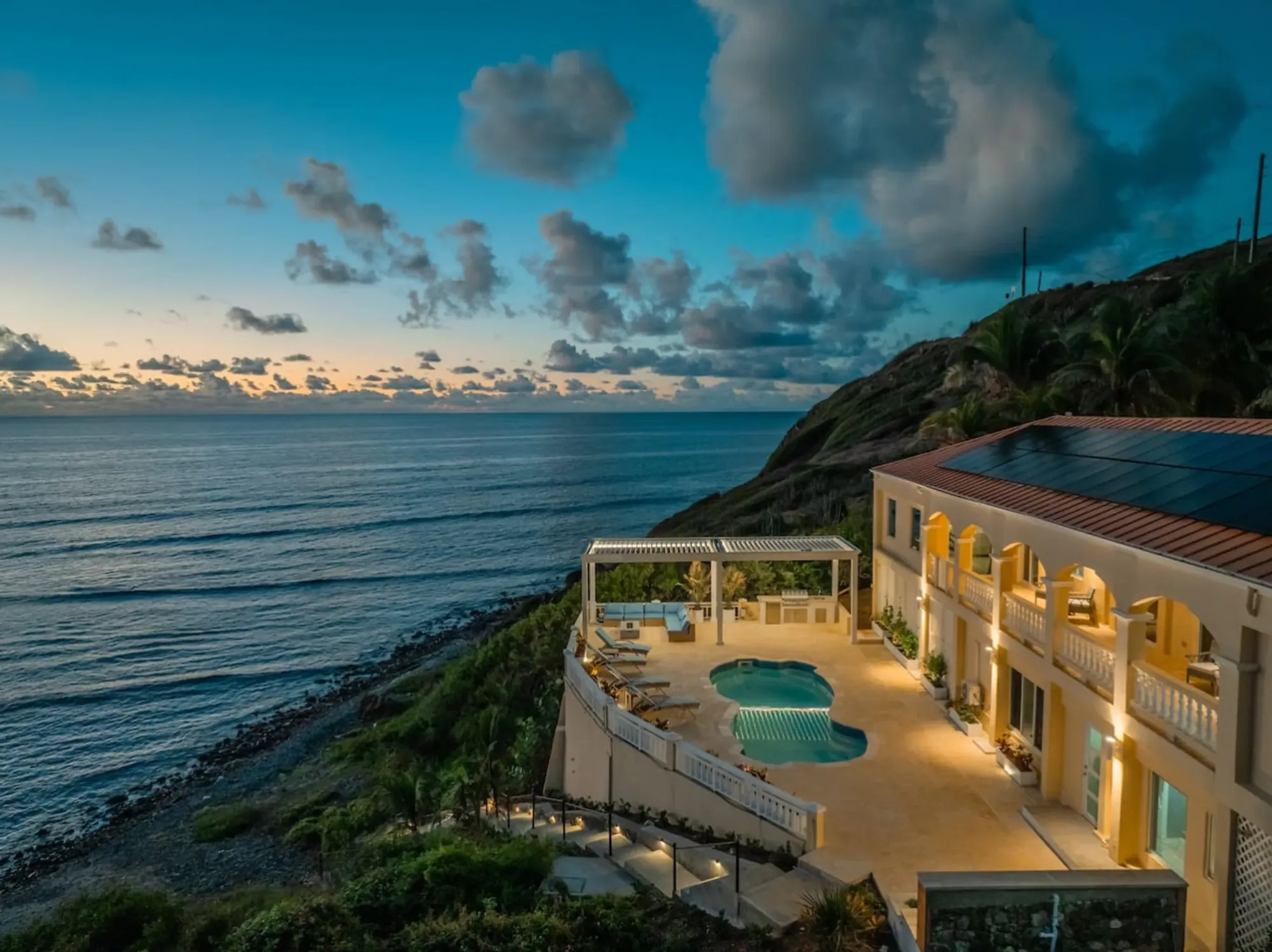
The Cerulean's pool at sunset above the sea
The Cerulean

Twelve of you, one private beach.

The Cerulean sleeps twelve on St. Croix's quiet East End — check your dates.

Sleeps 12 · 4.90 ★ · rates by season
Keep reading

Related guides.

The Cerulean villa at dawn above the sea
The Cerulean

Read it here. Live it from the villa.

Five bedrooms, a private beach, and all of this within a day trip.

Sleeps 12 · 4.90 ★ · rates by season